Désandans

Désandans

Désandans

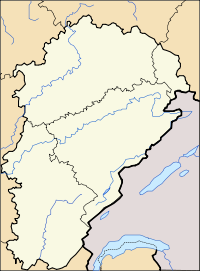
Désandans is located in France
{{{alt}}}
Désandans
Administration
Country France
Region Franche-Comté
Department Doubs
Arrondissement Montbéliard
Canton Montbéliard-Ouest
Intercommunality Vallée du Rupt
Mayor André Parrot
(2008–2014)
Statistics
Elevation 359–514 m (1,178–1,686 ft)
Land area1 5.47 km2 (2.11 sq mi)
Population2 715  (2008)
 - Density 131 /km2 (340 /sq mi)
INSEE/Postal code 25198/ 25750
1 French Land Register data, which excludes lakes, ponds, glaciers > 1 km² (0.386 sq mi or 247 acres) and river estuaries.
2 Population without double counting: residents of multiple communes (e.g., students and military personnel) only counted once.

Coordinates: 47°32′02″N 6°40′41″E / 47.5338888889°N 6.67805555556°E / 47.5338888889; 6.67805555556

Désandans is a commune in the Doubs department in the Franche-Comté region in eastern France.

Population

Historical population of Désandans
1962 1968 1975 1982 1990 1999 2008
307 344 384 390 521 586 715

See also

References


Wikimedia Foundation. 2010.

Игры ⚽ Нужен реферат?

Look at other dictionaries:

  • Désandans — Désandans …   Deutsch Wikipedia

  • Desandans — Désandans Désandans Pays  Franc …   Wikipédia en Français

  • Désandans — 47° 32′ 02″ N 6° 40′ 41″ E / 47.5339, 6.6781 …   Wikipédia en Français

  • Echenans — Échenans DEC …   Deutsch Wikipedia

  • Mont-Terrible — 1793 – 1800 Informations générales Statut Département de la Révolution française Chef lieu Porrentruy Histoire et évènements 1793 Création 1800 …   Wikipédia en Français

  • Échenans — Échenans …   Deutsch Wikipedia

  • Principauté de Montbéliard — Grafschaft Mömpelgard (de) 1042 – 1793 armoiries …   Wikipédia en Français

  • County of Montbéliard — Grafschaft Mömpelgard (de) Comté de Montbéliard (fr) State of the Holy Roman Empire …   Wikipedia

  • Aibre — Aibre …   Deutsch Wikipedia

  • Le Vernoy — Le Vernoy …   Deutsch Wikipedia

Share the article and excerpts

Direct link
Do a right-click on the link above
and select “Copy Link”