- Malbuisson
-
Malbuisson


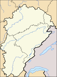
Administration Country France Region Franche-Comté Department Doubs Arrondissement Pontarlier Canton Pontarlier Intercommunality Mont d'Or et des Deux Lacs Mayor Claude Mignon
(2008–2014)Statistics Elevation 846–1,091 m (2,776–3,579 ft) Land area1 6.60 km2 (2.55 sq mi) Population2 626 (2008) - Density 95 /km2 (250 /sq mi) INSEE/Postal code 25361/ 25160 1 French Land Register data, which excludes lakes, ponds, glaciers > 1 km² (0.386 sq mi or 247 acres) and river estuaries. 2 Population without double counting: residents of multiple communes (e.g., students and military personnel) only counted once. Coordinates: 46°47′56″N 6°18′15″E / 46.7988888889°N 6.30416666667°E
Malbuisson is a commune in the Doubs department in the Franche-Comté region in eastern France.
Contents
Overview
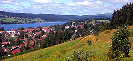
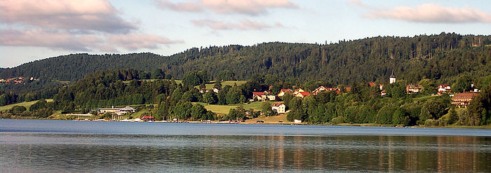
In balcony above the lake Saint-Point, between water and the forest, the village of Malbuisson stretch on two kilometers between Vézenay, formerly separated village, and the forest of "La Fuvelle". At the beginning of the 20th century, Malbuisson knew an important expansion with the development of tourism, made possible by the construction of a railway line named the "Tacot" between Pontarlier and Foncine. Then classified "station climatérique" (alt. 900 m), Malbuisson became a pleasant destination by the rich people of Pontarlier, of Besançon, but also by some Parisian, fallen under the charm from the places and the possible activities. Since then, the economy of the village is developed mainly around tourism and the village perpetuates this tradition thus, while proposing:
- Nordic skiing, paths for the practice of the VTT, the hiking or excursion in racket with snow on the surrounding mountains
- boat, pedal boat, fishing and swimming on the lake
- hotel establishments and restaurants of quality, and many trade proposing local products
- preserved nature
Geography
Malbuisson lies 15 km (9.3 mi) south of Pontarlier on the Lac de Saint-Point.
Population
Historical population of Malbuisson 1794 1820 1841 1861 1881 1901 1921 1936 1946 1954 146 153 164 242 277 279 291 269 318 345 1962 1968 1975 1982 1990 1999 2006 2008 284 267 298 335 366 400 498 626 Tourism
Malbuisson is a charming village typical of the “Franche-Comté” region, located on the edge of the Saint-Point lake, at an altitude of 850m to 1000m, close to the culminating at the Landmark of the area: Le Mont D’or at1463m. Malbuisson was destined to become one of the most popular tourism destinations in the heart of Jura chain of mountains.
The village perpetuates tourism, hospitality and a gastronomy tradition inherited from the beginning of the 20th century, when the first nature and calmness lovers constructed imposing and beautiful villas with a lot of character, and spent delightful hours strolling around the lake fishing, or walking in the surrounding forest.
A testament to this glorious time, are the star rated hotels and restaurants, referred to in the most famous French and International gastronomical guides (Guide Michelin), inviting at a relaxing and comfortable stay, with a voyage through fine flavours and the best quality regional products. In this privileged place, with the forest covering approximately half of the communal territory, it offers to nature and sport lovers, a large choice of activities, like excursion or hill-walking, mountain biking, cross-country skiing or snowshoe walking during winter, with all paths marked, making it possible to discover the splendid various landscapes of Jura mountains.
On the lake itself, sailers, sailboarder and kite-surfers will appreciate the good wind conditions and fishermen will find their happiness in teasing a bit of pike or famous “Corégone” (Salmon family). Around the lake edge, a pedestrian path circles the lake and passes near the nautical complex which makes it possible in summer, to benefit from the in-door/outdoor swimming pool and the aquatic park with toboggans and other games etc.. And for sure, the village has all the necessary shops and services to meet any demands or requests, and is regularly host to several fetes, parties, or sportive & cultural events.
Economy
In addition to tourism, Malbuisson has one of the last cheese factories to produce Comté cheese in the traditional fashion in big copper cauldrons.
See also
References
External links
- INSEE commune file
- Malbuisson on the intercommunal Web site of the department (French)
- www.malbuisson.fr - Official website of Malbuisson
Categories:- Communes of Doubs
Wikimedia Foundation. 2010.


