- Maryland Route 370
-
This article describes a Maryland state highway numbered 370. For the Interstate with the same number, see Interstate 370.
Maryland Route 370
Unionville Road 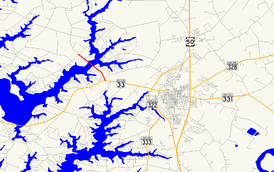
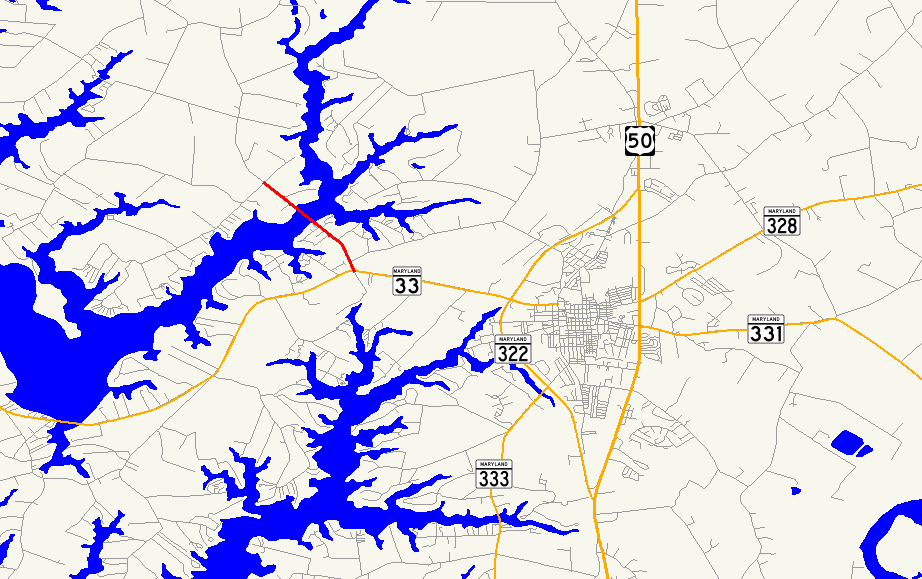
Route information Maintained by MDSHA Length: 1.58 mi[1] (2.54 km) Major junctions South end:  MD 33 west of Easton
North end: Miles River Road near Unionville Location Counties: Talbot Highway system Maryland highway system
Interstate • US • State • Minor • Former • Turnpikes←  I-370
I-370MD 371  →
→Maryland Route 370 (MD 370) is a state highway in the U.S. state of Maryland. Known as Unionville Road, the state highway runs 1.58 mi (2.54 km) from MD 33 near Easton to Miles River Road near Unionville. MD 370 connects Easton with the northwestern Talbot County villages of Unionville and Tunis Mills, which are separated from the county seat by the Miles River. The Miles River Bridge was constructed in the early 1910s. MD 370 was completed in the early 1930s when the bridge was connected with a modern road to MD 33.
Contents
Route description
MD 370 begins at an intersection with MD 33 (St. Michaels Road) west of Easton. The state highway heads northwest as a two-lane road through a mix of farmland and residential subdivisions. MD 370 crosses the Miles River on a bascule drawbridge before reaching its northern terminus at an intersection with Miles River Road near Unionville. Unionville Road continues north as a county highway toward the center of Unionville and Tunis Mills.[1][2]
History
The original Miles River Bridge was constructed as a state-aid project in 1913, along with 2 mi (3.2 km) of roads connecting the bridge to Unionville and Tunis Mills.[3] The bridge was connected with a modern road to MD 33 by 1933.[4] The original Miles River Bridge was replaced by the present bridge in 1984.[5]
Junction list
The entire route is in Talbot County.
Location Mile
[1]Destinations Notes 0.00 MD 33 (St. Michaels Road) – Easton, Saint MichaelsSouthern terminus Unionville 1.58 Unionville Road north / Miles River Road west Northern terminus 1.000 mi = 1.609 km; 1.000 km = 0.621 mi References
- ^ a b c "Highway Location Reference: Talbot County" (PDF). Maryland State Highway Administration. 2009. http://www.marylandroads.com/Location/2009_TALBOT.pdf. Retrieved 2010-09-13.
- ^ Google, Inc. Google Maps – Maryland Route 370 (Map). Cartography by Google, Inc. http://maps.google.com/maps?f=d&source=s_d&saddr=MD-370+S%2FUnionville+Rd&daddr=MD-370+N%2FUnionville+Rd&hl=en&geocode=FQzKTwIdTI12-w%3BFYwNUAIdHkh2-w&mra=ls&sll=38.803196,-76.133366&sspn=0.030702,0.077162&ie=UTF8&ll=38.792159,-76.125555&spn=0.030706,0.077162&t=h&z=14. Retrieved 2010-09-13.
- ^ Report of the State Roads Commission of Maryland. 1912-1915. Baltimore: Maryland State Roads Commission. May 1915. pp. 65, 95. http://www.archive.org/details/annualreportsofs1912mary. Retrieved 2010-09-13.
- ^ Maryland State Roads Commission (PDF). Map of Maryland (Map) (1933 ed.). http://commons.wikimedia.org/wiki/File:Maryland_State_Highway_Map_-_1933.pdf. Retrieved 2010-09-13.
- ^ "NBI Structure Number: 100000200018010". National Bridge Inventory. http://nationalbridges.com/nbi_record.php?StateCode=24&struct=100000200018010. Retrieved 2010-09-13.
External links
Roads in Talbot County, Maryland State highways 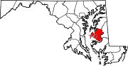
U.S. Highways Categories:- State highways in Maryland
- Roads in Talbot County, Maryland


Wikimedia Foundation. 2010.