- Burgh Castle
-
Coordinates: 52°35′08″N 1°39′13″E / 52.58547°N 1.65365°E
Burgh Castle 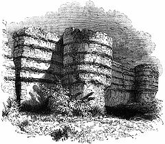
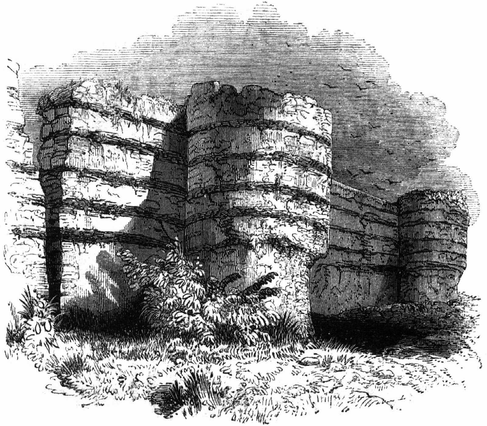
Burgh Castle walls, 1845 engraving
 Burgh Castle
Burgh Castle shown within NorfolkArea 6.76 km2 (2.61 sq mi) Population 955 - Density 141 /km2 (370 /sq mi) OS grid reference TG476049 Parish Burgh Castle District Great Yarmouth Shire county Norfolk Region East Country England Sovereign state United Kingdom Post town GREAT YARMOUTH Postcode district NR31 Police Norfolk Fire Norfolk Ambulance East of England EU Parliament East of England List of places: UK • England • Norfolk 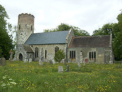 Church of St Peter and St Paul at Burgh Castle
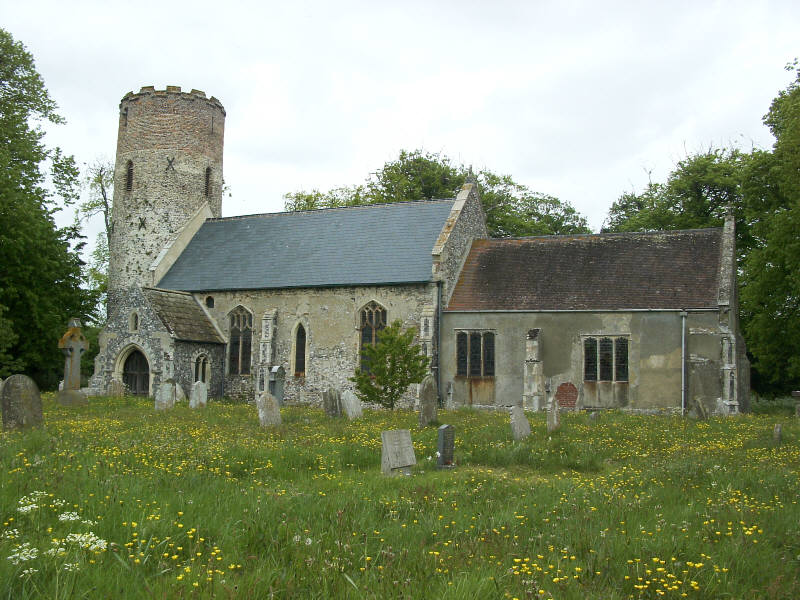
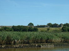 The wall of the fort
Burgh Castle is a village and civil parish in the English county of Norfolk. It is situated on the east bank of the River Waveney, near Great Yarmouth, some 6 km west of Great Yarmouth and within the Broads National Park.[1]
Contents
Roman Fort
Main article: Burgh Castle Roman SiteBurgh Castle is the site of one of several Roman forts constructed to hold cavalry as a defence against Saxon raids up the rivers of the east and south coasts of southern Britain (the Saxon Shore). Possibly this was Gariannonum, a name that appears in a single source; the identification was once thought secure, but is now thought doubtful by specialists. The fort is a very large rectangle with three of the tall massively built walls still extant; the fourth fell into what was once an estuary but is now a marsh. Breydon Water is all that is left of the estuary this fort once overlooked. The castle is owned by the Norfolk Archaeological Trust, with the walls in the care of English Heritage. The site is freely open to the public.[2]
Other
Since William Camden, Burgh Castle has been suggested as the site of "Cnobheresburg", the unknown place (a castrum or fort) in East Anglia, where in about 630 the first Irish monastery in southern England was founded by Saint Fursey as part of the Hiberno-Scottish mission described by Bede. Historians find many arguments against this location, but are unable to agree on a better one. The Roman fort at Burgh Castle was excavated by Charles Green during 1958-61. A detailed report by Norfolk Museums Service in 1983 (East Anglian Archaeology 20) shows that there was never any monastic settlement in Burgh Castle itself.
The church of Burgh Castle St Peter and St Paul is one of 124 existing round-tower churches in Norfolk.
The civil parish of Burgh Castle has an area of 6.76 km2 and in the 2001 census had a population of 955 in 376 households. For the purposes of local government, the parish today falls within the district of Great Yarmouth. However prior to the Local Government Act 1972, the parish was within Lothingland Rural District in Suffolk.[3][4]
The House of Burke take the original form of their surname, de Burgh, from the area.
References
- ^ Ordnance Survey (2005). OS Explorer Map OL40 - The Broads. ISBN 0-319-23769-9.
- ^ Norfolk Archaeological Trust
- ^ Office for National Statistics & Norfolk County Council (2001). Census population and household counts for unparished urban areas and all parishes. Retrieved December 2, 2005.
- ^ Local Government Act 1972, Schedule 1 Part II Non-metropolitan counties.
External links
- Map sources for Burgh Castle.
- Information from Genuki Suffolk on Burgh Castle.
- http://www.edp24.co.uk/Content/Postcard_From/burghcastle.asp
- History and research on Burgh Castle: English Heritage
- http://www.fromoldbooks.org/OldEngland/pages/129-wall-of-burgh-castle/
- http://www.romanmap.com/htm/names/Burgh%20Castle.htm
- Website with photos of Burgh Castle St Peter and St Paul, a round-tower church
- http://www.flickr.com/photos/lsurpix/sets/72157606330194894/ Photos of the church and fort
- http://www.furseypilgrims.co.uk/who.htm Christian pilgrimage to Burgh Castle.
Ashby with Oby · Belton with Browston · Bradwell · Burgh Castle · Caister-on-Sea · Filby · Fleggburgh · Fritton and St Olaves · Hemsby · Hopton-on-Sea · Martham · Mautby · Ormesby St Margaret with Scratby · Ormesby St Michael · Repps with Bastwick · Rollesby · Somerton · Stokesby with Herringby · Thurne · West Caister · Winterton-on-Sea
See also: South Norfolk · Great Yarmouth · Broadland · North Norfolk · King's Lynn and West Norfolk · Breckland Categories:- Villages in Norfolk
- Buildings and structures in Norfolk
- Castles in Norfolk
- Ruins in Norfolk
- English Heritage sites in Norfolk
- Civil parishes in Norfolk
- Kingdom of East Anglia


Wikimedia Foundation. 2010.