- Crowland
-
Coordinates: 52°40′36″N 0°10′08″W / 52.6768°N 0.1688°W
Crowland 
Croyland Abbey
 Crowland
Crowland shown within LincolnshirePopulation 3,607 Parish) OS grid reference TF2410 District South Holland Shire county Lincolnshire Region East Midlands Country England Sovereign state United Kingdom Post town PETERBOROUGH Postcode district PE6 Dialling code 01733 21xxxx Police Lincolnshire Fire Lincolnshire Ambulance East Midlands EU Parliament East Midlands UK Parliament South Holland and The Deepings List of places: UK • England • Lincolnshire Crowland (modern usage) or Croyland (medieval era name and the one still in ecclesiastical use) is a small town in south Lincolnshire, England, positioned between Peterborough and Spalding, with two sites of historical interest.
Contents
Geography
From 1894 the parish, being the only part of the Peterborough Rural Sanitary District in Lincolnshire, formed its own Crowland Rural District. This was merged into Spalding Rural District under a County Review Order in the 1930s. It has formed part of the South Holland district since April 1974.
Crowland falls within the drainage area of the Welland and Deepings Internal Drainage Board.[1]
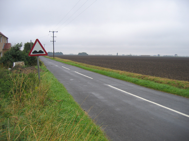
Crowland is nearer to the outskirts of Peterborough than Spalding, and (similar to other settlements of the Welland) is less than 1 mile (1.6 km) north of the Lincolnshire boundary with the City of Peterborough. The main road is the A16, which provides connections with Spalding to the north and Peterborough to the south (via the A47). The east-west B1166 connects with Deeping St. James along the north side of the Welland to the west and Holbeach Drove to the east, and Thorney is accessed via the B1040 to the south-east.
The civil parish extends south as far as Kennulph's Drain. This is the boundary with a small section of Newborough, which encompasses the parish adjacent south, that of Borough Fen. The A16 crosses the former A1073 (now an unclassified local road) from east to west just south of the Alderlands farm and campsite. The parish boundary follows a drain westwards and the A16 between Kennulph's Farm and Poplar's Farm. It follows Speechley Drove to the north and to the west of Eardley Grange, bordering Borough Fen. It crosses the east-west Corporation Bank and then borders Peakirk for a few hundred yards.
Crowland
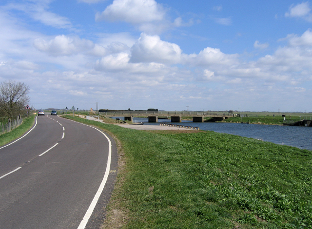
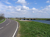 Fen Bridge, where the B1166 crosses the River Welland
 Queens Bank and Great Postland
At Kennulph's Stone, it no longer borders Peterborough but South Kesteven and the parish of Deeping St. James for about 220 yards (200 m). On the north side of the Welland, to the west of Wards Farm, and on the B1166, it no longer borders South Kesteven, but the parish of Deeping St. Nicholas (in South Holland). The boundary follows Raisen's Dyke to the north, crossing Crowland Common. The north-west corner of the parish has a 440 yards (400 m) section of the Peterborough to Lincoln Line.
The boundary follows eastwards, to the south, South Drove Drain and just to the north of Peacock's Farm and Law's Farm. The boundary crosses the Welland, then follows the New River to the east, to the north of Cloot House and Bank House Farm. To the north of St Guthlac's Cross, it meets Spalding Road (former A1073) and borders Cowbit, and follows the north side of Queen's Bank, crossing the A16. Just south of here, to the west of Spalding Road, is Crowland Airfield, home of a gliding club. For 880 yards (800 m) north of Queen's Bank Farm, it borders the large parish of Weston. Eastwards across to Middlemoor Farm, it borders Moulton. From the area south of Little Postland, it borders the large parish of Whaplode (Whaplode Drove).
It crosses the B1166 at Shepeau Stow, which includes a few houses in the parish on the west side of Back Bank, although the village is part of Whaplode parish. The area, in the parish, to the west of here was known as Great Postland. The boundary follows Dowsdale Bank, and just north of Dowsdale Plantation, the parish meets the City of Peterborough, and the parish of Thorney at the Lincolnshire-Peterborough boundary. It follows the Old South Eau under Fall's Bridge, near Empson's Farm. A footpath follows the boundary to where it crosses the B1040 at Nene Terrace, following the west side of the B1040 for 330 yards (300 m) where it meets the (Peterborough) parish of Newborough.
Nature reserve
Th Crowland Ponds Nature Reserve is north of the town, next to the west side of the Welland.
History
Crowland
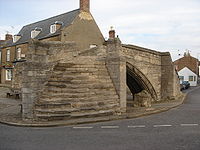 Trinity Bridge stands on dry land
 Great Postland Station
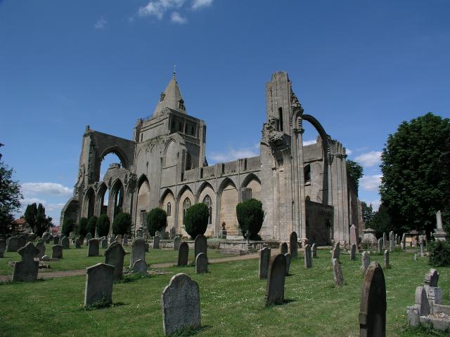
The town's two historical points of interest are the unique fourteenth Century three-sided bridge, Trinity Bridge, which stands at its central point, which used to be the confluence of three streams; and the other is its ruined mediaeval Croyland Abbey,[2] which was dedicated to Saint Mary the Virgin, Saint Bartholomew and Saint Guthlac in the eighth century. The Croyland Chronicle,[3] an important source for medieval historians, is believed to be the work of some of the monastery's inhabitants.
In about 701 a monk named Guthlac came to what was then an island in the Fens to live the life of a hermit. Following in Guthlac’s footsteps, a monastic community came into being here. Marshland beside the island was drained and a town gradually grew up near the abbey.
The town was captured after a short siege by Parliamentarian forces in 1643[4]
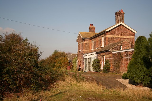
The Great Northern and Great Eastern Joint Railway crossed the north-east part of the parish until the 1980s. It passed near De Key's Farm to the east and Martin's Farm to the north. Postland railway station was near Postland House.
Education
The town currently has two schools, South View primary school, and The St Guthlac School, a co-educational secondary modern school.
St Guthlac School, named after the abbey's founder, is situated at the junction of the B1166 and B1040. Crowland school pupils have the option of single sex grammar school education ten miles away at Spalding, and sixth form students attend other schools, again at Spalding or at Deeping St James.[citation needed]
Lincolnshire Country Council made the decision at the begin of July 2011 that The St Guthlac School will close as part of the creation of the University Academy Holbeach, to be situated on the site of the former George Farmer Technology and Language College in Holbeach. Education4Crowland, a group of residents and members of the Parish, District and County Councils, has been formed to help fight for the retention of secondary education within the town and the creation of a Free School.[citation needed]
Notable people
See also
- Welland, Ontario - contained the former township of Crowland
- Magdalene College, Cambridge - founded in 1428 by John Litlington, Abbot of Crowland
References
- ^ Welland and Deepings IDB
- ^ "Crowland Tourist Information". Excelsior Information Systems Limited. http://www.aboutbritain.com/towns/crowland.asp. Retrieved 2009-05-07.
- ^ "Croyland Chronicle". Richard III Society Online Library. http://www.r3.org/bookcase/croyland/croy1.html. Retrieved 2009-05-07.
- ^ "a Fenland Notes and Queries; April 1899, article on a piece of Parliamentarian propaganda.". http://boar.org.uk/ariwxo3FNQ761.htm.
- Samuel Lewis, ed (1848). A Topographical Dictionary of England. pp. 737–742.'Crowfield - Croydon'. http://www.british-history.ac.uk/report.aspx?compid=50908#s4. Detailed History
- William Page, ed (1906). A History of the County of Lincoln. Victoria County History. 2. pp. 105–118,'Houses of Benedictine monks: The abbey of Crowland'. http://www.british-history.ac.uk/report.aspx?compid=37992. Abbey History
External links
- Crowland Parish Plan Website Website
- Crowland Website
- Crowland Links
- The Saint Guthlac School's Website
- South View Primary School's Website
- Education4Crowland Website
- Save St Guthlacs School Website
- Peterbrough and Spalding Gliding Club
Video links
Ceremonial county of Lincolnshire England Portal Unitary authorities Boroughs or districts Major settlements Alford • Barton-upon-Humber • Boston • Bourne • Brigg • Broughton • Burgh-le-Marsh • Caistor • Cleethorpes • Crowland • Crowle • Epworth • Gainsborough • Grantham • Grimsby • Holbeach • Horncastle • Immingham • Kirton-in-Lindsey • Lincoln • Long Sutton • Louth • Mablethorpe • Market Deeping • Market Rasen • North Hykeham • Scunthorpe • Skegness • Sleaford • Spalding • Spilsby • Stamford • Wainfleet All Saints • Winterton • Wragby
See also: List of civil parishes in LincolnshireTopics Settlements on the River Welland, Source – Wash Market Harborough · Ketton · Stamford · The Deepings (Market Deeping, Deeping St. James, Deeping Gate) · Crowland · SpaldingCategories:- Towns in Lincolnshire
- Civil parishes in Lincolnshire
- South Holland, Lincolnshire
- Nature reserves in Lincolnshire


Wikimedia Foundation. 2010.