Sarchu

Sarchu
Sarchu
—  city  —
Sarchu
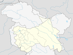
Location of Sarchu
in Jammu and Kashmir and India
Coordinates 32°53′N 77°32′E / 32.89°N 77.53°E / 32.89; 77.53Coordinates: 32°53′N 77°32′E / 32.89°N 77.53°E / 32.89; 77.53
Country India
State Jammu and Kashmir
District(s) Leh
Time zone IST (UTC+05:30)

Sarchu (Also called Sir Bhum Chun), a tented camp in the Himalayas on the Leh-Manali Highway, on the boundary between Himachal Pradesh and Ladakh (Jammu and Kashmir) in India. It is situated between Baralacha La to the south and Lachulung La to the north, at an altitude of 4,290 m.[1]

The journey along the Manali-Leh highway at high altitude and variable road conditions, normally takes two days, so travellers and tourists use this spot as an overnight stop. An Indian army camp is sited nearby on the banks of the Tsarap Chu river. The highway and thus the camp are closed during the winter, when snow blocks the high passes along the road.

This spot can also be used as a start point for the difficult trek into the Zanskar region of Ladakh.

References

  1. ^ [1]

Wikimedia Foundation. 2010.

Игры ⚽ Нужен реферат?

Look at other dictionaries:

  • Leh–Manali Highway — Leh Manali Highway लेह मनाली राजमार्ग Lēha manālī rājamārga Route information Length: 479 km (298 mi) …   Wikipedia

  • Manali-Leh-Highway — Der Tanglang La Der Manali Leh Highway (auch Leh Manali Highway) ist ein 477 Kilometer langer Verkehrsweg in Indien, der die Städte Leh (Ladakh) und Manali (Himachal Pradesh) verbindet. Die Straße ist für die indische Streitkräfte von… …   Deutsch Wikipedia

  • Geology of the Himalaya — [ Fig 1: The earth in the Early Permian. At that time, India is part of Gondwana and bordered to the north by the Cimmerian Superterrane. Paleogeographic reconstructions. By Dèzes (1999), based on Stampfli and Borel (2002) and Patriat and Achache …   Wikipedia

  • More plains — is crossed by the road from Leh to Manali. This stretch of 40 km [1] falls in between Leh and Sarchu. This road has an average elevation of 4000 meters [2] and is flanked by mountain ranges on both sides. At some places the road runs along… …   Wikipedia

  • Leh — This article is about the municipality in India. For its namesake district, see Leh district. For other uses, see LEH (disambiguation). Leh लेह / གླེ་   city   …   Wikipedia

  • Manali, Himachal Pradesh — For other uses, see Manali (disambiguation). Manali   city   …   Wikipedia

  • Lungalacha La — Infobox Mountain Pass Name = Lungalacha La Photo = Caption = Elevation = 5059 m Location = IND Range = Coordinates = Topographic Traversed by = Leh Manali highwayLachulanga la (el. 5059 m) is a mountain pass on the Leh Manali highway. It located… …   Wikipedia

  • Chandra Taal — Location Middle Himalaya, Spiti Valley, Coordinates …   Wikipedia

  • Leh-Manali Highway — The Leh Manali Highway is a highway in India connecting Leh and Manali. It crosses some of the highest mountain passes in the world, including Rohtang La (3,978 m, 13,050 ft), Baralacha La (4,892 m, 16,050 ft), Lachulung La (5,059 m, 16,600 ft)… …   Wikipedia

  • Cold Desert — is included as 16th biosphere reserves of India in 2009 under UNESCO s MAB (Man And Biosphere Reserve) program. It includes in itself Pin Valley National Park and surroundings;Chandratal and Sarchu Kibber Wildlife Sancturary in Himachal… …   Wikipedia

Share the article and excerpts

Direct link
Do a right-click on the link above
and select “Copy Link”