- Darcha
-
Darcha — village — 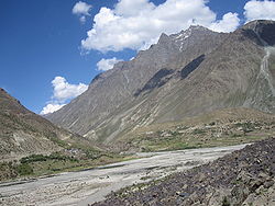
Coordinates 33°15′42″N 77°11′44″E / 33.261657°N 77.195435°ECoordinates: 33°15′42″N 77°11′44″E / 33.261657°N 77.195435°E Country India State Himachal Pradesh District(s) Lahaul and Spiti Population
• Density
298 (2001[update])
• 584 /km2 (1,513 /sq mi)
Time zone IST (UTC+05:30) Area
0.51 square kilometres (0.20 sq mi)
• 3,360 metres (11,020 ft)
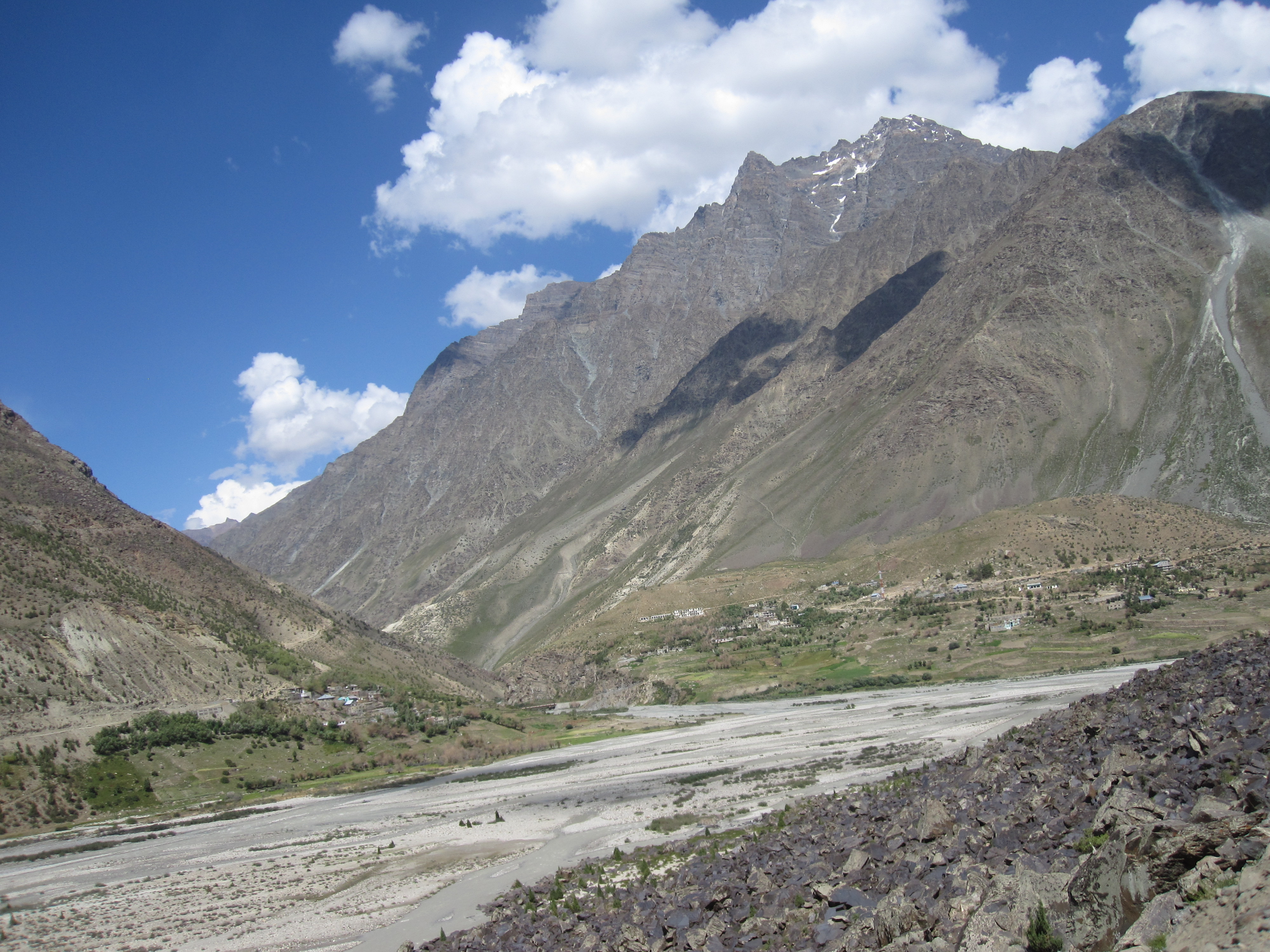
Darcha (elev. 3360 m[1]) is village on the Bhaga River in Lahaul, Himachal Pradesh, India. It is the northernmost permanent settlement in Himachal Pradesh along the Manali-Leh Highway.[2] The Rough Guide to India describes it as "a lonely cluster of dry-stone huts and dingy tent camps".[3]
The village has 65 households and a total population of 298, of which 152 are male and 146 are female.[4] There are 2 residents belonging to scheduled castes and 222 belonging to scheduled tribes.[4] Primary schooling is available in the village; there are no medical facilities.[4] Drinking water is available, and the village has power and telephone connections.[4]
Some buses between Manali and Leh stop for the night in Darcha, where travelers sleep in tents.[5] The village is the endpoint of a popular trek beginning in Padum, Zanskar.[2] All passing vehicles must stop at Darcha's police checkpoint for passport checks.[2][5][6] Roadside stalls offer basic food.[2]
References
- ^ http://himachaltourism.gov.in/post/Darcha.aspx
- ^ a b c d http://books.google.com/books?id=T7ZHUhSEleYC&pg=PA341
- ^ http://books.google.com/books?id=kAMik_6LbwUC&pg=PA523
- ^ a b c d 2001 India Census. See censusindia.gov.in (registration required). Data aggregated for Darcha Dangma and Darcha Sumdol.
- ^ a b http://books.google.com/books?id=vdMNBxOsvrUC&pg=RA1-PA168
- ^ http://books.google.com/books?id=TyZGp_YVzb8C&pg=PA196
Lahaul and Spiti Passes Valleys Lahaul · SpitiCities and Towns Monasteries Dhankar · Gandhola · Gemur · Gozzangwa · Guru Ghantal · Kardang · Key · Kibber · Kungri · Lhalung · Shashur · Tabo · Tangyud · Tayul · Gyuto Tantric Monastic UniversitySee also Categories:- Lahaul and Spiti
- Cities and towns in Lahaul and Spiti district


Wikimedia Foundation. 2010.