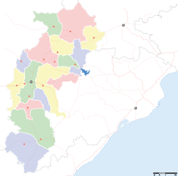
- Champa, Chhattisgarh
-
For other places with the same name, see Champa (disambiguation).
Champa — city — Coordinates 22°03′N 82°39′E / 22.05°N 82.65°ECoordinates: 22°03′N 82°39′E / 22.05°N 82.65°E Country India State Chhattisgarh District(s) Janjgir-Champa Population 37,949 (2001[update]) Time zone IST (UTC+05:30) Area
• 253 metres (830 ft)
Champa (Hindi: चाँपा) is a city and a municipality in Janjgir-Champa district in the state of Chhattisgarh, India.
Contents
Geography
Champa is located at 22°03′N 82°39′E / 22.05°N 82.65°E.[1] It has an average elevation of 253 metres (830 feet). Champa is located on the banks of River Hasdeo, a tributary of Mahanadi.
Demographics
As of 2001[update] India census,[2] Champa had a population of 37,949. Males constitute 52% of the population and females 48%. Champa has an average literacy rate of 67%, higher than the national average of 59.5%; with male literacy of 77% and female literacy of 56%. 14% of the population is under 6 years of age.
Economy
Champa is famous for the three K 's, namely, Kosa silk, kanchan (gold), and lastly kasa (brass metal). Champa has large industries viz. Madhya Bharat Paper Limited (MBPL),Prakash Industries and many mega power projects are in under construction.
Education
The Indian Institute of Handloom and Textile Technology is located here.it has only one Post Graduate Degree college at Champa Govt. M.M.R.Post Graduate college Champa & Many famous Schools Delhi Public School Champa, Hasdeo Public school champa Sarswati Shishu Mandir Hr. Sec. School Champa & Lions English Hr. Sec. School Champa.Golden era convent school.
References
- ^ Falling Rain Genomics, Inc - Champa
- ^ "Census of India 2001: Data from the 2001 Census, including cities, villages and towns (Provisional)". Census Commission of India. Archived from the original on 2004-06-16. http://web.archive.org/web/20040616075334/http://www.censusindia.net/results/town.php?stad=A&state5=999. Retrieved 2008-11-01.
Cities and towns in Janjgir-Champa Janjgir-Champa Akaltara · Baloda · Champa · Kharod · Naila Janjgir · Naya Baradwar · Sakti · Shivrinarayan
Cities and towns
in other districtsCategories:- Cities and towns in Janjgir-Champa district
- Railway stations in Chhattisgarh
- Chhattisgarh geography stubs
Wikimedia Foundation. 2010.


