- Popocatépetl
-
Popocatepetl 
Popocatepetl from Amecameca (looking south-east)Elevation 5,465 m (17,930 ft) Prominence 3,020 m (9,908 ft) Listing Ultra Location Mexico-Puebla-Morelos, Mexico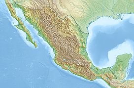
 Popocatepetl
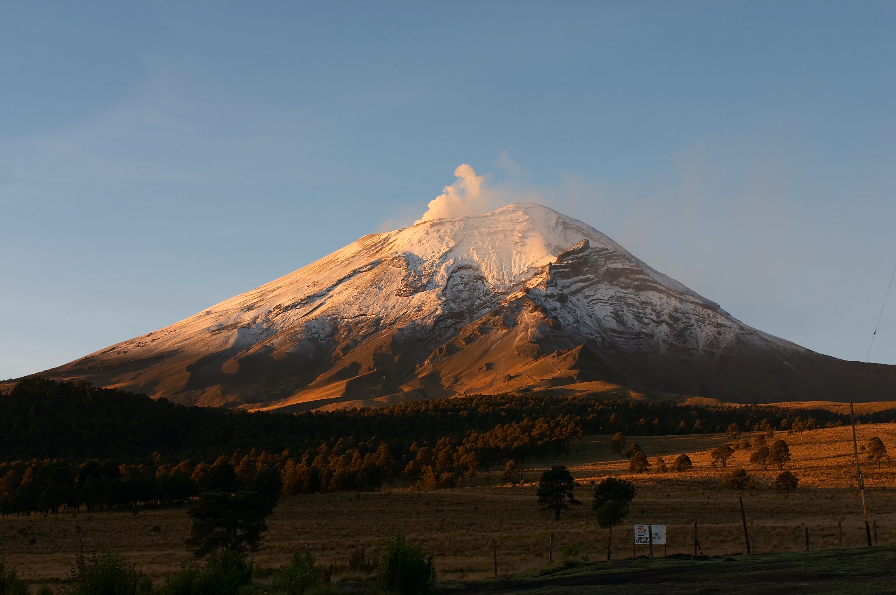
Coordinates 19°01′20″N 98°37′40″W / 19.02222°N 98.62778°WCoordinates: 19°01′20″N 98°37′40″W / 19.02222°N 98.62778°W Geology Type Stratovolcano Last eruption 2011 (ongoing)[1] Climbing First ascent 1289 by Tecuanipas tribe Easiest route rock/snow climb Popocatépetl also known as "Popochowa" by the local population is an active volcano and, at 5,426 m (17,802 ft), the second highest peak in Mexico after the Pico de Orizaba (5,636 m/18,491 ft). Popocatepetl is linked to the Iztaccihuatl volcano to the north by the high saddle known as the Paso de Cortés, and lies in the eastern half of the Trans-Mexican volcanic belt.
Popocatepetl is 70 km (43 mi) southeast of Mexico City, from where it can be seen regularly, depending on atmospheric conditions. The residents of Puebla, a mere 40 km (25 mi) east of the volcano, enjoy the views of the snowy and glacier-clad mountain almost all year long. The volcano is also one of the three tall peaks in Mexico to contain glaciers, the others being Iztaccihuatl and Pico de Orizaba. Magma erupted from Popocatepetl is a mixture of dacite and basaltic andesite.
Contents
Toponymy
The names is Popocatepetl comes from the Nahuatl words popōca 'it smokes' and tepētl 'mountain', thus Smoking Mountain. The name Don Goyo comes from the mountain's association in the lore of the region with San Gregorio (St. Gregory), "Goyo" being a nickname-like short form of Gregorio.
Geology
The stratovolcano contains a steep-walled, 400 × 600 m (1,300 × 2,000 ft) wide crater. The generally symmetrical volcano is modified by the sharp-peaked Ventorrillo on the NW, a remnant of an earlier volcano. At least three previous major cones were destroyed by gravitational failure during the Pleistocene, producing massive debris avalanche deposits covering broad areas south of the volcano. The modern volcano was constructed to the south of the late-Pleistocene to Holocene El Fraile cone.[1] Three major plinian eruptions, the most recent of which took place about 800 CE, have occurred from Popocatépetl since the mid Holocene, accompanied by pyroclastic flows and voluminous lahars that swept basins below the volcano.[2]
Popocatepetl is one of the most violent volcanoes in Mexico, having had more than 15 major eruptions since the arrival of the Spanish in 1519. A major eruption occurred in 1947 to begin this cycle of activity. Then, on December 21, 1994, the volcano spewed gas and ash which was carried as far as 25 km (16 mi) away by prevailing winds. The activity prompted the evacuation of nearby towns and scientists to begin monitoring for an eruption. In December 2000, tens of thousands of people were evacuated by the government based on the warnings of scientists. The volcano then made its largest display in 1,200 years.[3]
 Popocatepetl sends a plume of volcanic ash south on January 23, 2001, with Iztaccíhuatl at right. View from the International Space Station.
According to paleomagnetic studies, the volcano is about 730,000 years old. Elevation 5,450 m (17,880 ft) in cone form with a diameter of 25 km (16 mi) at its base and the crater has an elliptical shape with an orientation northeast-southeast. the walls of the crater oscillate between 600 to 840 m (2,000 to 2,760 ft). Popocatépetl is currently active after being dormant for about half of last century. In 1991 the volcano's activity increased and since 1993 smoke can be seen constantly emanating from the crater.
There is a large record of the volcano's activity throughout antiquity. In 1927 an eruption was artificially triggered by the use of dynamite in the crater for sulfur extraction. The last violent eruption was registered in 2000. on December 25, 2005, the volcano's crater produced a new explosion which ejected a large column of smoke and ash about 3 km (1.9 mi) into the atmosphere and expulsion of lava.
History
The first Spanish ascent of the volcano was made by an expedition led by Diego de Ordaz in 1519. The early 16th-century monasteries on the slopes of the mountain are a World Heritage Site.
Picture gallery
-

The north side of Popocatepetl viewed from Paso de Cortés
-

Popocatepetl at sunrise, looking west, from Puebla
-

View of Popocatepetl from Mexico City
-

Popocatepetl at sunrise from Mexico City.
See also
- 4000 meter peaks of México
- 4000 meter peaks of North America
- List of volcanoes in Mexico
- Volcanic Seven Summits
- Mountain peaks of México
- Mountain peaks of North America
- The legend of Popocatepetl and Iztaccihuatl
References
- ^ a b "Popocatépetl". Global Volcanism Program, Smithsonian Institution. http://www.volcano.si.edu/world/volcano.cfm?vnum=1401-09=. Retrieved 2008-12-18.
- ^ "Popocatépetl - Eruptive History". Global Volcanism Program. Smithsonian Institution. http://www.volcano.si.edu/world/volcano.cfm?vnum=1401-09=&volpage=erupt. Retrieved 2009-07-02.
- ^ USGS, 2000-12-21. Residents on slopes of Popocatepetl Volcano heed evacuation notice. Retrieved 2009-10-20.
- Pittman, Richard S. (1954). "A grammar of Tetelcingo (Morelos) Nahuatl". Language 30.1 (Part 2): 67ff..
- Secor, R. J. (2001). Mexico's Volcanoes: A Climbing Guide (3rd ed.). Mountaineers Books. pp. 160ff.. ISBN 0-89886-798-3. http://books.google.co.uk/books?id=XEqrPcMJ8vYC&lpg=PP1&dq=secor%20mexico's%20volcanoes&pg=PA4#v=onepage&q&f=false.
- "Popocatépetl". Global Volcanism Program, Smithsonian Institution. http://www.volcano.si.edu/world/volcano.cfm?vnum=1401-09=. Retrieved 2008-12-18.
- Yarza de la Torre, Esperanza (1971). Volcanes de México. Aguilar. pp. 237ff.. (in Spanish)
External links
 Popocatépetl erupts, January 2004
World Heritage Sites in Mexico North West Archaeological Zone of Paquimé, Casas Grandes · Islands and Protected Areas of the Gulf of California1 · Rock Paintings of Sierra de San Francisco · Whale Sanctuary of El Vizcaino

North Central Franciscan Missions in the Sierra Gorda of Querétaro · Historic Centre of Zacatecas · Historic Monuments Zone of Querétaro · Historic Town of Guanajuato and Adjacent Mines · Protected town of San Miguel and the Sanctuary of Jesús Nazareno de Atotonilco
West Agave Landscape and Ancient Industrial Facilities of Tequila · Historic Centre of Morelia · Hospicio Cabañas, Guadalajara · Islands and Protected Areas of the Gulf of California1 · Monarch Butterfly Biosphere Reserve1 ·
East Earliest 16th-Century Monasteries on the slopes of Popocatépetl1 · Pre-Hispanic City of El Tajín · Historic Centre of Puebla · Historic Monuments Zone of Tlacotalpan
South West Historic Centre of Oaxaca and Archaeological Site of Monte Albán · Pre-Hispanic City and National Park of Palenque ·
South Central Archaeological Monuments Zone of Xochicalco · Central University City Campus of the UNAM · Earliest 16th-Century Monasteries on the slopes of Popocatépetl1 · Historic Centres of Mexico City and Xochimilco · Luis Barragán House and Studio · Monarch Butterfly Biosphere Reserve1 · Pre-Hispanic City of Teotihuacán
South East Ancient Maya City of Calakmul, Campeche · Historic Fortified Town of Campeche · Pre-Hispanic City of Chichén Itzá · Sian Ka'an · Pre-Hispanic Town of Uxmal
1 Shared with other region/sCategories:- Mountains of Mexico
- Volcanoes of Mexico
- Trans-Mexican Volcanic Belt
- Stratovolcanoes
- Subduction volcanoes
- Pleistocene volcanoes
- Active volcanoes
- VEI-6 volcanoes
- World Heritage Sites in Mexico
- Geography of Mesoamerica
- Locations in Aztec mythology
- Locations in Mesoamerican mythology
-


Wikimedia Foundation. 2010.