- Orienta, Oklahoma
-
Orienta — Unincorporated community — Location within the state of Oklahoma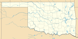
 Orienta
Coordinates: 36°21′36″N 98°28′26″W / 36.36°N 98.47389°WCoordinates: 36°21′36″N 98°28′26″W / 36.36°N 98.47389°W Country United States State Oklahoma County Major Time zone Central (CST) (UTC-6) - Summer (DST) CDT (UTC-5) ZIP codes FIPS code GNIS feature ID Orienta is a small community located at the junction US Highway 60 and US Highway 412 in Major County, Oklahoma. It lies north of Fairview, east of the Glass Mountains and south of the Cimarron River. The post office was established March 12, 1901, and took its name from the Kansas City, Mexico and Orient Railway along which it was built,
Sources
Shirk, George H. Oklahoma Place Names; Norman: University of Oklahoma Press, 1987: ISBN 0-8061-2028-2 .
Municipalities and communities of Major County, Oklahoma County seat: Fairview City 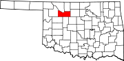
Towns Ames | Cleo Springs | Meno | Ringwood
Unincorporated
communitiesChester | Cheyenne Valley | Crystal Lakes | Dane | Isabella | Orienta | Orion
Categories:- Populated places in Major County, Oklahoma
- Unincorporated communities in Oklahoma
- Oklahoma geography stubs


Wikimedia Foundation. 2010.