- Opeongo River
-
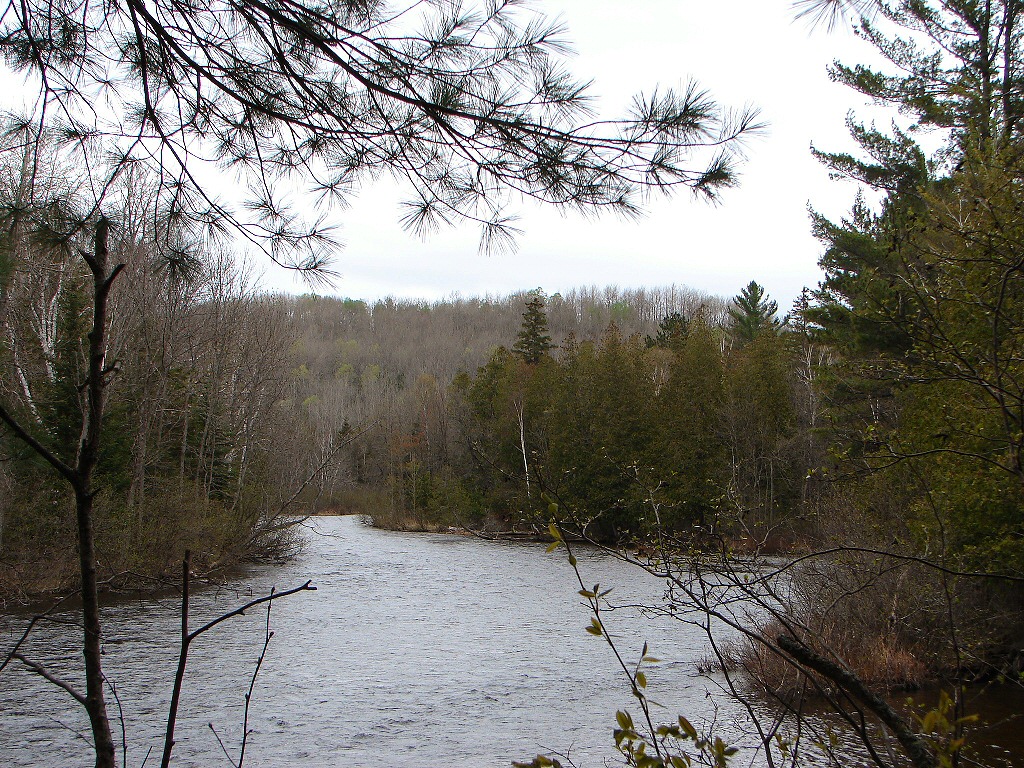
Opeongo River River 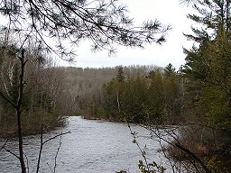 Opeongo River near the confluence with the Aylen River
Country Canada Ontario Ontario Region Northeastern Ontario District Nipissing Part of Saint Lawrence River drainage basin Source Opeongo Lake - location Preston Township, Unorganized South Nipissing District; in Algonquin Provincial Park - elevation 403 m (1,322 ft) - coordinates 45°41′55″N 78°16′28″W / 45.69861°N 78.27444°W Mouth Madawaska River - location East of Madawaska village, South Algonquin Township - elevation 311 m (1,020 ft) - coordinates 45°30′22″N 77°56′45″W / 45.50611°N 77.94583°W 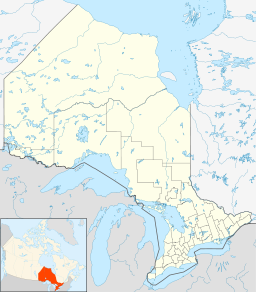
 Location of the mouth of the Opeongo River in Ontario
The Opeongo River is a river in the Saint Lawrence River drainage basin in Nipissing District in northeastern Ontario, Canada.[1][2] The river is entirely within Algonquin Provincial Park and Opeongo River Provincial Park, except for a small portion around Victoria Lake, and is a left tributary of the Madawaska River.
Contents
Course
The river begins in Algonquin Provincial Park at the outflow from Annie Bay on the East Arm of Opeongo Lake in geographic Preston Township, in the Unorganized South Part of Nipissing District, controlled by the Opeongo Lake Dam and flows southeast to Booth Lake. It exits the lake east controlled by the Booth Lake Dam, enters geographic Clancy Township, exits Algonquin Provncial Park into Opeongo River Provincial Park[3] and reaches Victoria Lake. The river leaves the lake at the northeast over a dam and continues southeast, passes from Unorganized South Nipissing District into the geographic Dickens Township in the municipality of South Algonquin, passes through a series of rapids, takes in the left tributary Aylen River, turns southwest, and empties into Bark Lake on the Madawaska River, at the Ontario Highway 60 bridge and east of the community of Madawaska. The Madawaska River flows via the Ottawa River to the Saint Lawrence River.
Recreation
The river is used for recreational canoeing and kayaking.
Tributaries
- Aylen River (left)
- Victoria Lake
- McNevin Creek (right)
- Shall Lake
- Oram Creek (right)
- Shall Creek (left)
- Crotch Lake
- Shirley Creek (left)
- Robin Creek (left)
- Bridle Creek (left)
- Booth Lake
- Rumley Creek (right)
- Cob Creek (right)
- McCarthy Creek (right)
- Chipmunk Creek (left)
- Tip Up Creek (left)
References
- ^ "Opeongo River". Geographical Names Data Base. Natural Resources Canada. http://geonames.nrcan.gc.ca/search/unique_e.php?id=FDMQO&output=xml. Retrieved 2011-08-08.
- ^ "Opeongo River". Atlas of Canada. Natural Resources Canada. 2010-02-04. http://atlas.nrcan.gc.ca/site/english/maps/topo/map?mapsize=750%20666&mapxy=1314317.82999%20-201990.296331&scale=500000&feature_na=Opeongo%20River&searchstring=Opeongo%20River&layers=fapfeature%20fapfeature%20north_arrow%20other_features%20million_grid%20t50k_grid%20grid_50k_3%20roads%20hydrography%20boundary%20builtup%20vegetation%20populated_places%20railway%20power_network%20manmade_features%20designated_areas%20water_features%20water_saturated_soils%20relief%20contours%20toponymy%20contour%20nodata_ntdb_50k&map_layer%5bnortharrow%5d_class%5b0%5d_style%5b0%5d=ANGLE%20-15.27321554537481&urlappend=%26unique_key%3D0c599536849c20c3e053cb29e9ef700c%26map.layer%5Btextzoom03%5D%3DFEATURE+POINTS+1336637.69921+-210983.869821+END+TEXT+%22Opeongo+River%22+END%26map.layer%5Btextzoom46%5D%3DFEATURE+POINTS+1336637.69921+-210983.869821+END+TEXT+%22Opeongo+River%22+END%26map.layer%5Blineresultzoom0%5D%3DDATA+fap_rivers%26map.layer%5Blineresultzoom1%5D%3DDATA+fap_rivers%26map.layer%5Blineresultzoom2%5D%3DDATA+fap_rivers%26map.layer%5Barrowzoom03%5D%3DFEATURE+POINTS+1336637.69921+-210983.869821+END+END. Retrieved 2011-08-08. Shows the river course.
- ^ "Opeongo River". Ontario Parks. 2002-11-08. http://www.ontarioparks.com/english/opeo.html. Retrieved 2011-08-08.
Other map sources:
- McMurtrie, Jeffrey (2008). "Algonquin Provincial Park and the Haliburton Highlands". Wikimedia Commons. http://commons.wikimedia.org/wiki/File:Algonquin_Map_2008_-_Version_1.0_-_Smaller_rs.jpg. Retrieved 2011-08-08.
- Ministry of Transportation of Ontario (2010-01-01) (PDF). Map 9 (Map). 1 : 700,000, Official road map of Ontario. http://www.mto.gov.on.ca/english/traveller/map/images/pdf/southont/sheets/Map9.pdf. Retrieved 2011-08-08.
- Ontario Ministry of Municipal Affairs and Housing (2006). Restructured municipalities - Ontario map #5 (Map). Restructuring Maps of Ontario. http://www.mah.gov.on.ca/Asset1607.aspx. Retrieved 2011-08-08.
Categories:- Rivers of Ontario
- Geography of Nipissing District, Ontario
- Northern Ontario geography stubs

Wikimedia Foundation. 2010.