Økern (station)

Økern (station)
Økern
Okern tbane 01.jpg
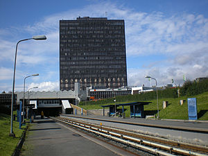
Location
Place Økern
Municipality Oslo
Coordinates 59°55′41″N 10°48′16″E / 59.92806°N 10.80444°E / 59.92806; 10.80444Coordinates: 59°55′41″N 10°48′16″E / 59.92806°N 10.80444°E / 59.92806; 10.80444
Line Grorud Line
Distance 5.4 km (3.4 mi)
Service
Opened 16 October 1966
Type At-grade
Line(s)

5 

Connections

Økern is a station on Grorud Line on the Oslo Metro between the stations of Hasle and Risløkka, 5.4 km from Stortinget station. The station is located at the intersection between the subway line and the Ring 3 highway which runs north of Oslo, and Økern is a transportation node with connections to a number of local bus lines.

The area around Økern is largely commercial, with the office park Økern Næringspark and the shopping centre Økern senter in the immediate vicinity.

The station is part of the original stretch of the Grorud Line, and was opened 16 October 1966. The architect for the station was Guttorm Bruskeland.[1] The station is being rebuilt, for instance platforms will be heated to prevent snow and ice from settling.[2]

References

  1. ^ Subway stations in the East From sporveien.no, official site of Oslo's transit system
  2. ^ Økern t-bane Statens vegvesen (Norwegian road authority)
TERMINUS NEXT STATION
← WEST
Økern NEXT STATION
EAST→
TERMINUS
Storo Hasle Line 5 Risløkka Vestli


Wikimedia Foundation. 2010.

Игры ⚽ Поможем решить контрольную работу

Look at other dictionaries:

  • Risløkka (station) — Infobox T bane station name = Risløkka caption = locale = Økernbråten municipality = Oslo line = Grorudbanen distance = 6.5 km elevation = coordinates = coord|59|55|56|N|10|49|23|E|display=title,inline|region:NO 03 scale:50000 type:railwaystation …   Wikipedia

  • Hasle (station) — Infobox T bane station name = Hasle caption = locale = Hasle municipality = Oslo line = Grorudbanen distance = 4.6 km elevation = coordinates = coord|59|55|26|N|10|47|36|E|display=title,inline|region:NO 03 scale:50000 type:railwaystation start =… …   Wikipedia

  • Nationaltheatret (station) — For the mainline railway station underneath, see Nationaltheatret Station. Nationaltheatret Entrance Location Place Vika Municipality …   Wikipedia

  • Mortensrud (station) — Mortensrud Location Place Mortensrud, Søndre Nordstrand Municipality Oslo Coordinates …   Wikipedia

  • Nydalen (station) — For the railway station, see Nydalen Station. Nydalen Location Place Nydalen, Nordre Aker Municipality …   Wikipedia

  • Østhorn (station) — Østhorn Lo …   Wikipedia

  • Montebello (station) — Montebello Location Place Montebello Municipality Oslo Coordinates …   Wikipedia

  • Nordberg (station) — Nordberg Location …   Wikipedia

  • Majorstuen (station) — Majorstuen Two MX3000 at the station Location Place Majorstuen Municipality Oslo …   Wikipedia

  • Østerås (station) — Østerås MX3000 unloading at Østerås. Location Place Østerås Municipality Bærum Coordinates …   Wikipedia

Share the article and excerpts

Direct link
Do a right-click on the link above
and select “Copy Link”