- Mapperley
-
Coordinates: 52°58′44″N 1°07′23″W / 52.979°N 1.123°W
Mapperley 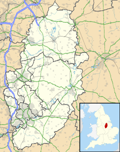
 Mapperley
Mapperley shown within NottinghamshireDistrict Gedling/City of Nottingham Shire county Nottinghamshire Region East Midlands Country England Sovereign state United Kingdom Post town NOTTINGHAM Postcode district NG3 Dialling code 0115 Police Nottinghamshire Fire Nottinghamshire Ambulance East Midlands EU Parliament East Midlands UK Parliament Gedling List of places: UK • England • Nottinghamshire Mapperley is a residential and commercial area of north-eastern Nottingham, England. The area is bounded by Sherwood to the north-west, Thorneywood to the south and Gedling to the east.
Contents
History
The older part of Mapperley, dating from the late 19th century, is Mapperley Park. Situated on the north eastern edge of the City of Nottingham Boundary, this area boasts many fine Victorian and Edwardian villas, some of which have been divided into flats, as well as a considerable number of middle class inter- and post-war houses. It remains a desirable place to live and its status as a conservation area has recently been confirmed by a Conservation Area Appraisal. Further from the city are Mapperley and the area known colloquially as "Mapperley Top", part of the suburban borough of Gedling. This area was largely developed during the inter-war period swallowing up many acres of farmland and the old 'coppice' to create the suburb of Mapperley as it largely exists today.
Geography
The area is located within the Mapperley Plains ward[1], within the Gedling area, on a raised plateau and overlooks the city giving views of over 18 miles to the River Trent and the power station at Ratcliffe-on-Soar.
Mapperley is a relatively large geographical area, but as its boundaries are split between two local authorities it is not usually accepted as a single suburb.
Locally the name "Mapperley Top" is used to describe the collection of shops running along Woodborough Road in Nottinghamshire roughly three miles from the Nottingham city centre.
More recently BBC Radio Nottingham and 96 Trent FM, along with three DAB digital radio multiplex (NOW Nottingham, BBC National DAB, and Digital One) broadcast from the transmitter location known as Mapperley Ridge.
Politics
Mapperley today is represented both on Nottingham City Council and Gedling Borough Council. The current councillors are even split: three for the City Ward, who are Labour Party councillors, and three for the borough, who are Conservative Party councillors.
Bus service
Nottingham City Transport
- 25: Nottingham - Carlton - Mapperley - Arnold.
- 45: Nottingham - Mapperley - Gedling
- L9: Nottingham - Carlton - Mapperley - Sherwood - City Hospital - Arnold - Bestwood Park.
Premiere Travel
- 7: Nottingham - Mapperley - Lambley - Woodborough - Calverton.
- 7.1: Nottingham - Mapperley - Arnold - Calverton.
- 7.2: Nottingham - Mapperley - Gedling - Netherfield.
- 7.3: Nottingham - Mapperley - Carlton - Netherfield.
- 73/73A: Colwick - Netherfield - Carlton/Sneinton - Mapperley - Arnold
Nottingham Community Council
- L8: Mapperley & Sherwood.
See also
References
- ^ "Mapperley Plains ward". Gedling Borough Council. http://www.gedling.gov.uk/index/gcp-home/gcp-area_profile/gcp-mapperley.htm.
External links
Nottingham About Nottingham Areas of Nottingham Arboretum · Aspley · Bakersfield · Bilborough · Bulwell · Basford · Carrington · Clifton · Dunkirk · Forest Fields · Hockley · Hyson Green · Lace Market · Lenton · Lenton Abbey · Mapperley · The Meadows · The Park · Radford · Sherwood · Sneinton · St Ann's · Strelley · Top Valley · Wilford · WollatonCeremonial county of Nottinghamshire Unitary authorities Boroughs or districts Major settlements Arnold · Beeston · Bingham · Bircotes · Blidworth · Bulwell · Carlton · Cotgrave · Eastwood · Harworth · Hucknall · Kimberley · Kirkby-in-Ashfield · Mansfield · Mansfield Woodhouse · Netherfield · Newark · Nottingham · Ollerton · Rainworth · Retford · Ruddington · Stapleford · Southwell · Sutton-in-Ashfield · West Bridgford · Worksop
See also: List of civil parishes in NottinghamshireTopics Categories:- Districts of Nottingham

Wikimedia Foundation. 2010.