- U.S. Route 84 in Georgia
Infobox road
state=GA
type=
route=38
marker_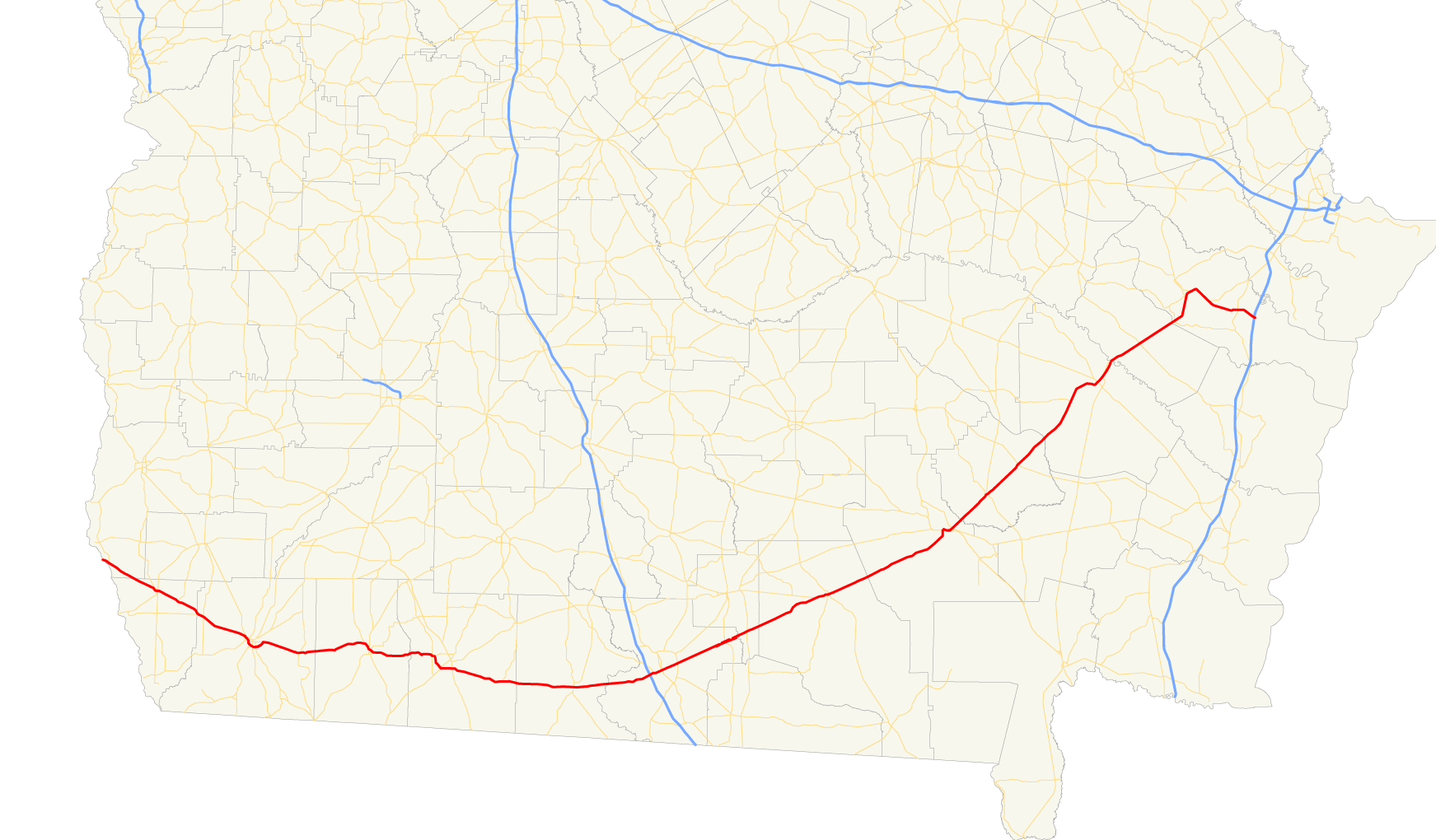
length_mi=
length_km=
established=
direction_a=West
direction_b=East
starting_terminus=
junction=
ending_terminus=
previous_route=37
next_route=39U.S. Route 84 in Georgia, is also signed as State Route 38 for its entire length in Georgia. After entering Georgia fromAlabama west ofJakin, Georgia , the route travels through the southern portion of the state, meeting its eastern terminus at Interstate 95 east of Midway.Routing
After entering the state from Alabama, U.S. Route 84 travels east through Donalsonville to Bainbridge. The routes travel around the city to the south on a
freeway bypass, cosigned withU.S. Route 27 /State Route 1. The route continues east through Cairo to Thomasville, where it bypasses downtown to the north and east, cosigned withU.S. Route 319 , thenU.S. Route 19 . The route then continues east to Quitman, where it becomes cosigned withU.S. Route 221 east, past its interchange withInterstate 75 , to Valdosta. In Valdosta, U.S. Route 221 departs, and U.S. Route 84 continues east-northeast to Waycross, where it is briefly cosigned withU.S. Route s 1, 23, and 82. U.S. Route 84 continues northeast from Waycross, passing through Blackshear before arriving in Jesup. In Jesup, the route becomes cosigned with U.S. Routes 25 and 301 northeast to Ludowici. In Ludowici, U.S. Routes 25 and 301 depart to the northwest, and U.S. Route 84 continues northeast to Hinesville. In Hinesville, the route becomes cosigned with State Route 196, and takes a drastic turn to the east. A short distance later, State Route 196 departs, and the U.S. Route 84 (as well as State Route 38) continue east to their eastern terminus at exit 76 on Interstate 95 east of Midway.History
Formerly, U.S. Route 84 met its eastern terminus at
U.S. Route 17 west of Brunswick, while U.S. Route 82 followed the present alignment of U.S. Route 84 to Midway. However, with realignment of highways near Waycross, the termini of the two routes were swapped. In addition, a segment of the route between Boston and Quitman was relocated to a more northernly routing in1966 , with the former routing being renumbered as State Route 364. State Route 364 was decommissioned in1982 . [http://www.geocities.com/garoadwarrior76/garoutelog361_380.html Accessed January 24, 2007]ignificance
U.S. Route 84 is a very significant route in southern Georgia. Almost all of the route sees an Average Annual Daily Traffic of 5,000 vehicles or more, and the AADT exceeds 20,000 vehicles in and around Waycross and Hinesville. [http://www.dot.state.ga.us/dot/plan-prog/transportation_data/mapproducts/Documents/Trafficflow_05.pdf] Because of this, most of the route is a multi-lane divided highway, especially west of Valdosta.
Banner Routes
U.S. Route 84 and State Route 38 have several banner routes in Georgia. From west to east:
U.S. 84 Business/S.R. 38 Business - Bainbridge
U.S. Route 84 Business/State Route 38 Business in Bainbridge follows the former routing of the mainline route through downtown, running west to east from both ends of the mainline route around town.
.R. 38 Spur - Cairo
in downtown.
U.S. 84 Business/S.R. 38 Business - Thomasville
.
.R. 38 Connector - Hinesville
, which meets the mainline much further south.
References
Wikimedia Foundation. 2010.