- Ludowici, Georgia
Infobox Settlement
official_name = Ludowici, Georgia
other_name =
native_name =
nickname =
settlement_type =City
motto =
imagesize =
image_caption =
flag_size =
image_
seal_size =
image_shield =
shield_size =
image_blank_emblem =
blank_emblem_type =
blank_emblem_size =
imagesize =
image_caption =
flag_size =
image_
seal_size =
image_shield =
shield_size =
image_blank_emblem =
blank_emblem_type =
blank_emblem_size =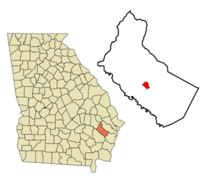
mapsize = 250px
map_caption = Location in Long County and the state of Georgia
mapsize1 =
map_caption1 =
image_dot_
dot_mapsize =
dot_map_caption =
dot_x =
dot_y =
pushpin_
pushpin_label_position =
pushpin_map_caption =
pushpin_mapsize =
subdivision_type = Country
subdivision_name =United States
subdivision_type1 = State
subdivision_name1 = Georgia
subdivision_type2 = County
subdivision_name2 = Long
subdivision_type3 =
subdivision_name3 =
subdivision_type4 =
subdivision_name4 =
government_footnotes =
government_type =
leader_title =
leader_name =
leader_title1 =
leader_name1 =
leader_title2 =
leader_name2 =
leader_title3 =
leader_name3 =
leader_title4 =
leader_name4 =
established_title =
established_date =
established_title2 =
established_date2 =
established_title3 =
established_date3 =
area_magnitude =
unit_pref = Imperial
area_footnotes =
area_total_km2 = 5.7
area_land_km2 = 5.7
area_water_km2 = 0
area_total_sq_mi = 2.2
area_land_sq_mi = 2.2
area_water_sq_mi = 0
area_water_percent =
area_urban_km2 =
area_urban_sq_mi =
area_metro_km2 =
area_metro_sq_mi =
area_blank1_title =
area_blank1_km2 =
area_blank1_sq_mi =
population_as_of = 2000
population_footnotes =
population_note =
population_total = 1440
population_density_km2 = 252.6
population_density_sq_mi = 654.5
population_metro =
population_density_metro_km2 =
population_density_metro_sq_mi =
population_urban =
population_density_urban_km2 =
population_density_urban_sq_mi =
population_blank1_title =
population_blank1 =
population_density_blank1_km2 =
population_density_blank1_sq_mi =
timezone = Eastern (EST)
utc_offset = -5
timezone_DST = EDT
utc_offset_DST = -4
latd = 31 |latm = 42 |lats = 38 |latNS = N
longd = 81 |longm = 44 |longs = 40 |longEW = W
elevation_footnotes =
elevation_m = 20
elevation_ft = 66
postal_code_type =ZIP code
postal_code = 31316
area_code = 912
blank_name = FIPS code
blank_info = 13-47784GR|2
blank1_name = GNIS feature ID
blank1_info = 0356371GR|3
website =
footnotes =Ludowici is a city in Long County, Georgia,
United States . The population was 1,440 at the 2000 census. The city is thecounty seat of Long CountyGR|6. It is a part of the Hinesville-Fort Stewart metropolitan statistical area.General Information
Ludowici is located at coor dms|31|42|38|N|81|44|40|W|city (31.710597, -81.744423)GR|1.
According to the
United States Census Bureau , the city has a total area of 2.2square mile s (5.8km² ), of which, 2.2 square miles (5.7 km²) of it is land and 0.45% is water.Ludowici pronounced "Loo'duh-with'-see"
Originally called Johnston Station, it was incorporated on August 23, 1905. The city was renamed after William Ludowici later on. Ludowici was a German immigrant, who contributed substantially to the construction of the county high school. Ludowici is located 30 miles from the coast and is nestled between Jesup, Georgia, Darien, Georgia, Hinesville/Ft. Stewart, Georgia and Glennville, Georgia.
There are four schools located in Ludowici. Smiley Elementary School, Walker Middle School (named after the late Rev. Samson Walker), Long County High School, and Faith Baptist Christian Academy, a Christian school.
Other properties in Ludowici include an IGA grocery store and Dollar General. Ludowici's chain restaurants include a Subway, Dairy Queen, and a Huddle House. Local restaurants include L&B's Southern Fried Chicken and Debbie's Diner.
The main natural attraction is the Altamaha River, and Ludowici features extended swamp land across the county.
“The Ludowici Brick and Tile Company” employed most people that resided in Long County in the early 20th century. The company produced the Ludowici tile, a distinctive clay roofing material that was popular among contractors in Florida at that time. There are a number of homes in the city that still display these distinctive roofs. The Ludowici Tile is now a favorite for residents living in the west i.e. California, New Mexico, Nevada, and Arizona. One tile can range from $25 to $50 each.
The town gained notoriety during the 1950s and 1960's for its aggressive traffic enforcement policies. The AAA motoring organization went so far as to specifically label Ludowici as a
speed trap . Allegedly, members of the local police force were engaging in manipulation of the timing of the traffic signal downtown so as to catch unsuspecting out-of-area motorists 'running' a suddenly changed red light. The switch for the stop light was located in the barber shop. This activity subsequently came to an end when then-GovernorLester Maddox stated that the practices of the Ludowici police were giving the entire state a bad reputation.Demographics
As of the
census GR|2 of 2000, there were 1,440 people, 526 households, and 370 families residing in the city. Thepopulation density was 649.0 people per square mile (250.4/km²). There were 636 housing units at an average density of 286.6/sq mi (110.6/km²). The racial makeup of the city was 72.78% White, 23.82% African American, 1.18% Native American, 0.14% Asian, 0.14% Pacific Islander, 1.25% from other races, and 0.69% from two or more races. Hispanic or Latino of any race were 2.29% of the population.There were 526 households out of which 41.3% had children under the age of 18 living with them, 46.4% were married couples living together, 19.2% had a female householder with no husband present, and 29.5% were non-families. 24.1% of all households were made up of individuals and 11.6% had someone living alone who was 65 years of age or older. The average household size was 2.74 and the average family size was 3.27.
In the city the population was spread out with 33.6% under the age of 18, 11.7% from 18 to 24, 27.4% from 25 to 44, 16.6% from 45 to 64, and 10.7% who were 65 years of age or older. The median age was 28 years. For every 100 females there were 95.4 males. For every 100 females age 18 and over, there were 87.5 males.
The median income for a household in the city was $27,386, and the median income for a family was $28,792. Males had a median income of $25,272 versus $16,250 for females. The
per capita income for the city was $11,701. About 18.5% of families and 18.1% of the population were below thepoverty line , including 22.9% of those under age 18 and 15.8% of those age 65 or over.Education System
Long County High(school)http://www.longcountyhs.com/Smiley ElementaryWalker Middle Faith Baptist Private school
References
External links
Wikimedia Foundation. 2010.