- Georgia State Route 23
Infobox road
state=GA
type=
route=23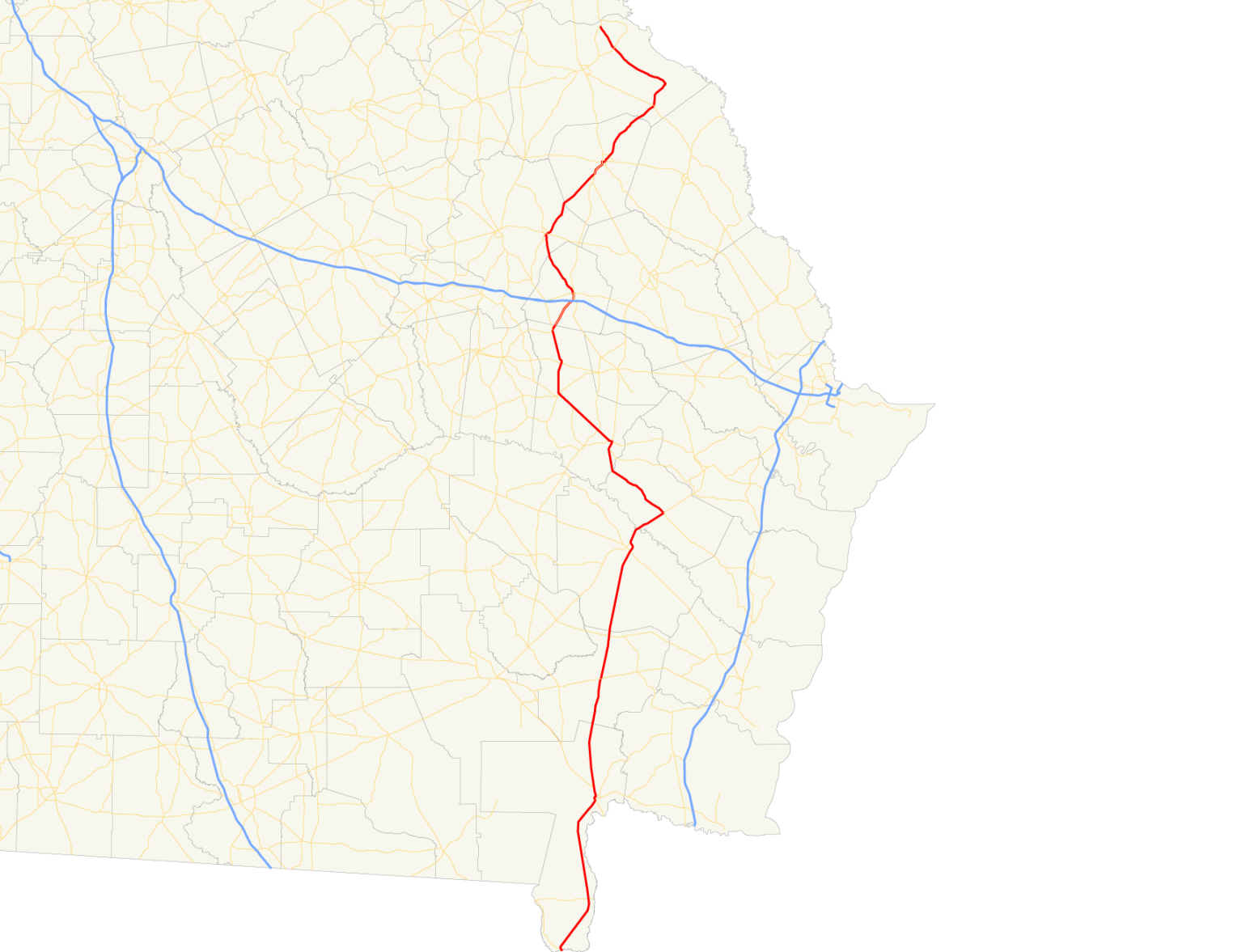
length_mi=
length_ref= [http://www.dot.state.ga.us/DOT/plan-prog/transportation_data/400reports/2002/dpp444_2002.pdf]
length_round=2
established=
direction_a=South
direction_b=North
starting_terminus=Florida state line south of Saint George
junction= in Metter
ending_terminus=
previous_route=22
next_route=24State Route 23 is a state route located in the eastern part of the
U.S. state of Georgia. The route travels from theFlorida state line in southernCharlton County north to State Route 56 north of Waynesboro.Routing
State Route 23 begins at the Florida state line near the southern most point in the state. It travels north, cosigned with S.R. 121, to Folkston. In Folkston, S.R. 23 and S.R. 121 become cosigned with U.S. 1/U.S. 23/U.S. 301/S.R. 4/S.R. 15. A few miles north of Folkston, U.S. 301 and S.R. 23 split from the other routes, and continue north to Jesup, where the two routes become cosigned with U.S. 25, U.S. 84, and S.R. 38 north to Ludowici. In Ludowici, U.S. 84 and S.R. 38 depart to the northeast, and the remainder of the routes continue northwest. In Glennville, S.R. 23 departs the other two routes to the northwest, cosigned with S.R. 57. Southeast of Reidsville, the two routes are joined by S.R. 121. In northern Tattnall County, S.R. 57 departs, and S.R. 23 and S.R. 121 continue northeast to Metter. S.R. 23 departs S.R. 121 in Metter, and continues northwest to Twin City, where it assumes a more northeasterly routing. South of Millen, S.R. 23 once again becomes cosigned with U.S. 25 and S.R. 121. The three routes continue northeast into downtown Millen, where S.R. 23 departs, and continues to the northeast. Northeast of Sardis, the route takes a drastic turn to the northwest, and continues to its northern terminus at S.R. 56.
ignificance
Other than the section of the route around Folkston, as well as that between Jesup and Ludowici, S.R. 23 sees only marginal traffic. A vast majority of the route sees an Average Annual Daily Traffic of 5,000 vehicles or less. [http://www.dot.state.ga.us/dot/plan-prog/transportation_data/mapproducts/Documents/Trafficflow_05.pdf]
Banner routes
State Route 23 has one banner route:
tate Route 23 Spur
in Twin City.
References
Wikimedia Foundation. 2010.