- Jesup, Georgia
Infobox Settlement
official_name = Jesup, Georgia
other_name =
native_name =
nickname =
settlement_type =City
motto =
imagesize =
image_caption =
flag_size =
image_
seal_size =
image_shield =
shield_size =
image_blank_emblem =
blank_emblem_type =
blank_emblem_size =
imagesize =
image_caption =
flag_size =
image_
seal_size =
image_shield =
shield_size =
image_blank_emblem =
blank_emblem_type =
blank_emblem_size =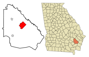
mapsize = 250px
map_caption = Location in Wayne County and the state of Georgia
mapsize1 =
map_caption1 =
image_dot_
dot_mapsize =
dot_map_caption =
dot_x =
dot_y =
pushpin_
pushpin_label_position =
pushpin_map_caption =
pushpin_mapsize =
subdivision_type = Country
subdivision_name =United States
subdivision_type1 = State
subdivision_name1 = Georgia
subdivision_type2 = County
subdivision_name2 = Wayne
subdivision_type3 =
subdivision_name3 =
subdivision_type4 =
subdivision_name4 =
government_footnotes =
government_type =
leader_title =
leader_name =
leader_title1 =
leader_name1 =
leader_title2 =
leader_name2 =
leader_title3 =
leader_name3 =
leader_title4 =
leader_name4 =
established_title =
established_date =
established_title2 =
established_date2 =
established_title3 =
established_date3 =
area_magnitude =
unit_pref = Imperial
area_footnotes =
area_total_km2 = 42.9
area_land_km2 = 42.8
area_water_km2 = 0.1
area_total_sq_mi = 16.6
area_land_sq_mi = 16.5
area_water_sq_mi = 0.1
area_water_percent =
area_urban_km2 =
area_urban_sq_mi =
area_metro_km2 =
area_metro_sq_mi =
area_blank1_title =
area_blank1_km2 =
area_blank1_sq_mi =
population_as_of = 2000
population_footnotes =
population_note =
population_total = 9279
population_density_km2 = 216.3
population_density_sq_mi = 559
population_metro =
population_density_metro_km2 =
population_density_metro_sq_mi =
population_urban =
population_density_urban_km2 =
population_density_urban_sq_mi =
population_blank1_title =
population_blank1 =
population_density_blank1_km2 =
population_density_blank1_sq_mi =
timezone = Eastern (EST)
utc_offset = -5
timezone_DST = EDT
utc_offset_DST = -4
latd = 31 |latm = 36 |lats = 7 |latNS = N
longd = 81 |longm = 53 |longs = 6 |longEW = W
elevation_footnotes =
elevation_m = 29
elevation_ft = 95
postal_code_type =ZIP code s
postal_code = 31500-31599
area_code = 912
blank_name = FIPS code
blank_info = 13-42268GR|2
blank1_name = GNIS feature ID
blank1_info = 0316104GR|3
website =
footnotes =Jesup is a city in Wayne County, Georgia,
United States . The population was 9,279 at the 2000 census. The city is thecounty seat of Wayne CountyGR|6.Geography
Jesup is located at coor dms|31|36|7|N|81|53|6|W|city (31.601866, -81.885070)GR|1.
According to the
United States Census Bureau , the city has a total area of 16.6square mile s (43.0km² ), of which, 16.5 square miles (42.8 km²) of it is land and 0.1 square miles (0.1 km²) of it (0.30%) is water.Demographics
As of the
census GR|2 of 2000, there were 9,279 people, 2,921 households, and 2,015 families residing in the city. Thepopulation density was 561.2 people per square mile (216.6/km²). There were 3,469 housing units at an average density of 209.8/sq mi (81.0/km²). The racial makeup of the city was 53.97% White, 41.91% African American, 0.12% Native American, 0.70% Asian, 2.20% from other races, and 1.10% from two or more races. Hispanic or Latino of any race were 7.17% of the population.There were 2,921 households out of which 33.1% had children under the age of 18 living with them, 43.6% were married couples living together, 21.6% had a female householder with no husband present, and 31.0% were non-families. 27.8% of all households were made up of individuals and 13.1% had someone living alone who was 65 years of age or older. The average household size was 2.54 and the average family size was 3.09.
In the city the population was spread out with 23.2% under the age of 18, 8.9% from 18 to 24, 33.1% from 25 to 44, 22.3% from 45 to 64, and 12.5% who were 65 years of age or older. The median age was 36 years. For every 100 females age 18 and over, there were 135.4 males.
The median income for a household in the city was $28,833, and the median income for a family was $35,955. Males had a median income of $35,191 versus $20,571 for females. The
per capita income for the city was $15,144. About 19.4% of families and 21.8% of the population were below thepoverty line , including 30.1% of those under age 18 and 19.3% of those age 65 or over.Education
Wayne County High School is located inJesup, Georgia and is the onlyhigh school inWayne County, Georgia . This complex replaced the original Wayne County High School on Orange Street, and was completed in 2002. The original facility is still proving its usefulness, housing theJesup Police , Wayne CountySheriff s Department, and TheBoys and Girls Club of Wayne County, as well as the Alternative School. Also, all sporting events, excluding Basketball and Tennis, including Football, Baseball, Soccer, and Softball are held at the original real Wayne County High School complex.Transportation
*
Jesup (Amtrak station) References
External links
* [http://www.wayne.k12.ga.us/WCHS/firstpage.htm Wayne County High School]
Wikimedia Foundation. 2010.