- Mojzesovo
-
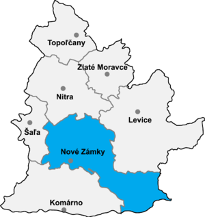 Nové Zámky District in the Nitra region
Mojzesovo (Hungarian: Özdöge) is a village and municipality in the Nové Zámky District in the Nitra Region of south-west Slovakia.
Contents
History
In historical records the village was first mentioned in 1273.
During is existence, this village was name Izdeg, name of the only family of the village of Mojzesovo who survived from Turkish invasion.
Geography
The village lies at an altitude of 130 metres and covers an area of 7.495 km². It has a population of about 1370 people.
Ethnicity
The population is about 99.5% Slovak.
Facilities
The village has a public library, a gym and football pitch.
External links
Nové Zámky · Štúrovo · Šurany
Andovce · Bajtava · Bánov · Bardoňovo · Belá · Bešeňov · Bíňa · Branovo · Bruty · Čechy · Černík · Dedinka · Dolný Ohaj · Dubník · Dvory nad Žitavou · Gbelce · Hul · Chľaba · Jasová · Jatov · Kamenica nad Hronom · Kamenín · Kamenný Most · Kmeťovo · Kolta · Komjatice · Komoča · Leľa · Lipová · Ľubá · Malá nad Hronom · Malé Kosihy · Maňa · Michal nad Žitavou · Mojzesovo · Mužla · Nána · Nová Vieska · Obid · Palárikovo · Pavlová · Podhájska · Pozba · Radava · Rastislavice · Rúbaň · Salka · Semerovo · Sikenička · Strekov · Svodín · Šarkan · Trávnica · Tvrdošovce · Úľany nad Žitavou · Veľké Lovce · Veľký Kýr · Vlkas · Zemné
Coordinates: 48°08′N 18°14′E / 48.133°N 18.233°E
Categories:- Villages and municipalities in Nové Zámky District
- Nitra Region geography stubs

Wikimedia Foundation. 2010.