- Nooksack River
-
Nooksack River North Fork Nooksack River  The silty North Fork Nooksack River from the Mosquito Lake Road Bridge.
Country United States State Washington Counties Whatcom Tributaries - left Wells Creek, Glacier Creek, Middle Fork Nooksack River, South Fork Nooksack River - right Canyon Creek Cities Ferndale, Marietta Source Cascade Range - location Mount Baker Wilderness - elevation 3,620 ft (1,103 m) [1] - coordinates 48°50′0″N 121°33′18″W / 48.833333°N 121.555°W [2] Mouth Bellingham Bay - elevation 0 ft (0 m) [1] - coordinates 48°46′29″N 122°35′57″W / 48.77472°N 122.59917°W [3] Length 75 mi (121 km) [4] Basin 786 sq mi (2,036 km2) [5] Discharge for Ferndale - average 3,814 cu ft/s (108 m3/s) [5] - max 48,200 cu ft/s (1,365 m3/s) - min 466 cu ft/s (13 m3/s) 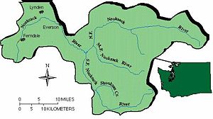 Nooksack Basin
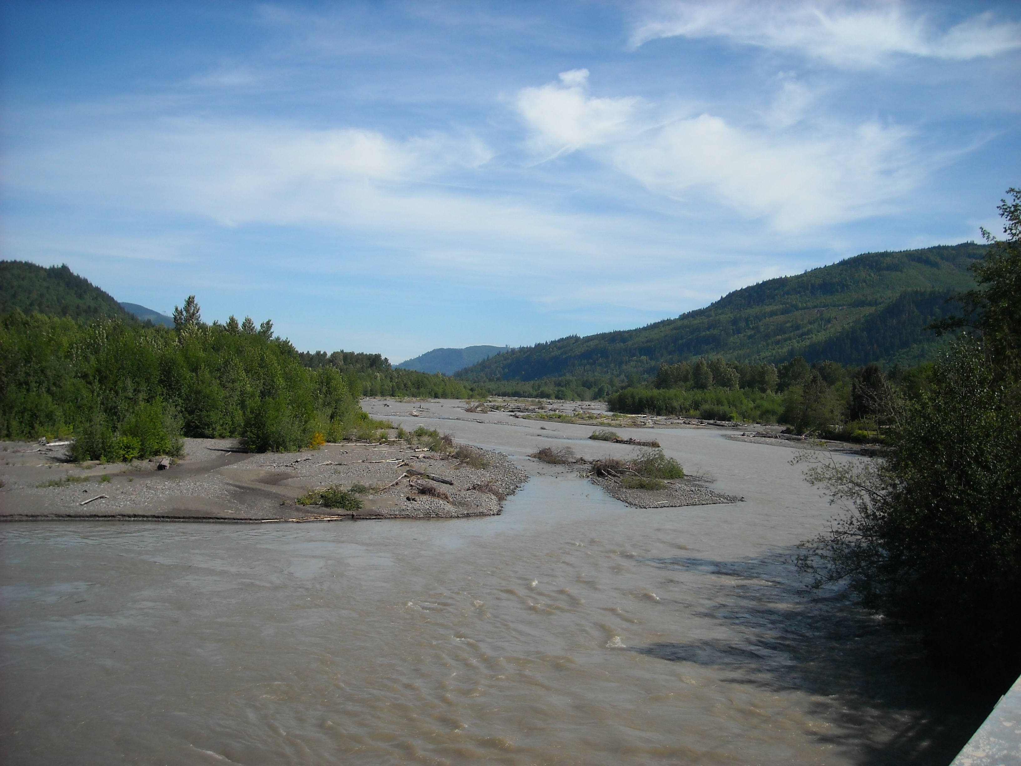
 Mouth of the Nooksack River in Washington
The Nooksack River is a river in the northwest part of the U.S. state of Washington. It drains an area of the Cascade Range around Mount Baker, near the Canadian border. The lower river flows through a fertile agricultural area before emptying into Bellingham Bay and, via the Strait of Juan de Fuca and the Strait of Georgia, the Pacific Ocean. The river begins in three main forks, the North Fork, Middle Fork, and South Fork. The North Fork is sometimes considered the main river.[2] Including the North Fork, the Nooksack is approximately 75 miles (121 km) long. All three forks originate in the Mount Baker Wilderness.
Contents
Course
North Fork
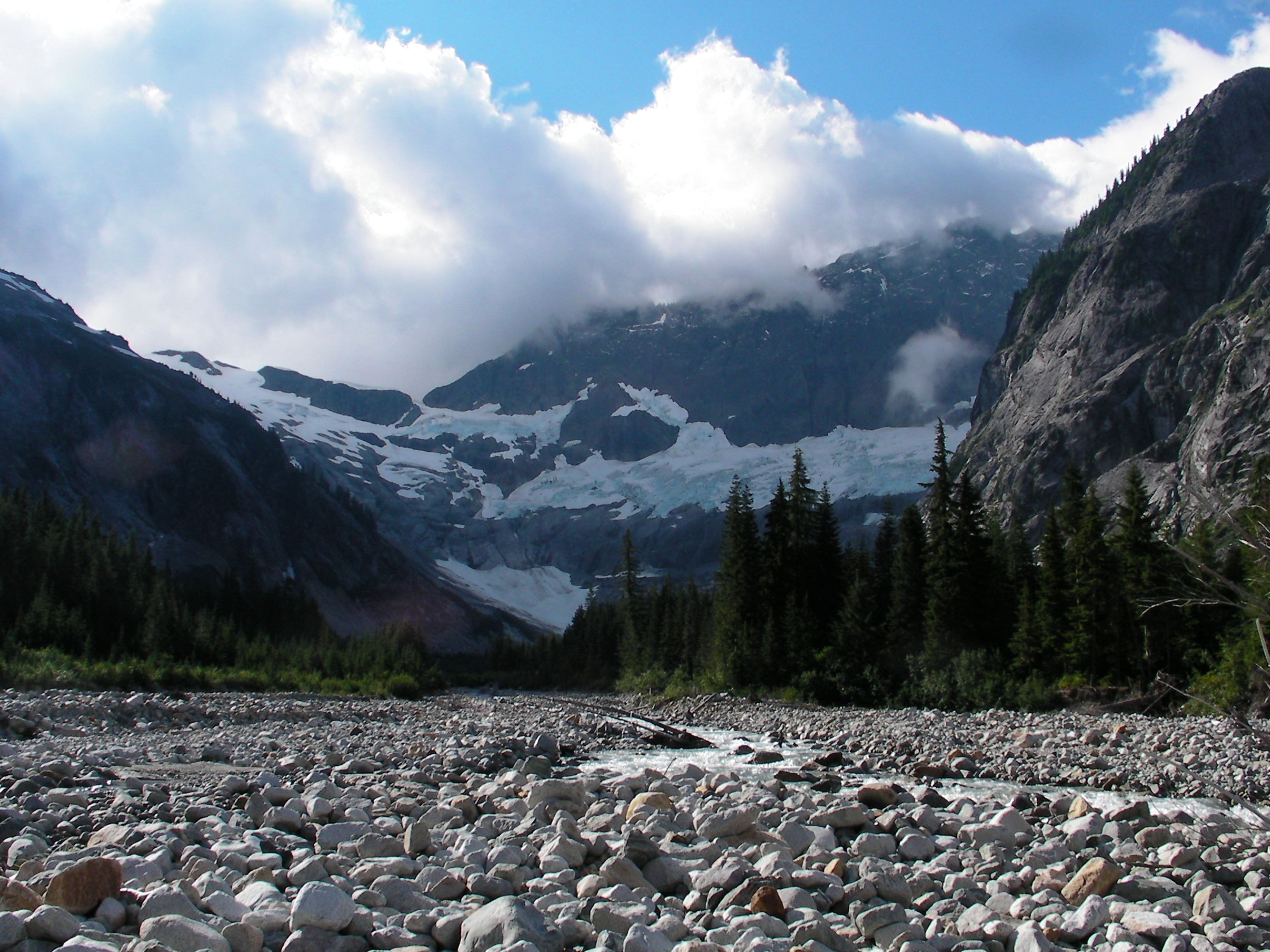
The North Fork Nooksack River rises at the Nooksack Cirque in central Whatcom County, north of Mount Shuksan in the western part of North Cascades National Park. It flows generally west, passing north of Mount Baker. For most of its course the North Fork is paralleled by State Route 542 (also called the Mount Baker Highway).
Flowing west from the Nooksack Cirque, the river picks up large creeks such as Price Creek, a short creek draining Price Lake, as well as Ruth Creek, before flowing under the uppermost highway bridge.
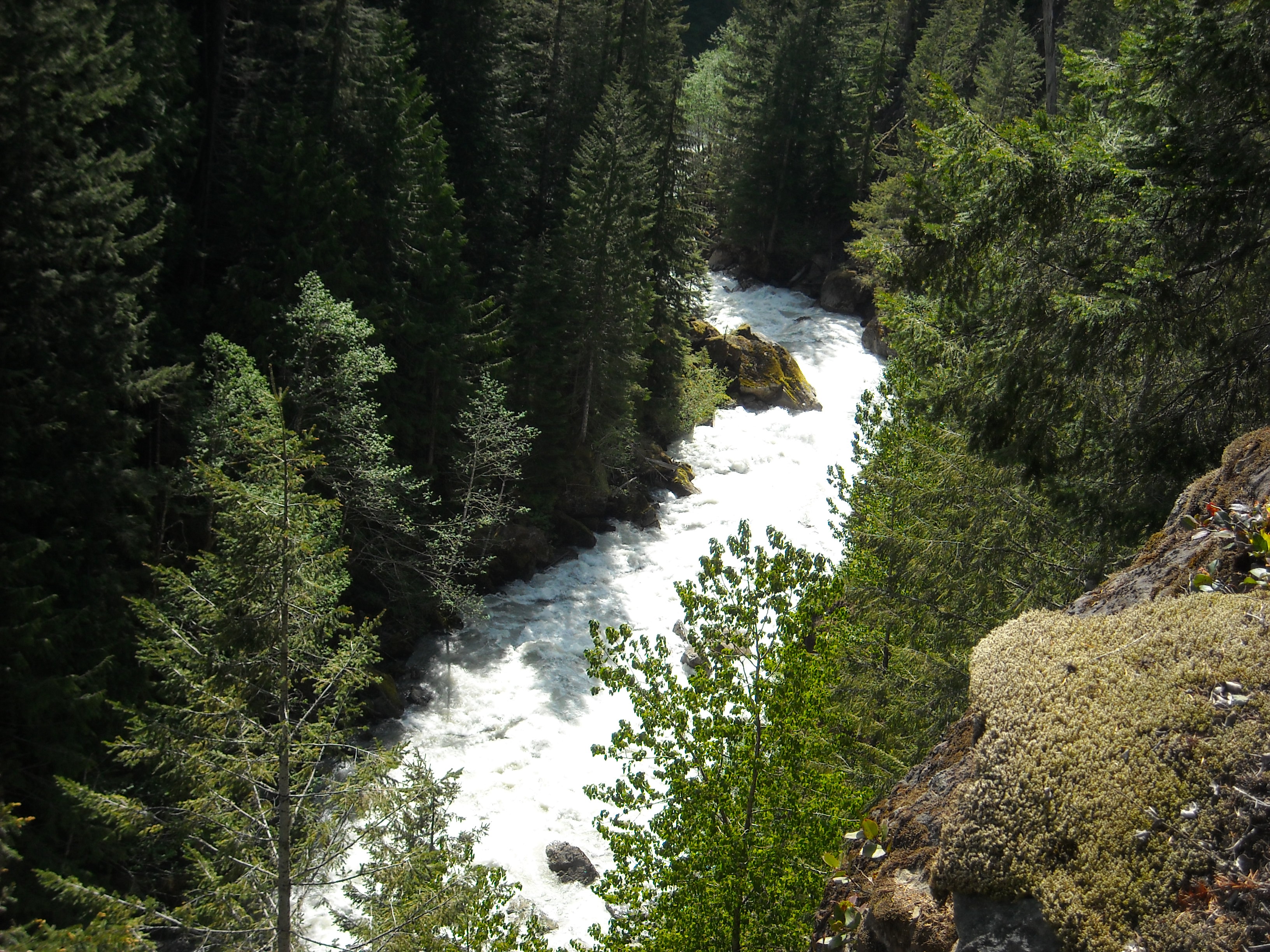
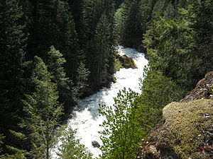 Looking down at the raging North Fork Nooksack River from the Mount Baker Highway, which, at this location, sits atop a 200 foot cliff that drops almost straight into the river. This location is just upstream from Nooksack Falls.
At Nooksack Falls the river flows through a narrow valley and drops freely 88 feet (27 m) into a deep rocky river canyon. The falls are viewable from the forested cover near the cliff edge. A small parking lot nearby contains a kiosk with information about the falls and a hydroelectric project.
Continuing to flow west, the North Fork receives several tributaries including Wells Creek, which joins the river right at the base of the falls as well as Glacier Creek, and Canyon Creek, before the river turns briefly south. The Middle Fork and South Fork join within a few miles of one another. The Middle Fork joins first, creating the Nooksack River proper. The South Fork joins just east of Deming in the Nooksack Indian Reservation.

Middle Fork
The Middle Fork Nooksack River, about 20 miles (32 km) long, originates on the southern slopes of Mount Baker near Baker Pass.[6] It flows generally northwest between Mount Baker and Twin Sisters Mountain.
South Fork
The South Fork Nooksack River, about 50 miles (80 km) long, rises in southern Whatcom County, east of Twin Sisters Mountain near Bell Pass and Lake Wiseman.[7] It flows briefly south, entering Skagit County, then northwest and north, reentering Whatcom County and flowing by Acme.
Nooksack River
After the Middle and South Forks join, the combined river flows northwest, emerging from the mountains and flowing past Everson and Lynden. Near Everson, the river is at risk of floods breaching the right bank, allowing flow into lower lands to the north, through Sumas River and into Canada. At Lynden the river turns southwest and then, near Ferndale, south, to enter the north side of Bellingham Bay at the Lummi Indian Reservation, approximately 3 miles (4.8 km) west of Bellingham.[8]
The river is subject to flooding due to high rainfall amounts and some of the deepest snow packs in the country, sometimes triggered by a Pineapple Express, a weather pattern that brings central Pacific wind and rain to the northwest. One such storm flooded the city of Everson on November 7, 2006.[9]
 Glacier Creek joins the Nooksack River
River modifications
The river once supplied hydroelectricity near its source and at Nooksack Falls. The river is also partially blocked with a low diversion dam on the Middle Fork by the city of Bellingham to divert water into Lake Whatcom, Bellingham's drinking water supply.
In the late 19th century, most of the stream flow of the Nooksack River near its mouth flowed through the present channel of the short Lummi River to Lummi Bay, northwest of Bellingham Bay. Near the turn of the century, a log jam plugged the channel to Lummi Bay, forcing the river to change its channel to the present one. The accumulation of the new river delta has been an ongoing field of research regarding the new wetlands it has created while no longer resupplying the previous delta on Lummi Bay, except during high flow conditions.
See also
References
- ^ a b Google Earth elevation for GNIS coordinates.
- ^ a b U.S. Geological Survey Geographic Names Information System: Nooksack River
- ^ U.S. Geological Survey Geographic Names Information System: Nooksack River
- ^ Nooksack River, The Columbia Gazetteer of North America.
- ^ a b Nooksack River Basin, Water Resource Data, Washington, 2005, USGS.
- ^ U.S. Geological Survey Geographic Names Information System: Nooksack River
- ^ U.S. Geological Survey Geographic Names Information System: Nooksack River
- ^ Course info mainly from: Washington Road & Recreation Atlas. Benchmark Maps. 2000.
- ^ Blumenthal, Les (October 12, 2008). "Endangered species ruling could slow development in floodplains". The News Tribune (Tacoma News, Inc.). http://www.thenewstribune.com/tacoma/24hour/politics/story/506488.html. Retrieved 2008-10-12.[dead link]
Categories:- Lynden, Washington
- Nooksack
- Rivers of Washington (state)
- Geography of Bellingham, Washington
- Landforms of Whatcom County, Washington


Wikimedia Foundation. 2010.