- Liard Highway
-
Liard Highway
Route information Existed: 1984 – present Major junctions South end:  BC 97 near Fort Nelson, BC
North end: Highway 1 near Fort Simpson, NT Highway system British Columbia provincial highways
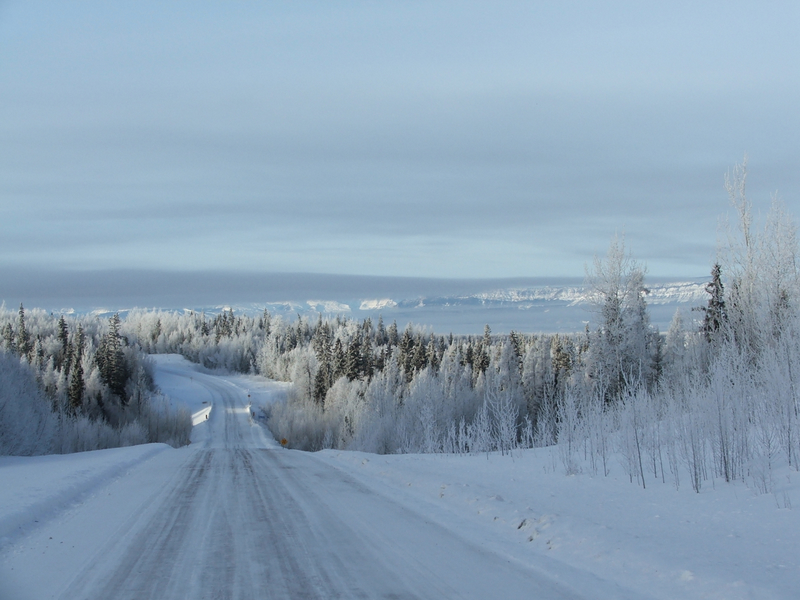
Northwest Territories highways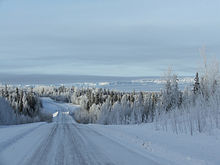 Liard Highway in winter.
The Liard Highway, numbered Highway 77 in British Columbia and Highway 7 in the Northwest Territories, is a highway in Canada, which forms the sole road connection between B.C. and the Northwest Territories.
The highway officially opened to traffic in 1984 and was assigned the number 77 in 1986. Highway 77 begins at a point on the Alaska Highway 28 km (17 mi) northwest of Fort Nelson, and it travels 138 km (86 mi) northeast along an expanse of flat land to the border of British Columbia and the Northwest Territories, where it continues as a very rough dirt and gravel road under the 'Highway' 7 designation for 254 km through the Northwest Territories, ending at a junction with Highway 1 south of Fort Simpson.
External links
- Google Maps: Highway 77 route in British Columbia
- Google Maps: Highway 7 route in the Northwest Territories
Roads of British Columbia Provincial highways 1 · 1A · 2 · 3 · 3A · 3B · 4 · 4A · 5 · 5A · 6 · 7 · 7B · 8 · 9 · 10 · 11 · 12 · 13 · 14 · 15 · 16 · 17 · 18 · 19 · 19A · 20 · 21 · 22 · 22A · 23 · 24 · 26 · 27 · 28 · 29 · 30 · 31 · 31A · 33 · 35 · 37 · 37A · 39 · 41 · 43 · 49 · 52 · 77 · 91 · 91A · 93 · 95 · 95A · 97 (A · B · C · D) · 99 · 101 · 113 · 118 · 395 · South Fraser Perimeter Road (under construction)Other provincially maintained roads Atlin Road · Bridge River Road · Cecil Lake Road · Coalmont Road · Cultus Lake Road · Glover Road · Head Bay Road · Hemlock Valley Road · Horsefly Road · Jesmond Road · Likely Road · Mission Mountain Road · Nazko Road · Omineca Resource Road · Pavilion Mountain Road · Port Mellon Highway · Queen Charlotte City-Skidegate Road · Strathcona Parkway · Telegraph Creek Road · Westside RoadHistorical provincial highways Municipal limited-access roads Barnet Highway · Gaglardi Way · Golden Ears Way · Grant McConachie Way · Knight Street · SW Marine Drive · Marine Way · Russ Baker WayHistoric roads and trails Alaska Highway · Atlin Road · Cariboo Road · Chilkoot Trail · Crowsnest Highway · Dewdney Trail · Dewdney Trunk Road · Douglas Road · Hudson's Bay Brigade Trail · Lillooet Cattle Trail · Nisga'a Highway · Okanagan Trail · Old Cariboo Road · Old Yale Road (Grand Trunk Road) · River Trail · Whatcom TrailSee also Italics denotes highways with expressway sections.
Bold denotes highways with expressway and freeway sections.Roads and highways in the Northwest Territories Highways Highway 1 (Mackenzie) · Highway 2 (Hay River) · Highway 3 (Yellowknife) · Highway 4 (Ingraham) · Highway 5 (Fort Smith) · Highway 6 (Fort Resolution) · Highway 7 (Liard) · Highway 8 (Dempster)
Other roads Categories:- British Columbia provincial highways
- Roads in the Northwest Territories
- Canada road stubs
- British Columbia stubs

Wikimedia Foundation. 2010.