- Frankston North, Victoria
-
Frankston North
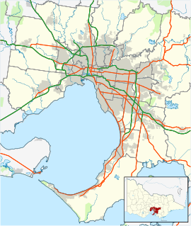
Melbourne, Victoria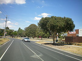
 Frankston North
Population: 5,492 (2006)[1] Postcode: 3200 Area: 5.2 km² (2.0 sq mi) Location: LGA: City of Frankston State District: Cranbourne Federal Division: Dunkley Suburbs around Frankston North: Seaford Carrum Downs Frankston North Frankston Langwarrin Frankston North, also known as The Pines, is a suburb in Melbourne, Victoria, Australia, 37 km south-east from Melbourne's central business district. Its Local Government Area is the City of Frankston. At the 2006 Census, Frankston North had a population of 5,492.
Frankston North landmarks include the Pines Forest Swimming Centre,[2] Long Island Country Golf Club, [1] and the former site of Monterey High School, which was removed in the early 1990s when the High and Technical schools were combined and moved to the former Technical school site. This site is now Monterey Community Park which houses a skate park, playground, barbecue and toilet facilities. Planning is also underway to redevelop the old school oval into a village green which will include a community sound stage and paths linking this area to Monterey Community Park.
The Pines
Frankston North is a working class suburb, nicknamed The "Pines" because of the former Ministry of Housing Pines Estate which made up the bulk of the suburb.
In fact, despite the nickname, there are no longer any pine trees in the area due to the removal of non-native fauna in the early 1990s.
Houses are a mixture of low scale dwellings set in gardens. The streetscape is generally open due to the low horizontal building forms and low or open style fencing.
Buildings and homes are predominantly 1960s - 1970s Housing Commission of Victoria homes made of conite, fibro rendering with some contemporary styling added by renovation. Sealed roads have kerbs and footpaths on both sides of the street. Trees are medium to large and planted irregularly in streets. The approximate size of Frankston North is 5.2 km2.
Population and housing
The 2001 Census of Population and Housing data collected by the Australian Bureau of Statistics states that 5,771 persons lived in Frankston North as at 2001. Of these, some 4,463 were aged 15 years or over and 4,118 were born in Australia. 929 or 16% or residents had completed tertiary qualifications.[1]
- Median age: 35
- Median monthly housing loan repayment: $400 – $599
- Median weekly rent: $200 – $250
- Median weekly individual income: $500 – $1099
- Median weekly family income: $800 – $1099
- Median weekly household income: $700 – $1299
- Average household size: 2.5 [1]
Mahogany Neighbourhood Centre
In 1983 the City of Frankston purchased a former Ministry of Housing rent office at 2 Candlebark Crescent, Frankston North. [2]
A "Neighbourhood House Action Group" consisting of 14 members worked for the building to become a Neighbourhood House. This eventuated on 13 September 1983. Pines Neighbourhood House became an Incorporated Association on 1 March 1984. On 26 September 2001 the name was changed to Mahogany Neighbourhood Centre Inc. Funding was minimal until 1989 when the House was granted funding under the State Government Neighbourhood House Co-ordination Program.
Pines Neighbourhood House originally serviced 400 defence force homes (which have since been handed back to the Ministry of Housing) and the local community. In 1997 the House was granted funding from Adult Community & Further Education (ACFE) to provide low cost classes for adults.
In December 1998 the organisation moved into the purpose-built Mahogany Community Centre (owned by Frankston City Council). The Centre was officially opened on 25 February 1999.
Former Monterey High School site
During 1994 the decision was taken to merge Monterey High School and Monterey Technical School to reduce the administrative costs of running two schools. Monterey Secondary College was formed and was based at the previous Technical school site on Silvertop Street. The High school campus was deconstructed, in preparation for development of the site situated on the corner of Monterey Boulevard and Forest Drive.
The ex-high school site was earmarked for several public works projects including its use as public land - as either park space or sports reserve. None eventuated, and instead, the site was sold to a developer by the Kennett Liberal government while it lay dormant and decomposed. The Bracks Labor Government later compulsorily re-purchased the land and offered it for free to the City of Frankston. Asbestos was found at the site during the early 1990s when residents embarked on a community clean up program until a committee of management was established by the council. An asbestos removal program, to commence in 1996, never materialised.
A petition, signed by 1,879 residents of Carrum Downs and presented to the Victorian Legislative Assembly in 1997 further sought action to begin "construction of suitable facilities in Carrum Downs with the view of relocating Monterey Secondary College from its present location in Frankston North". The action, intended to secure educational facilities in Carrum Downs, an adjoining suburb, was unsuccessful.
A Public Sector Investment Program estimated the site to be worth $1m during 2000-01. The money to purchase the site was to be sourced from the sale of proceeds from surplus properties by the Department of Treasury and Finance but again never eventuated.
As of 2006 this former site, now known as Monterey Community Park had a skate park and playground added with a toilet block and walking/cycle track also now in place. There are current plans for a village green type area to be built including a shaded performance area and further pathways. These works are reported to be completed by February 2010 and will be utilised at that time for Pines Pride Day, an annual event now held on the site.
Monterey Secondary College
Main article: Monterey Secondary CollegeMonterey Secondary College was formed by the merger of Monterey High School and Monterey Technical School during the early 1990s. The merger was conducted to reduce the administrative and running costs for both schools.
The High school that was on the corner of Monterey Boulevard and Forest Drive was closed,and the two were amalgamated on the site of the Technical school in Silvertop Avenue. The former High School site is now Monterey Community Park.
The school is known for its successful participation in the Victorian Rock Eisteddfod Challenge, winning first prize during 1995 with their performance based on a Batman theme.[citation needed] The school is also known for its sporting achievements.
Notable students include the local federal MP, Bruce Billson, football players Nathan Burke and Russell Greene, journalist Shaun Carney, and actress Jackie Woodburne.
History of Frankston North
Reserve created for Preservation and Growth of Timber
In 1853, a 42 square miles (109 km2) 'run' of land, named "Balleymarong" edit was established and later acquired by Sir Andrew Clarke, Surveyor General to the Colony of Victoria from 1853. Balleymarong's northern boundary was Eumemmering Creek (now the Patterson River). The southern boundary was Skye Road. Boundary Road (now McClelland Drive) was the eastern boundary with the western side boundary being Port Phillip Bay. [3]
The 1860 Victorian Land Act led to the sub-division and sale of land in Balleymarong. The Victorian Government reserved 3,600 acres (15 km2) for various purposes. 1,370 acres (6 km2) was set aside 'For the Preservation and Growth of Timber'.
Circa 1870, the inbound 'Clarke Reserve' was proposed as an alternative site for the Old Melbourne Cemetery. It was later agreed that an area at Springvale was a better site. The 'Clarke Reserve' was established in 1909 as a State Pine forest called the Frankston Pine Plantation. W.J. Hartland was appointed as Conservator in Charge. Pinus radiata was the most successful of the various species planted. A count taken of numbers revealed that over 1 million trees had been planted.
Mr James Brown was appointed as the second Forest Officer to the State Pine Plantation in the 1920s. A residence was built in Dandenong Road for him and his daughter by the Victorian Forest Commission. This house still exists. The last Officer in Charge of the State Pine Plantation was Harry Firth who lasted until 1956.
Fire in the Pines Plantation
During 1955 a fire destroyed a large part of the plantation. Another fire would threaten the housing estate later in the century during 1999. In 1956, 296 acres (1.2 km2) were excised from the reserved area to allow the Housing Commission to build houses for low income families.[3]
The first stage of the housing in Pines Forest was completed in 1957 and Pines Forest Post Office opened on 12 October 1959 (closing in 1980). The Pines Forest Post Office is now run as a private business in the Pines Forest shopping strip on the corner of Forest Drive and Mahogany boulevard.[4]
The first streets constructed were in the south of the area. The names of the streets alluded to the species of pines planted in the plantation:
- The first street constructed was Pine Street, followed by Plantation Street and Forest Drive. The various pine species reflected in street names are Monterey, Radiata, Corsican, Aleppo, Norfolk, and Excelsior (Excelsa). Many other streets in Frankston North are named after exotic and native species. Several species of flowering eucalyptus were planted in the street verges. Excelsior Drive was the northern boundary.
In 1965, the second wave and eventual completion of the building program began east of Excelsior Drive and extended as far as the proposed Mornington Peninsula Freeway to the east. The freeway zone acted as a buffer between the houses and the Frankston Municipal tip.
1970s and 1980s
Frankston North, "The Pines", had a reputation during the 1970s and 1980s for being a "high crime" suburb. Leader Community Newspapers records show that car theft, assaults, vandalism and drug related crime were commonplace. There was continual rivalry and fighting between pupils of Monterey Technical and High schools. It was commonplace to witness on-field violence at home games of the 'Pines Football Club'.[4]
East Ward councilor Jane Hill said that there was "No reason for (the) Pines stigma" and said that its reputation existed only in the minds of a minority of Frankston residents.
Community action during 1980 prevented a proposal to subdivide the Pines Flora and Fauna Reserve. Unions supported the stance against the plan which was developed in the 1970s.[5]
The Pines Shakes off its Reputation
Monterey Boulevard, a major thoroughfare which travels from West to East through the centre of the suburb used to be a well known illegal street drag racing location until traffic chicanes were installed in 1993. There are now speed humps and roundabouts throughout the estate and a local Hoon hotline has been established.
During the 1990s, many state owned homes were sold to the inhabitants as private homes, particularly within the eastern quarter. This led to better maintenance and presentation as home owners renovated.
Pines Flora and Fauna Reserve
The Pines Flora and Fauna Reserve is a 108 hectare reserve which contains a significant remnant of bushland from the Mornington Peninsula. Access is via walking tracks on Tamarisk Drive, Excelsior Drive and Warrawee Circuit. [6]
The reserve is considered ideal for recreation activities such as nature study, photography and walking. Trig Point contains expansive views of the reserve, Port Phillip Bay and the Dandenong Ranges. A network of tracks allows visitors to walk to most features of the reserve.
Very little is known of Aboriginal activity in the area other than the use of the springs as a source of fresh water by the Bunurong people. A proposal in the 1970s to sandmine the remaining bushland met with community uproar and the Eureka Flag was raised on Trig Point (the site from which the Frankston area was originally surveyed) and the area claimed for the people of Frankston.
The reserve is a very important habitat for native fauna, particularly small mammals, reptiles and amphibians. Southern Brown Bandicoots, Swamp Wallabies, echidnas, and Brushtail and Ringtail Possums are present but are often hard to find as they are not all active during the day. The reserve is also a potential habitat for the endangered New Holland Mouse.
Over 100 different bird species have been recorded including honeyeaters, waterbirds, birds of prey and parrots. A number of significant species have been recorded including the Painted Button Quail, Brush Bronzewing, Latham's Snipe and Swift Parrot.
Much of the vegetation of the reserve is remnant heathland with Silver-leaf Stringybark and Black Sheoak. It is still in a reasonable natural condition and contains many species of plants now rare on the Mornington Peninsula. Native orchids are a highlight of the many wildflowers that mainly bloom in spring. Rabbit Ears Orchid, Dwarf Greenhood Orchid and the not so common Common Spider Orchid (Dendrobium tetragonum) are some of the orchids to be found among the 170 or more plant species recorded.
Pines Football Club
Pines Football club, known as The Pythons, are a renowned local football team with their homeground based at Eric Bell Reserve, more commonly known to locals and rival teams as the "Snakepit".[7]
The strength of the club's ties can be traced to its origins. The Club was formed in 1964, not long after the establishment of a housing commission estate in Pines Forest/Frankston North. The club experienced several lean years in which it struggled to win a game before local juniors began graduating into the senior team. In fact in its early years it was the junior sides that helped establish the club's success. In 1967 the club's under 12 team was the first side to represent the Pines Football club in a grand final. As young players graduated through its ranks the football club began winning premierships in all competition levels including 3 consecutive flags between 1968 and 1970 via its under-15 side.
On the estate of some 2000 houses, with several players in most of them, the football club improved when local teenagers began making their mark. Barry Burke, the father of St Kilda midfielder Nathan Burke, moulded the team into a premiership unit.
Pines football club also produced several VFL/AFL players, most notably Russell Greene (Hawthorn & St Kilda), Brendan Moore, Steve Newman and Kevin Taylor.
Pines Forest Swimming Centre
Frankston North is home to a 50 metre heated outdoor six-lane swimming pool. The Swimming Centre contains a giant waterslide and slide pool, which is visible from adjoining Forest Drive. The centre also contains a Toddlers pool, barbecue facilities and half-court basketball area. Operated by Frankston City Council, the centre is used by schools from surrounding suburbs for sports and recreational activities.
Rotary Club of Frankston North
Due to the population of the City of Frankston increasing rapidly in the late 1960s and the early 1970s, a local chapter of the club was established for Frankston North. The inaugural meeting (or interest meeting) of the new Club was held on the 14th of March, 1973 at the Sundowner hotel, Seaford. It was attended by 27 people and was chaired by Past District Governor, John Emerton. Others present were District Governor George Allsop, Bruce Hall - President of the sponsoring Club, Frankston, the District Governor's special representative Norm Arthur (Past President of the Frankston Club), and a number of interested Rotarians from the Frankston Club.[8]
The meeting unanimously resolved that a new Club should be formed and that it should be known as the Rotary Club of Frankston North. In accordance with Rotary requirements, territorial limits were set, and these limits, as described in the 'Intention to Cede' papers proposed by the Rotary Club of Frankston, were accepted by the new Club.[9]
The election of office bearers then took place and the following officers were appointed:
- Charter President - Lloyd Worland
- Charter Vice-President - Bob Dawson
- Charter Secretary - Lloyd Beard
- Charter Treasurer - Max Batey
The Pines Cultural Mapping Project
During 2003 an extensive Cultural Mapping exercise was developed in collaboration with the community of North Frankston. The exercise focused on the implementation of six significant community art projects.[10]
The project is funded by the Victorian government's Department of Human Services and the City of Frankston. Support was also provided by the Mahogany Neighbourhood Centre, Monterey Secondary College and local service providers and businesses.
The project included the development of art designations for The Pines Gateways, such as banners and markers and mosaic pavers for the Pines Parks entrances and exits.
Proposals were developed for the future development of the Monterey High School site within the precinct and other ideas that were relevant to the community.
The six community art projects developed between January 2002 to May 2003 were:
- Recollections - The Pines: A mixed-media wall hanging using paint and textile done by Seniors and Community members (Completed)
- Street Pole Markers: Developed conjointly with Monterey Secondary College Year 9 and 11 students, volunteer artists and the artist facilitator, Jenny Saulwick (on-going)
- The Pines Cultural Map Website (refer links below)
- Pines Exhibition: A portable display showing The Pines, Frankston North, its past and present. The Pines Cultural Mapping Project will also be presented on this portable display. To be shown at the Mahogany Neighbourhood Centre in Frankston North, and other venues. (in process)
- A Community Garden:"Pines Patch" Located at the rear of the Mahogany Neighbourhood Centre Annex. (in process)
- Community Murals: Two works to be created for the interior of the Annex, Mahogany Neighbourhood Centre.(in process)
Social and Political conditions
Local Government
Frankston North is classified as part of the North West Ward of the City of Frankston, which also covers Seaford and parts of Frankston. The North West ward and two other multi-councillor wards were created before the 2005 elections, held on 26 November 2005, replacing the previous single-councillor wards.
At the 2005 elections, voters selected for the North-West Ward: Vicki McClelland, Mark Conroy, and Glenn Aitken. At the end of November 2005, Vicki McClelland from Frankston North was unanimously elected mayor by her fellow councillors for a two year term.
Frankston North Community Group
The Frankston North Community Group is a political lobby group that aims to represent the needs and requirements of Frankston North residents at council meetings and through official chanels. A number of community projects have been a product of the Frankston North Community Group. All locals are encouraged to attend the meetings held once a month at the Frankston Forest Baptist Church on Monterey Boulevarde. Special guests are often in attendance such as councilors, members of parliament and local business people.[11]
Frankston North Community Map
The Frankston North Community Map was launched by Jude Perera, MP for Cranbourne on 20 June 2006. The map was a result of community collaboration and visually displays services and amenities available to Frankston North residents. The map, which are available from local businesses and shops, were designed by a professional designer and includes information regarding services such as medical centres, child health centres and schools.[12]
Community Renewal Frankston North
This program is funded by the State Government and there are currently eight Community Renewal sites around the state, of which one is Frankston North, the project team for this site are project manager, Amanda Leck and project officer, Michelle May, who are located at the Mahogany Centre.
Community Renewal brings residents, businesses, government and local organisations together to help transform communities into places of opportunity and activity. Its aims are:
- Ongoing community participation in decision-making;
- New job and learning opportunities;
- Increased neighbourhood volunteering and other support;
Upgraded community facilities and open spaces;
- Greater participation in cultural, recreational and sporting activities; and
- Improved feelings of safety and wellbeing.
Frankston North Community Renewal will build on the initiatives of previous community strengthening programs that have been delivered in the area over the past five years, including Pines Connecting the Community, Best Start and Communities for Children.
Key facts about Frankston North
Community renewal works in disadvantaged urban neighborhoods in rapidly changing suburbs that don’t have a high concentration of public housing.
Compared to Victoria as a whole, Frankston North
- Has more single person households and more single parent families
- Is more disadvantaged by a range of measures including unemployment, resident income and level of education
- Has more homes that are being purchased or rented from the government, and fewer that are owned
- Has more Indigenous but fewer non-English speaking residents including from the Philippines and Germany.
In terms of community engagement, compared to Victoria as a whole, Frankston North
- Has lower levels of participation in activities like organised groups and organised sport
- Has similar percentage of residents that feel it’s an active community, and more residents who think that there is easy access to parks, bike tracks and recreational areas.
A consumer credit report by Dun & Bradstreet published in 2009 showed that, of all Australian suburbs, Frankston North has citizens most at risk of defaulting on bills and loans.[5][6]
/==Public facilities and transport==
- Frankston North has no direct access to rail services, but is serviced by two bus lines which run through the suburb via the Frankston-Dandenong route.
- Frankston North McDonalds offers free WiFi access.
- The Peninsula Legal Centre was originally based at Frankston North and was known as 'The Frankston North Legal Centre'. Pro bono advice services are provided by the Law Institute of Victoria as part of the program to support Community Legal Centre's with legal advice. Some 20 staff and over 100 volunteers support this "Outreach" program.[13]
- Frankston North is also served by local branches of Alcoholics Anonymous and The Salvation Army.
- Frankston North is home to several places of worship including The Salvation Army on Forest Drive, Frankston Presbyterian Church [14] on Radiata Street, St Johns Aglican Church on Monterey Boulevarde and the Catholic Archdiocese Church Holy Family on Moreton Street.
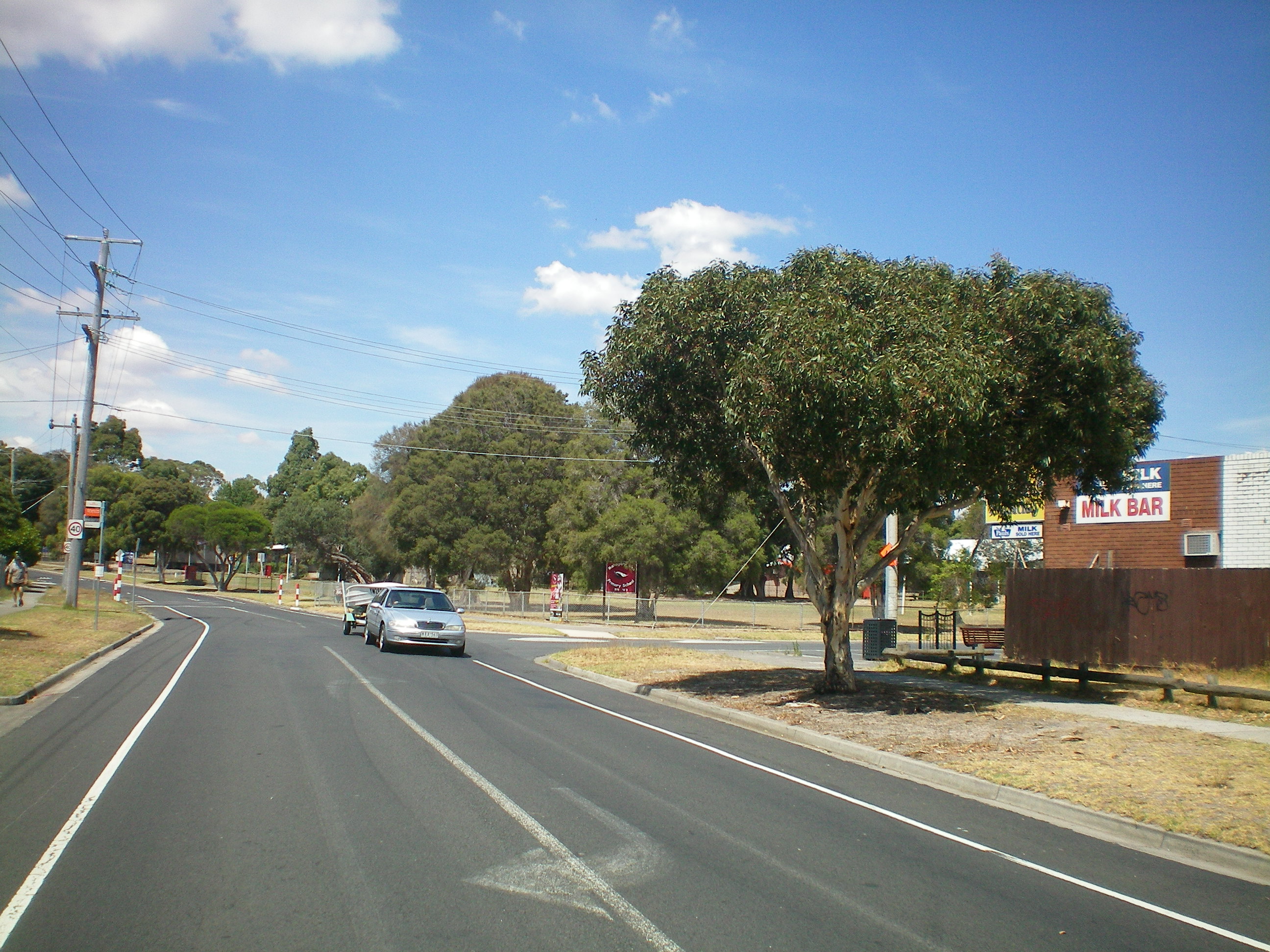
- Frankston North is home to two retail shopping strips: one at the Western end of Excelsior Drive known as the Excelsior shops, and another on Mahogany Avenue known as The Pines Forest Shopping Centre. Between them, residents have access to the services of a Licensed Post Office, supermarkets, milk bars, dry cleaning service, chemist and food outlets including Chinese, Fish and Chips and green grocers.
- There are four schools remaining in The Pines. These are the new Mahogany Rise Primary School which is the result of combining Pines Forest Primary School and Monterey Primary on the Monterey Primary sight, the Aldercourt Primary School, St Michael's Coptic Christian School and Monterey Secondary College.
- Frankston North-The Pines is serviced by Neighbourhood Watch which is broken up by five separate areas each with its own Co-ordinator and their Zone Representatives within a Committee consisting of a Newsletter Editor,Secretary,Treasurer and an Overall Co-ordinator/President(Stan Doric JP the initiator in 2004)current to 2010, liaison during this time with Victoria Police (Frankston City) Co-ordinator L/S/Const Sharron Coburn.The areas are known as FRK 22,FRK 23,FRK 24,FRK 25,FRK 26 and are bound by Frankston-Dandenong Road,Pines Flora & Fauna Reserve,Ballarto Rd,Peninsula Country Golf Club.
Meetings to discuss safety issues are held on the fourth Wednesday of the month 7.00pm, except for December and January, at 26 Mahogany Avenue- Mahogany Neighbourhood Centre, (unless otherwise advised in the monthly newsletter)all of the community is invated to attend.
Notable residents
The associate editor of The Age, Shaun Carney pointed out both the Liberal (Bruce Billson) and Labor (Helen Constas) candidates for the local federal seat of Dunkley at the 2004 Federal Election attended Monterey High School, now known as Monterey Secondary College in Frankston North.
- AFL footballer Nathan Burke once lived in Frankston North.
References
- ^ a b c Australian Bureau of Statistics (25 October 2007). "Frankston North (State Suburb)". 2006 Census QuickStats. http://www.censusdata.abs.gov.au/ABSNavigation/prenav/LocationSearch?collection=Census&period=2006&areacode=SSC21289&producttype=QuickStats&breadcrumb=PL&action=401. Retrieved 2007-09-26.
- ^ http://www.frankston.vic.gov.au/Services_A-Z/Aquatic_Centres/index.aspx
- ^ http://www.thepines.org.au/pages/pines_history10.htm
- ^ Premier Postal History. "Post Office List". https://www.premierpostal.com/cgi-bin/wsProd.sh/Viewpocdwrapper.p?SortBy=VIC&country=. Retrieved 2008-04-11
- ^ Cooper, Mex (7 September 2009). "Victorians most at risk of loan defaults: report". The Age (Melbourne). http://www.theage.com.au/national/victorians-most-at-risk-of-loan-defaults-report-20090907-fdzh.html.
- ^ "Victorian suburbs most at risk". The Age (Melbourne). 7 September 2009. http://www.theage.com.au/national/victorian-suburbs-most-at-risk-20090907-fe0f.html.
External links
- Frankston North Community (Renewal) website
- Mahogany Centre official website
- Monterey Secondary College website
- Frankston North Rotary Club website
- The Pines/Frankston North Cultural Mapping Project
- Pines Cultural Map website
- Pines Flora and Fauna Reserve Visitors Guide
Coordinates: 38°07′23″S 145°09′11″E / 38.123°S 145.153°E
Suburbs of the City of Frankston | Melbourne | Victoria Carrum Downs · Frankston · Frankston North · Frankston South · Langwarrin · Langwarrin South · Sandhurst · Seaford · Skye
Categories:- Suburbs of Melbourne
- Suburbs and localities in the City of Frankston

Wikimedia Foundation. 2010.