- Daymer Bay
-
Coordinates: 50°33′36″N 4°55′30″W / 50.560°N 4.925°W
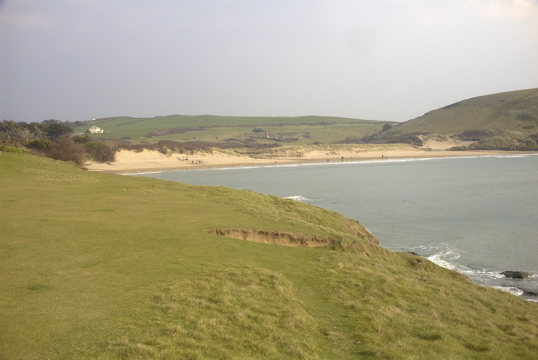
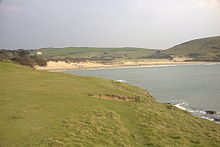 Daymer Bay seen from Trebetherick Point with Brea Hill on the right of the picture. St Enodoc's Church is visible behind the centre of the beach
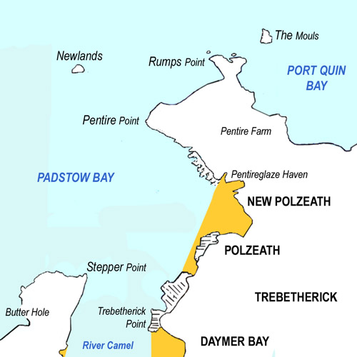
 Sketch map showing Daymer Bay and surrounding area
Daymer Bay is a bay and a beach on the east side of the River Camel estuary in north Cornwall, United Kingdom. It is situated approximately six miles (10 km) north of Wadebridge[1].
Daymer Bay lies west of Trebetherick village at grid reference SW 928 775. The bay is bounded to the north by Trebetherick Point and to the south by Brea Hill.
Daymer Bay beach is backed by dunes and behind them is St Enodoc's Church where the poet John Betjeman is buried. The beach is very popular for windsurfing and kitesurfing.
References
- ^ Ordnance Survey: Landranger map sheet 200 Newquay & Bodmin ISBN 9780319229385
Geography of Cornwall Cornwall Portal Unitary authorities Major settlements Bodmin • Bude • Callington • Camborne • Camelford • Falmouth • Fowey • Hayle • Helston • Launceston • Liskeard • Looe • Lostwithiel • Marazion • Newlyn • Newquay • Padstow • Par • Penryn • Penzance • Porthleven • Redruth • Saltash • St Austell • St Blazey • St Columb Major • St Ives • St Just-in-Penwith • St Mawes • Stratton • Torpoint • Truro • Wadebridge
See also: Civil parishes in CornwallRivers Topics History • Status debate • Flag • Culture • Places • People • The Duchy • Diocese • Politics • Hundreds/shires • Places of interest • full list...Categories:- Beaches of Cornwall
- Bays of Cornwall
- Populated coastal places in Cornwall
- Cornwall geography stubs
Wikimedia Foundation. 2010.