- Danbury Township, Ottawa County, Ohio
-
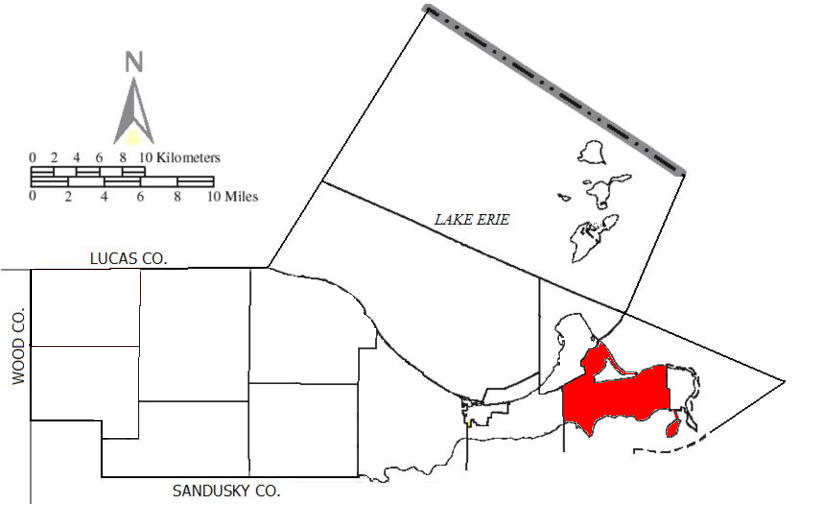
Danbury Township, Ottawa County, Ohio — Township — Location of Danbury Township in Ottawa County.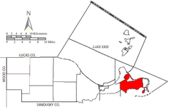
Coordinates: 41°31′56″N 82°45′58″W / 41.53222°N 82.76611°WCoordinates: 41°31′56″N 82°45′58″W / 41.53222°N 82.76611°W Country United States State Ohio County Ottawa Area – Total 56.5 sq mi (146.4 km2) – Land 18.2 sq mi (47.2 km2) – Water 38.3 sq mi (99.2 km2) Elevation[1] 640 ft (195 m) Population (2000) – Total 4,631 – Density 254.4/sq mi (98.2/km2) Time zone Eastern (EST) (UTC-5) – Summer (DST) EDT (UTC-4) FIPS code 39-20058[2] GNIS feature ID 1086760[1] Danbury Township is one of the twelve townships of Ottawa County, Ohio, United States. The 2000 census found 4,631 people in the township, 3,869 of whom lived in the unincorporated portions of the township.[3]
Contents
Geography
Located at the eastern point of the county at the end of the Marblehead Peninsula, it borders the following townships:
- Kelleys Island - northeast, across Lake Erie
- Sandusky - southeast, across Sandusky Bay
- Margaretta Township, Erie County - south, across Sandusky Bay
- Portage Township - west
- Catawba Island Township - northwest
The village of Marblehead lies at the eastern point of the township, and the unincorporated community of Lakeside lies on its northern shore.
Name and history
 Cemetery on Johnson's Island
It is the only Danbury Township statewide.[4]
This township is included in the region known as the Firelands and was originally a part of Huron County.[5] It was named for Danbury, Connecticut.
Huron County was established by the Ohio General Assembly on February 7, 1809 and, at the time, comprised present-day Erie County (except for a small piece in the west); Huron County, Ruggles Township in Ashland County, Danbury Township, and part of Catawba Island Township.[6]
Johnson's Island, the location of a significant Prisoner-of-war camp during the Civil War, is located in Sandusky Bay just south of the Marblehead Peninsula. It is now a part of the village of Marblehead.
Government
The township is governed by a three-member board of trustees, who are elected in November of odd-numbered years to a four-year term beginning on the following January 1. Two are elected in the year after the presidential election and one is elected in the year before it. There is also an elected township fiscal officer,[7] who serves a four-year term beginning on April 1 of the year after the election, which is held in November of the year before the presidential election. Vacancies in the fiscal officership or on the board of trustees are filled by the remaining trustees.
Notable residents
- Louis C. Shepard, Medal of Honor recipient during the Civil War.
References
- ^ a b "US Board on Geographic Names". United States Geological Survey. 2007-10-25. http://geonames.usgs.gov. Retrieved 2008-01-31.
- ^ "American FactFinder". United States Census Bureau. http://factfinder.census.gov. Retrieved 2008-01-31.
- ^ Ottawa County, Ohio — Population by Places Estimates Ohio State University, 2007. Accessed 15 May 2007.
- ^ "Detailed map of Ohio" (PDF). United States Census Bureau. 2000. http://www2.census.gov/geo/maps/general_ref/cousub_outline/cen2k_pgsz/oh_cosub.pdf. Retrieved 2007-02-16.
- ^ Milan and the Milan Canal, by Charles E. Frohman, c.1976, pp. 26-28.
- ^ Ohio Lands, A Short History, a publication of the Ohio Auditor of State, c. 1994, p. 10.
- ^ §503.24, §505.01, and §507.01 of the Ohio Revised Code. Accessed 4/30/2009.
External links
Municipalities and communities of Ottawa County, Ohio City 
Villages Clay Center | Elmore‡ | Genoa | Marblehead | Oak Harbor | Put-in-Bay | Rocky Ridge
Townships Unincorporated
communitiesCurtice | Forest Park | Graytown | Gypsum | Isle St. George | Lacarne | Lakeside | Martin | Middle Bass | Williston
Footnotes ‡This populated place also has portions in an adjacent county or counties
Categories:- Townships in Ottawa County, Ohio
- Toledo metropolitan area


Wikimedia Foundation. 2010.