- Catawba Island Township, Ottawa County, Ohio
Infobox Settlement
official_name = Catawba Island Township, Ottawa County, Ohio
settlement_type = Township
nickname =
motto =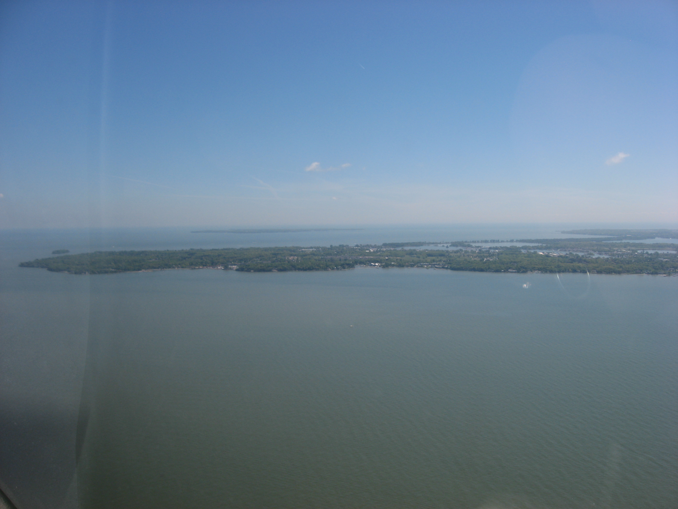
imagesize = 250px
image_caption = Aerial view of Catawba Island from the west
image_
mapsize = 250px
map_caption = Location of Catawba Island Township in Ottawa County.
mapsize1 =
map_caption1 =subdivision_type = Country
subdivision_name =United States
subdivision_type1 = State
subdivision_name1 =Ohio
subdivision_type2 = County
subdivision_name2 = Ottawagovernment_footnotes =
government_type =
leader_title =
leader_name =
leader_title1 =
leader_name1 =
established_title =
established_date =unit_pref = Imperial
area_footnotes =area_magnitude =
area_total_km2 = 43.8
area_land_km2 = 14.8
area_water_km2 = 29.1
area_total_sq_mi = 16.9
area_land_sq_mi = 5.7
area_water_sq_mi = 11.2population_as_of = 2000
population_footnotes =
population_total = 3157
population_density_km2 = 213.9
population_density_sq_mi = 554.0timezone = Eastern (EST)
utc_offset = -5
timezone_DST = EDT
utc_offset_DST = -4
elevation_footnotes = GR|3
elevation_m = 177
elevation_ft = 581
latd = 41 |latm = 33 |lats = 49 |latNS = N
longd = 82 |longm = 50 |longs = 20 |longEW = Wpostal_code_type =
ZIP code
postal_code = 43452
area_code = 419
blank_name = FIPS code
blank_info = 39-12588GR|2
blank1_name = GNIS feature ID
blank1_info = 1086758GR|3
website =
footnotes =Catawba Island Township is one of the twelve townships of Ottawa County,
Ohio ,United States . The 2000 census found 3,157 people in the township. [ [http://www.osuedc.org/profiles/population/places.php?sid=41&fips=39123 Ottawa County, Ohio — Population by Places Estimates]Ohio State University , 2007. Accessed 15 May 2007.] Aside fromMouse Island , there is not a single notable island within the township.Geography
The township is located in the northeastern part of the county on the northern point of the
Marblehead Peninsula , forming its own peninsula — not an island — intoLake Erie . It borders the following townships:
*Put-in-Bay Township - north, across Lake Erie
*Kelleys Island - northeast, across Lake Erie
*Danbury Township - southeast
*Portage Township - southwestNo municipalities are located in Catawba Island Township.
Name and history
It is the only Catawba Island Township statewide. One source claims that it is named for the Catawba tribe, who once lived in the Carolinas. [ [http://www.everyculture.com/North-America/Catawba-Orientation.html Catawba Orientation ] ]
Government
The township is governed by a three-member board of trustees, who are elected in November of odd-numbered years to a four-year term beginning on the following January 1. Two are elected in the year after the presidential election and one is elected in the year before it. There is also an elected township clerk, who serves a four-year term beginning on April 1 of the year after the election, which is held in November of the year before the presidential election. Vacancies in the clerkship or on the board of trustees are filled by the remaining trustees.
References
External links
* [http://www.co.ottawa.oh.us County website]
* [http://www.catawbaislandtownship.com/ Township website]
Wikimedia Foundation. 2010.