- Diadema, São Paulo
-
City of Diadema Diadema skyline 
Flag
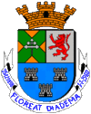
Coat of armsMotto: "Floreat Diadema" (Latin)
"Let's make it flourish Diadema"Location in the São Paulo state. Coordinates: 23°41′10″S 46°36′38″W / 23.68611°S 46.61056°WCoordinates: 23°41′10″S 46°36′38″W / 23.68611°S 46.61056°W Country  Brazil
Region Southeast State São Paulo Government - Mayor Mario Reali (PT) Area - Total 30.7 km2 (11.9 sq mi) Elevation 780 m (3,020.8 ft) Population (2006) - Total 395,333 - Density 12,898.3/km2 (33,406.4/sq mi) Time zone UTC-3 (UTC-3) - Summer (DST) UTC-2 (UTC-2) HDI (2000) 0.790 – medium Website Diadema City Diadema is a city in São Paulo state, Brazil. The distance from the capital is 17 km (from Praça da Sé). The city has an area of 30.65 square kilometres (11.83 sq mi) and a population of 357,064, and is accessed by a transit called EMTU (Empresa Metropolitana de Transportes Urbanos de São Paulo).
History
Since its beginning, Diadema occupation process had one fundamental factor: its geographical location between the coast - Vila de São Vicente - and the plateau - Vila de São Paulo de Piratininga (São Paulo city early name). It was the existence of a connecting road between São Bernardo do Campo and Santo Amaro that provided ways for the early inhabitants to arrive to the neighborhoods in the early 18th century. The avenues that are now known as Antonio Piranga and Piraporinha were originated from this early roads.
Until the 1940s, Diadema was constituted by four neighborhoods belonging to São Bernardo do Campo: Piraporinha, Eldorado, Taboão e Vila Conceição. Dispersed, they were only connected through roads of difficult passage and each neighborhood had its own life. Piraporinha near São Bernardo; Taboão, also connected to São Bernardo do Campo due to the proximity and to São Paulo through Água Funda Avenue. Eldorado, a neighborhood that had unique characteristics, because of the Billings Dam, had a greater proximity to São Paulo, to the Santo Amaro region and finally Vila Conceição formed by the farms that once belonged to the Vila Conceição Company.
External links
- (Portuguese) Diadema Official Site
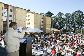
 President Luiz Inácio Lula da Silva gives a speech in Diadema
 Categories:
- Populated places in São Paulo (state)
Wikimedia Foundation. 2010.


