- São Vicente, São Paulo
Infobox City
official_name = Município da Estância
Balneária de São Vicente
imagesize =
image_caption =
nickname =
motto =.jpg)
image_shield = Brasao de Sao Vicente(Sao Paulo).gif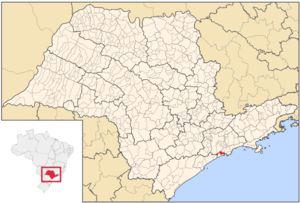
mapsize = 250px
map_caption = Location of São Vicente
pushpin_mapsize =
subdivision_type = Country
subdivision_type1 = Region
subdivision_type2 = State
subdivision_name = BRA
subdivision_name1 = Southeast
subdivision_name2 = São Paulo
leader_title =Mayor
leader_name =Tércio Garcia
area_note =
area_magnitude = 1 E9
area_total_km2 = 148
population_as_of = 2007
population_footnotes = cite web|url=http://www.ibge.gov.br/home/estatistica/populacao/contagem2007/popmunic2007layoutTCU14112007.xls|title=Estimativas - Contagem da População 2007|publisher=IBGE |accessdate=2008-07-11]
population_metro =
area_metro_km2 =
population_total = 323599
population_density_km2 = 2186.48
population_density_metro_km2 =
timezone =UTC-3
utc_offset = -3
timezone_DST =UTC-2
utc_offset_DST = -2
latd = 23
latm = 57
lats = 48
latNS = S
longd = 46
longm = 23
longs = 32
longEW= W
elevation_m = 6
elevation_ft =
blank_name = HDI (2000)
blank_info = 0,798 – medium
Postal Code =
website = [http://www.saovicente.sp.gov.br/ São Vicente City]
footnotes =São Vicente is a coastal city of Southern São Paulo,
Brazil . Its estimated population in 2006 was 329 370 inhabitants.It was the first Portuguese permanent settlement in the
Americas and the first capital of theCaptaincy of São Vicente , now the state of São Paulo. Established as a proper village in 1532 byMartim Afonso de Sousa on what was then the Porto dos Escravos (port of the slaves), operated by three Portuguese colonists who trafficked on slaves captured by allied tribes, São Vicente is titled "Cellula Mater" (Mother Cell) of Brazil for being the first organized town in the country. The first City Council of all the Americas was democratically elected and established in São Vicente onAugust 22 1532 .Today's city is positioned off the island of São Vicente. Its economy is based on
tourism .A suspension bridge linking the island and the mainland was first constructed in 1914. Neighborhoods include Humaitá, Parque das Bandeiras, Vila Ema and Quarentenário. São Vicente is linked with the
Rodovia Manuel da Nóbrega .Population history
References
*
External links
* [http://www.saovicente.sp.gov.br/ São Vicente's official home page]
* [http://www.nossosaopaulo.com.br/Reg_13/Reg13_SaoVicente.htm Portal Nosso São Paulo]Geographic Location
Centre = São Vicente
North =Cubatão ,São Paulo andSão Bernardo do Campo
Northeast =
East = Santos
Southeast =
South =Atlantic Ocean
Southwest =
West =Mongaguá andPraia Grande
Northwest =

Wikimedia Foundation. 2010.