- Qarshi
-
Qarshi
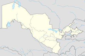
ҚаршиU.S. airbase in Qarshi Location in Uzbekistan Coordinates: 38°52′N 65°48′E / 38.867°N 65.8°E Country  Uzbekistan
Province Qashqadaryo Province Population (1999) – Total 197,600 Qarshi (Uzbek: Qarshi / Қарши; Persian: نخشب / Nakhshab; Mongolian: Харш; Russian: Карши) is a city in southern Uzbekistan. It is the capital of Qashqadaryo Province and has a population of 197,600 (1999 census estimate). It is about 520 km south-southwest of Tashkent, and about 335 km north of Uzbekistan's border with Afghanistan. It is located at latitude 38° 51' 48N; longitude 65° 47' 52E at an altitude of 374 meters. The city is important in natural gas production, but Qarshi is also famous for its production of woven flat carpets.
Contents
History
Originally the Sogdian city of Nakhshab, and the Islamic Uzbek (Turkic) city of Nasaf, Qarshi was the second city of the Emirate of Bukhara. It is in the center of a fertile oasis that produces wheat, cotton, and silk and was a stop on the 11 day caravan route between Balkh and Bukhara. The Chagatai Mongol khans Kebek and Qazan built palaces here on the site of Genghis Khan's summer pasture.[1] In 1364, Timur also built a fortified palace with moats in what is now the southern part of the city. The modern name "Qarshi" means fort.
With the decline of Shahrisabz in the 18th century, Qarshi grew in importance, and was the seat of the Crown Prince to the Emirate of Bukhara. The city had a double set of walls, 10 caravanserais and 4 madrassahs during this time. By 1868, the Russians had annexed the Zarafshan Valley, and in 1873, the treaty turning Bukhara into a Russian protectorate was signed in Qarshi, much to the dismay of the Emir's son, Abdul Malik, who took to the hills in rebellion.
In the early 1970s, the first section of a major irrigation project was completed to divert water from the Amu Darya River in Turkmenistan eastward into Uzbekistan in order to irrigate the land surrounding Qarshi. Almost all of these irrigated lands around Qarshi are planted with cotton.
Points of interest
- Khoja Adbul Aziz Madrassah - largest in town, now housing the Regional Museum
- Rabiya Madrassah - a late 19th century female madrassah
- Kok Gumbaz Mosque - part of a 16th century complex of buildings
- World War II Memorial - Perhaps one of the ex-Soviet Union's most monumental monuments
Education
- One university and one institution of higher learning:
Coordinates: 38°52′N 65°48′E / 38.867°N 65.8°E
Notes
References
- Grousset, René. The Empire of the Steppes: A History of Central Asia. Trans. Naomi Walford. New Jersey: Rutgers, 1970. ISBN 0813513049
 Cities of Uzbekistan
Capital Cities Andijan • Angren • Asaka • Bekabad • Beruniy • Bukhara • Chimboy • Chirchiq • Fergana • Guliston • G‘ijduvon • G‘uzor • Jizzakh • Juma • Kattaqo‘rg‘on • Kogon • Kosonsoy • Margilan • Mo‘ynoq • Namangan • Navoiy • Nukus • Nurota • Olmaliq • Qarshi • Qorako‘l • Qorasuv • Qo‘ng‘irot • Qo‘qon • Rishton • Samarkand • Shahrisabz • Shirin • Sirdaryo • Termez • To‘rtko‘l • To‘ytepa • Uchquduq • Urganch • Urgut • Vobkent • Xiva • Xo‘jayli • Yangiabad • Yangiyer • Yangiyo‘l • ZarafshonCategories:- Populated places in Uzbekistan
Wikimedia Foundation. 2010.


