- Namangan
-
Namangan
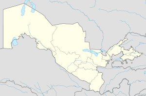
Namangan / НаманганLocation in Uzbekistan Coordinates: 41°38′N 71°58′E / 41.633°N 71.967°ECoordinates: 41°38′N 71°58′E / 41.633°N 71.967°E Country  Uzbekistan
Province Namangan Province Elevation 476 m (1,562 ft) Population (2010) - Total 441,3 Twin Cities - Seongnam  South Korea
Namangan (Uzbek: Namangan / Наманган; Russian: Наманган) is the third-largest city in Uzbekistan (2010 pop. 441,3.). It is the capital of Namangan Province, in the northern edge of Fergana Valley of north-eastern Uzbekistan.
Geography
Namangan is about 300 km east of Tashkent, about 65 km west of Andijan, and about 75 km north of Fergana. It is located at 40°59′N 71°35′E / 40.98°N 71.58°E 1561 feet (476 meters) above sea level. The Qoradaryo and Naryn Rivers join together to form the Syr Darya just outside the southern edge of the city.
History
Namangan was originally a settlement of the native turkish[citation needed] population of Central-Asia[citation needed]. After the destructive earthquake in Akhsikanth city, the population of the city moved to Namangan.
Namangan was known to have been a settlement in the 15th century and a part of the Khanate of Kokand by the middle of the 18th century. It takes its name from the local salt mines (in Persian: نمککان namak kan)[citation needed]. At the time of the Russian occupation, Namangan was a center of Islamic learning, with 20 madrassahs and over 600 mosques[citation needed]. After annexation by the Russians in 1876, cotton production and food processing became the dominant economic activity. Namangan suffered a destructive earthquake in 1926. The primary language of the people of the Namangan region is Uzbek; Tajik is spoken partially in Chust and Kasan-sai districts.
Since Uzbekistan independence in 1991, Namangan has gained a reputation for Islamic awakening, with many mosques and schools funded by charity organizations from Middle Eastern countries, including the conservative Wahabi sect from Saudi Arabia.[citation needed] This has also translated into political opposition against the secular government of Uzbekistan.[citation needed] Some women have discarded traditional colorful scarves for large white veils or even the black paranja.[citation needed]
Main Tourist Sights of Namangan
- Mullo Kyrgyz Madrasseh – built in 1910
- Mosque of Ota Valikhan Tur – built in 1915, and one of the largest in Central Asia; now home to local branch of the Wahabi sect
- Namangan Natural History Museum – housing local archaeological discoveries
- Hadja Amin Kabri Architectural Complex – ornate terra-cotta facade from the 18th to 19th century
- Akhsykent ruins - 1st century settlement located 25 km west of Namangan, on the Syr-Darya River. Formerly capital of Fergana Valley, it was destroyed by the Mongols, rebuilt by the Timurids and abandoned in the 17th century for Namangan after an earthquake.
External links
- Political Salience of Ethnic Identities in Namangan and Samarqand (pdf)[dead link]
- [1]
- Open Street Map
 Cities of Uzbekistan
Capital Cities Andijan • Angren • Asaka • Bekabad • Beruniy • Bukhara • Chimboy • Chirchiq • Fergana • Guliston • G‘ijduvon • G‘uzor • Jizzakh • Juma • Kattaqo‘rg‘on • Kogon • Kosonsoy • Margilan • Mo‘ynoq • Namangan • Navoiy • Nukus • Nurota • Olmaliq • Qarshi • Qorako‘l • Qorasuv • Qo‘ng‘irot • Qo‘qon • Rishton • Samarkand • Shahrisabz • Shirin • Sirdaryo • Termez • To‘rtko‘l • To‘ytepa • Uchquduq • Urganch • Urgut • Vobkent • Xiva • Xo‘jayli • Yangiabad • Yangiyer • Yangiyo‘l • ZarafshonCategories:- Populated places in Uzbekistan
- Cities in Central Asia
- Uzbekistan geography stubs
Wikimedia Foundation. 2010.

