- Naryn River
-
Naryn River (Нарын дарыясы) River 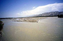 The Naryn River near the town of Naryn
Countries Kyrgyzstan, Uzbekistan Regions Naryn Province, Jalal-Abad Province Tributaries - left At-Bashi River, Alabuga River - right On Archa River, Kara-Suu River (Jalal-Abad Province,Kyrgyzstan), Jumgal River, Kökömeren River Cities Naryn, Naryn Province, Karaköl, Jalal-Abad Province, Tashkömür, Jalal-Abad Province Length 807 km (501 mi) Basin 59,100 km2 (22,819 sq mi) Discharge for near mouth - average 429 m3/s (15,150 cu ft/s) The Naryn River (Kyrgyz: Нарын, Russian: Нарын) rises in the Tian Shan mountains in Kyrgyzstan, Central Asia, flowing west through the Fergana Valley into Uzbekistan. Here it merges with the Kara Darya River (at 40°54′N 71°45′E / 40.9°N 71.75°ECoordinates: 40°54′N 71°45′E / 40.9°N 71.75°E) to form the Syr Darya. It is 807 kilometres (501 mi) long (together with Chong-Naryn River) and has an annual flow of 13.7 cubic kilometres (11,100,000 acre·ft).
The largest tributaries of the Naryn River are: Kichi-Naryn River, At-Bashi River, On Archa River, Kadjyrty River, Chychkan River, Alabuga River, Kökömeren River etc. [1]
The river contains many reservoirs which are important in the generation of hydroelectricity. The largest of these is the Toktogul Reservoir containing 19.9 cubic kilometres (16,100,000 acre·ft) of water.
Some places along the river: Kyrgyzstan: Kara-Say (see Barskoon), Naryn Province, Naryn, Dostuk, Jalal-Abad Province, Kazarman, Toktogul Reservoir, Kara-Köl, Tash-Kumyr.
Notes
External links
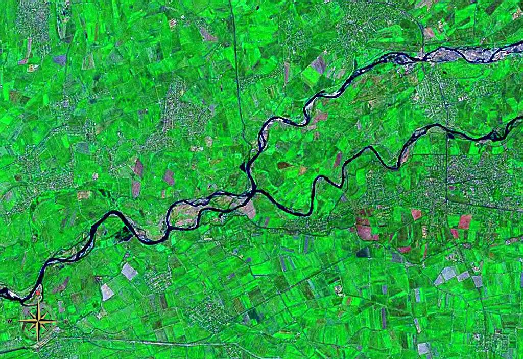
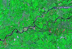 Confluence of Naryn and Kara Darya seen from space (false color). Many irrigated agricultural fields can be seen.
 Rivers of KyrgyzstanAla-Archa River • Alabuga River • At-Bashi River • Chatkal River • Chong-Kemin River • Chu River • Joon Aryk • Jyrgalan River • Kara Darya • Kara-Suu • Kegart River • Kichi-Kemin River • Kochkor River • Kurshab River • Naryn River • On Archa River • Sokh River • Talas River • Tar River (Kyrgyzstan) • Toshkan River • Vakhsh River • Ysyk-Ata RiverCategories:
- Rivers of Kyrgyzstan
- Rivers of Uzbekistan
- International rivers of Asia
- Naryn Province
- Jalal-Abad Province
- Kyrgyzstan geography stubs
- Uzbekistan geography stubs


Wikimedia Foundation. 2010.