- Nottingham Express Transit
-
This article is about trams from 2004 onwards. For trams 1875–1897, see Nottingham and District Tramways Company Limited. For trams 1897–1936, see Nottingham Corporation Tramways.

Nottingham Express Transit
Overview Type Tram Locale Nottingham Stations 23 Operation Opened 9 March 2004 Operator(s) Nottingham Tram Consortium Rolling stock Bombardier Incentro AT6/5 Technical Line length 14 km (8.7 mi) Track gauge Standard gauge Electrification 750 V DC OHLE Operating speed 80 km/h (50 mph) Route map Legend
Hucknall 

Butler's Hill Moor Bridge Bulwell Forest 
Bulwell 


Phoenix Park Cinderhill 

Highbury Vale 

David Lane Basford Wilkinson Street 

Wilkinson Street depot 


Shipstone Street 
Radford Road Beaconsfield Street Hyson Green Market Noel Street 

The Forest High School Nottingham Trent University Royal Centre Old Market Square Lace Market 
Westfield Broadmarsh (proposed) 
Station Street (for Nottingham )This route map:
Nottingham Express Transit (NET) is a light-rail tramway in the Nottingham area in England. The first line opened to the public on 9 March 2004, having cost £200 million (£229 million as of 2011)[1] to construct. The scheme took sixteen years from conception to implementation. It is operated by Nottingham Tram Consortium, a 50:50 partnership between Veolia Transdev and Nottingham City Transport.
Contents
Network
Line 1
The route of the current line starts at Nottingham railway station to the south of the city centre and extends north, passing the Lace Market, Nottingham Trent University, Forest Recreation Ground and terminating at Hucknall. There are currently 23 stops, with provision for an extra stop between Basford and Wilkinson Street close to the development of the site of the old British Gas works, and a proposal for an extra stop at the redeveloped Broadmarsh shopping centre adjacent to the projected new bus station.
This line is 14 km long, of which 4 km is on-street. A little north of the city centre is a section about 1 km long where northbound and southbound trams follow different streets and the lines cross at each end of this section to run on the 'wrong side'. From Wilkinson Street north (for about 8 km), the tramline runs alongside an existing railway, the Robin Hood Line. At Highbury Vale, about halfway along the line, a branch turns west to end 1 km later at Phoenix Park, while the main line runs north to Hucknall. There are park-and-ride facilities at several stations.
All the construction works on Line 1 were carried out by Carillion. The system is arguably the only 'new' tram system built in the UK to have been an instant success. Whilst others around the UK are now starting to carry the number of passengers that was hoped for, Nottingham's system has exceeded the most optimistic predictions, carrying 9.7 million people in 2005. This bolsters the case for the construction of new lines. As of 2006 it is also the only light railway in the British Isles to operate 100% low floor trams.
As of 4 April 2005, trams run every five minutes during peak times, and every six minutes during the weekday daytime, alternating Northbound to Hucknall/Phoenix Park, dropping to every 10 minutes Monday–Saturday evening, and every 15 minutes Sunday evening.
The tram has rail connections with East Midlands Trains, CrossCountry and Northern Rail at Station Street (for Nottingham railway station), as well Bulwell and Hucknall for the Robin Hood Line.
Bus connections are available throughout the system, with the main interchanges being at Hucknall, for TrentBarton Connect to get around the vast Hucknall Estates, and also the 141 for a fast connection to Mansfield; Moor Bridge for Trent Barton Rainbow 3 and NCT 70/71/L11 services for Arnold; Bulwell Forest for NCT 17 service to City Hospital; Bulwell for NCT 17/35/68/69/70/71/79/80/81/L6/L11 services; Cinderhill for Trent Barton Rainbow 1 to Eastwood(via a short walk to Nuthall Road) and NCT 35/70/71/72/79/L11 services; Wilkinson Street for Medilink (City Hospital to QMC) services; Royal Centre for TrentBarton and NCT services; Old Market Square for Trentbarton and NCT services; Lace Market for NCT 5/6/7/8/9/10/11/34/77/78/79/Citylink 1; Station Street for Premiere, TrentBarton and NCT services; Phoenix Park for the Phoenix Flyer to Nuthall, Kimberley, IKEA and Ilkeston.
Tickets are sold on board by conductors, assisted by conductors at The Forest tramstop during peak times. An all-day tram ticket costs £3.20. A CityRider (all trams and NCT buses within the CityRider zone) day ticket costs £3.40. A Kangaroo (all trams, buses and trains within the Kangaroo Zone) day ticket costs £3.40. (The CityRider and Kangaroo Zones cover different areas, the main difference being that the Kangaroo Zone covers only Hucknall on the tram, not bus or train). In Hucknall, a Trent Barton Connect day ticket costs £3.60 (adult) £2.00 on tram, £2.10 on bus (child). An adult tram single ticket costs £1.60 but £2.50 before 09.30 Monday–Friday, in a push for the few that buy them in the morning peak to buy all-day tickets instead (passengers are advised to purchase a PayPoint 10-trip ticket to reduced this cost to £1.40).
Weekly, monthly, quarterly and yearly EasyRider touchcards in conjunction with NCT are also available, as are PayPoint 10-trip, 3-day, 15-day and 30-day tram-only tickets.
Concessionary fares are available only to Nottingham City and Nottinghamshire County pass holders. Nottingham City pass holders travel for free, apart from between 0730-0930 Monday–Friday when full fare is charged. Nottinghamshire County pass holders travel free apart from before 0930 Monday–Friday when full fare is charged, and between 1600–1800 Monday–Friday when half fare is charged (70p evening, only single tickets available). All pass holders from other areas are charged at full fare as the free travel scheme applies only to buses outside of their local areas.
Child single tickets are £1.00; child all-day tickets are £1.70.
Prospective future lines
Nottingham Express Transit Legend
Robin Hood Line→Mansfield/Worksop 

Hucknall 
Butlers Hill Moor Bridge Bulwell Forest Bulwell 
Phoenix Park Cinderhill Highbury Vale Babbington Junction David Lane Basford 


Wilkinson Street 

Wilkinson Street Depot 

Shipstone Street Radford Road Beaconsfield Street Hyson Green Market Noel Street 

The Forest High School Nottingham Trent University Royal Centre Old Market Square Lace Market 
Broadmarsh Proposed 
Station Street Current terminus 

Nottingham railway station 
Nottingham Station Phase 2 


Meadows North "ng2" 
Midland Main Line Gregory Street 
Queen's Medical Centre 
A52 
University of Nottingham University Boulevard Middle Street Beeston Town Centre Chilwell Road Castle College Cator Lane Bramcote Lane Eskdale Drive Inham Road 
Toton Lane Park & Ride Meadows Centre Queens Walk 
Wilford Toll Bridge Wilford Village 
B679 Wilford Lane Wilford Lane Compton Acres Ruddington Lane 
B680 Ruddington Lane A52 Southchurch Drive North Rivergreen Clifton Centre Holy Trinity Summerwood Lane Clifton Park & Ride NET Phase Two is the collective term for the project to build extensions to Line One of Nottingham Express Transit (NET) NET Phase 2
The extension consists of two new lines from the city centre terminus at Station Street. A bridge will be constructed across the top of Nottingham Station. NET Phase 2: stations
Line 2
The Clifton route will go to the south of the City. It will serve the densely populated residential areas, including the Meadows, Wilford / Ruddington Lane area and the Clifton Estate, terminating at a new park and ride site serving the A453. It will cross the River Trent on the Wilford Toll Bridge which will be widened to allow pedestrians and cyclists to continue to use it, and then use part of the Great Central Railway formation though Wilford.
The route is 7.6 km, of which 63% is segregated. The journey time from the Old Market Square to the terminus will be 23.5 minutes.
Current outline designs show 13 tram stops, attracting approximately 3.9 million passenger journeys a year.
Line 3
The Chilwell and Beeston route will go to the south west of the city. It will serve the northern edge of the Meadows residential area, the ng2 development site, Queen's Medical Centre, the University of Nottingham, Beeston town centre and Chilwell, terminating at a new park and ride site at the junction of the A52 road and Toton Lane, about one mile from junction 25 of the M1 motorway.
The route is 9.8 km, of which 59% is segregated. The journey time from the Old Market Square to the terminus will be 30 minutes.
Current outline designs show 15 tram stops, attracting approximately 5.1 million passenger journeys a year.
Project progress
Programme Entry approval was given on 25 October 2006 with the Government agreeing to provide up to £437 million in Private Finance Initiative (PFI) credits. The local councils will also provide up to £141M in PFI credits. The two local councils (Nottinghamshire County and Nottingham City Councils) voted on 22 February 2007 and 3 March 2007 respectively to table an application for a Transport & Works Act Order.
The various documents which make up the City and County Councils’ application for the order were available to view at a number of venues from 26 April 2007 to 7 June 2007 when it was submitted to the Secretary of State for Transport for consideration. A public inquiry was held in December 2007. The project was given the go-ahead by the government on 30 March 2009.[2][3]
Following the local elections in 2009, Nottinghamshire County Council indicated that it was no longer willing to contribute financially to the project, so Nottingham City Council decided to cover the shortfall and be the sole promoter of the project. Nottinghamshire County Council confirmed that it would not obstruct the project.[4]
Funding for the work was approved by the government on 31 July 2009.[5][6] Selecting and appointing the contractor is expected to take 2 years. Building work on these lines is expected to begin in 2011, in two phases, with trams running from 2014. The tram scheme aims to reduce the number of car journeys into Nottingham by four million per annum.
The scheme survived the Comprehensive Spending Review ordered by the Coalition Government announced on 20 October 2010.
In March 2011, the government confirmed that funding has been granted to enable the construction of the two new lines. And at the end of the month, the preferred bidder to build the new lines and operate the complete extended tram network was announced as Tramlink Nottingham. The finalised contract is hoped to be signed by September.[7]
Tramlink Nottingham is a consortium consisting of Alstom, Keolis, trent barton, Vinci, OFI InfraVia & Meridiam Infrastructure.
Route
- See map
Tram fleet
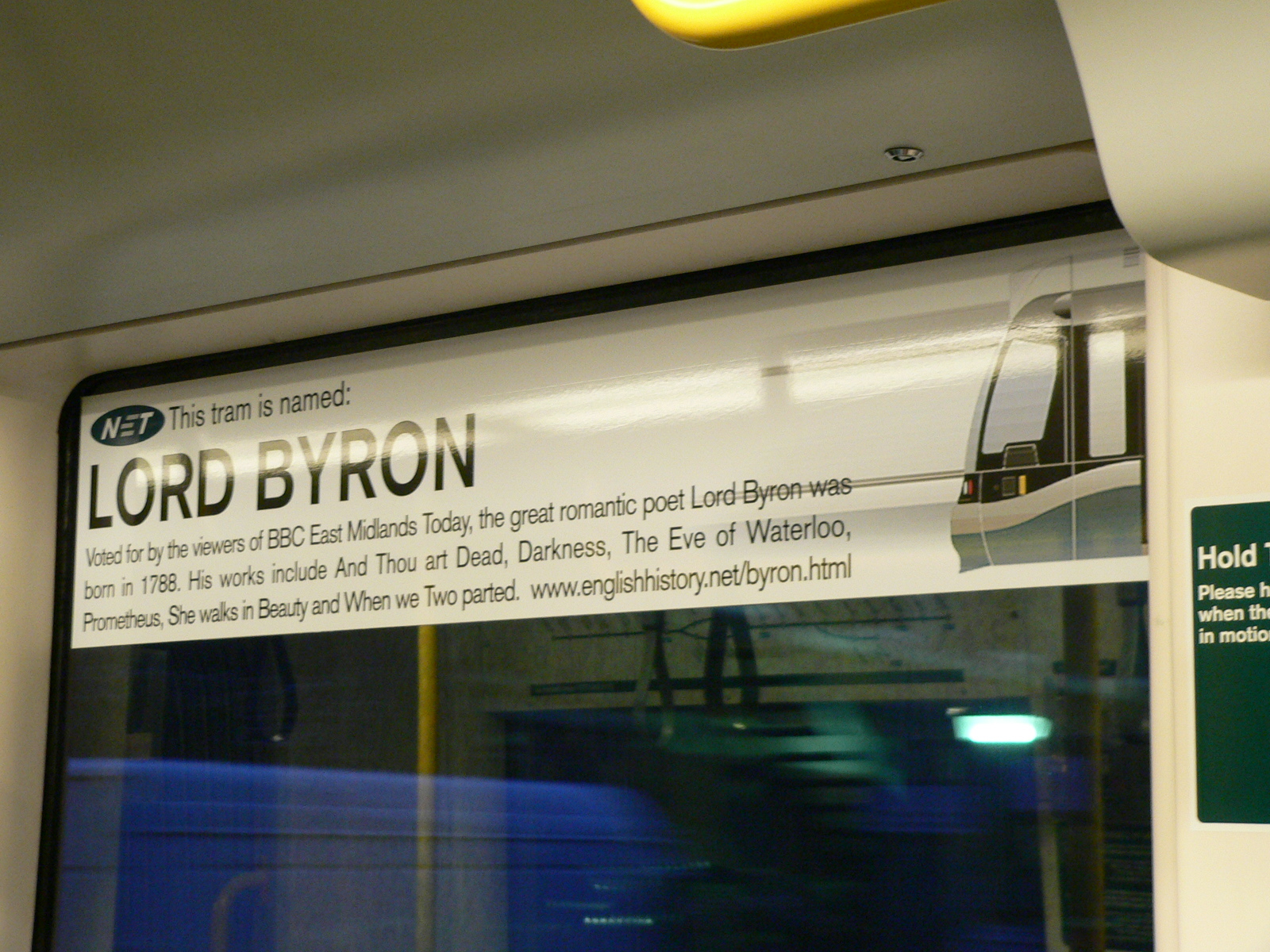
Main article: AT6/5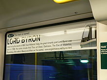 All NET trams are named, tram 205 carries the name of Lord Byron
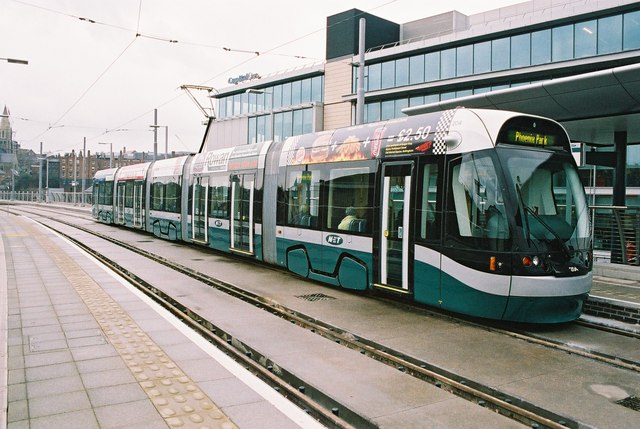
The system has 15 Incentro AT6/5 trams, similar to those used in Nantes, which were built by Bombardier Transportation (formerly ADtranz) in Derby. The Flexity Outlook Eurotram was also considered, but was rejected as its large single-leaf doors did not comply with British door-alarm regulations.
The trams run on 750 volts DC and have a top speed of 80 kilometres per hour (50 mph). They are 100% low-floor vehicles articulated in five sections, and are 33 metres long and 2.4 metres wide.
From a very early stage, the trams have been named after famous local people. Vinyl transfers carrying the names are mounted on diagonally opposite corners of the tram exterior. Upon introduction they were also on the front (in direction of travel) right-hand side on the top of tram windows, in the same style as advertisements.
Class Image Top speed Number Built mph km/h Incentro AT6/5 
50 80 15 2002–2003 As part of the project to build Phase 2 of the system, Alstom, which is part of the new Tramlink Nottingham consortium, will provide 22 new Citadis vehicles to expand the fleet.[8]
Incidents
- On 6 October 2007, a 23-year-old man from Hucknall died after being hit by a tram when he stepped in front of it at Weekday Cross. His death was the first such fatality since the trams were re-launched in the city.[9]
- On 27 July 2009 the GMB held a strike in protest at a proposed paycut of 0.6% offered by Nottingham Tram Consortium. A maximum of 5 trams, out of a normal service of thirteen, ran for twelve hours from 6am until 6pm, on the Hucknall route, with replacement buses running a shuttle from Phoenix Park.[10]
External links
- Nottingham Express Transit - official web site
- NET Phase Two - official web site for future extensions
- Take a virtual ride on the Nottingham tram
- Infrastructure & Tram Spec Sheet
References
- ^ UK CPI inflation numbers based on data available from Lawrence H. Officer (2010) "What Were the UK Earnings and Prices Then?" MeasuringWorth.
- ^ Nottingham Express Transit (2007-04-27). "The NE(x)T steps for Nottingham Express Transit". Archived from the original on 2007-07-06. http://web.archive.org/web/20070706201601/http://www.netphasetwo.com/07/netphasetwo_story.asp?NETworkNEWSId=40. Retrieved 2007-05-07.
- ^ Nottingham Express Transit (2009-03-30). "Government backs Nottingham's Tram Extensions". http://www.netphasetwo.com/.
- ^ http://www.thisisnottingham.co.uk/news/Tories-promise-impede-tram-extension/article-1156678-detail/article.html
- ^ http://www.transportbriefing.co.uk/news/story?id=6110
- ^ http://nds.coi.gov.uk/clientmicrosite/Content/Detail.aspx?ClientId=202&NewsAreaId=2&ReleaseID=405456&SubjectId=36
- ^ http://www.nottinghamcity.gov.uk/netphase2/index.aspx?articleid=7522
- ^ Tramlink Nottingham named preferred bidder for NET Phase 2 - Railway Gazette, 06/04/11
- ^ "First tram death victim is named". BBC News. 2007-10-08. http://news.bbc.co.uk/2/hi/uk_news/england/nottinghamshire/7033505.stm. Retrieved 2009-04-05.
- ^ accessdate = 2009-07-28 "Tram works carried out planned strike action yesterday after talks failed". Nottingham Evening Post. 2009-07-27. http://www.thisisnottingham.co.uk/news/Tram-strike-causes-delays-queues/article-1199840-detail/article.html accessdate = 2009-07-28.
UK light rail systems Tramways CurrentBlackpool tramway · Manchester Metrolink · Midland Metro · Nottingham Express Transit · Sheffield Supertram · TramlinkFutureEdinburgh TramsProposedCancelledBristol Supertram · CITI Belfast · Cross River Tram · Leeds Supertram · Merseytram · Penistone Line Tram-Train · West London Tram
Metro CurrentProposedNorth and West London Light Railway · West London OrbitalPreserved Black Country Living Museum · East Anglia Transport Museum · Heaton Park Tramway · National Tramway Museum · Seaton Tramway · Wirral Transport Museum · Wirral TramwayBus companies London SovereignBus companies part of Blazefield See also Nottingham City Transport (18% stake) · Nottingham Express Transit (tram system)Categories:- Transdev Group companies
- Tram transport in Nottingham
- Railway lines opened in 2004
- Electric railways in the United Kingdom
Wikimedia Foundation. 2010.