- Ogden, Quebec
-
Ogden, Quebec — Municipality — Location within Memphrémagog Regional County Municipality.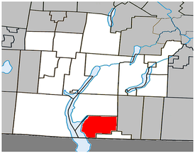
Coordinates (70, chemin Ogden[1]): 45°01′29″N 72°12′54″W / 45.02472°N 72.215°WCoordinates: 45°01′29″N 72°12′54″W / 45.02472°N 72.215°W Country  Canada
Province  Quebec
Region Estrie RCM Memphrémagog Established January 23, 1932 Electoral Districts
Federal
Compton—StansteadProvincial Orford Government[1][2][3] - Mayor Joseph Stairs - Federal MP(s) France Bonsant (BQ) - Quebec MNA(s) Pierre Reid (PLQ) Area[4] - Land 74.63 km2 (28.8 sq mi) Population (2006)[4] - Total 762 - Density 10.2/km2 (26.4/sq mi) - Change (2001-06)  0.0%
0.0%- Dwellings 486 Time zone EST (UTC-5) - Summer (DST) EDT (UTC-4) Postal Code(s) J0B Area code(s) 819 Access Routes[5]  Route 247
Ogden is a municipality of 750 people, part of the Memphrémagog Regional County Municipality in the Eastern Townships region of Quebec. It comprises the hamlets of Tomifobia (formerly Smith's Mills)[6] and Graniteville.
References
- ^ a b Ministère des Affaires Municipales et Régions: Ogden
- ^ Parliament of Canada Federal Riding History: COMPTON--STANSTEAD (Quebec)
- ^ Chief Electoral Officer of Québec - 40th General Election Riding Results: ORFORD
- ^ a b 2006 Statistics Canada Community Profile: Ogden, Quebec
- ^ Official Transport Quebec Road Map
- ^ "Liste des municipalités" (in French). Memphrémagog Regional County Municipality. http://www.mrcmemphremagog.com/munic.html. Retrieved 2009-10-12.

Stanstead (township) Lake Memphremagog
Potton
Stanstead-Est  Ogden
Ogden 

 United States
Derby, VermontStanstead (city) Administrative divisions of QuebecSubdivisions Communities Major cities Montreal · Quebec · Laval · Gatineau · Longueuil · Sherbrooke · Saguenay · Lévis · Trois-Rivières
Categories:- Municipalities in Quebec
- Incorporated places in Estrie
- Estrie geography stubs

Wikimedia Foundation. 2010.