- Potton, Quebec
-
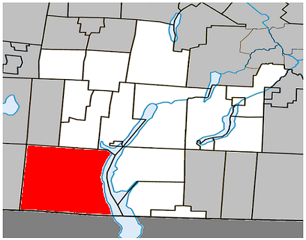
Potton, Quebec — Township — Location within Memphrémagog Regional County Municipality.
Coordinates (2, rue de Vale Perkins[1]): 45°02′58.74″N 72°23′30.04″W / 45.04965°N 72.3916778°WCoordinates: 45°02′58.74″N 72°23′30.04″W / 45.04965°N 72.3916778°W Country  Canada
Province  Quebec
Region Estrie RCM Memphrémagog Established July 1, 1855 Electoral Districts
Federal
Brome—MissisquoiProvincial Brome-Missisquoi Government[1][2][3] – Mayor Jacques Marcoux 2009-2013 – Federal MP(s) Christian Ouellet (BQ) – Quebec MNA(s) Pierre Paradis (PLQ) Area[4] – Land 261.64 km2 (101 sq mi) Population (2006)[4] – Total 1,790 – Density 6.8/km2 (17.6/sq mi) – Change (2001-06)  2.8%
2.8%– Dwellings 1,759 Time zone EST (UTC-5) – Summer (DST) EDT (UTC-4) Area code(s) 450 Access Routes[5]  Route 243
Website www.potton.ca Potton is a township of 1,700 people, part of the Memphrémagog Regional County Municipality in the Eastern Townships region of Quebec, 125km southeast of Montreal and next to the United States border, north of North Troy, Vermont. The main village in the township is Mansonville. Formerly a sleepy community best known for an unusual 19th-century round barn, Mansonville has experienced some growth and prosperity because of its proximity to the Owl's Head ski resort. Like many Eastern Townships and New England villages, Mansonville grew up around a water-powered mill which exploited a head of water above a fall on the North Branch of the Missisquoi River. The mill ceased operating with electrification in the early 20th century, which allowed economies of scale and centralized manufacturing in larger centres. It operated as a feed and grain mill until 2004, when it was destroyed by fire. Overlooking the mill site is the mansion of the Manson family that founded the town. The mansion has since become a bed and breakfast. Mansonville, like many Eastern Townships communities, has long had a mixture of French and English-speaking residents, as demonstrated by the presence of Roman Catholic, United and Anglican churches a few yards apart. Mansonville was also the home of Russian Orthodox prelate Metropolitan Vitaly Ustinov for some five decades until his death in 2006.
Geology and Soils
Most of the bedrock underlying the township is Cambrian-era slate, schist, phyllite, greywacke and quartzite. There are bands of ultramafic rock near the Missisquoi River valley, and basalt also occurs. Quaternary glaciation left deposits of stony loam till plus outwash deposits of sand and gravel. Benchlands overlooking the Missisquoi River commonly have deposits of clay loam. Brown podzolic and podzol profile developments are most common. The area is also rich in talc. For many years the Baker Talc company operated underground mining and open-pit operations, with a plant in Highwater.
References
- ^ a b Ministère des Affaires Municipales et Régions: Potton
- ^ Parliament of Canada Federal Riding History: BROME--MISSISQUOI (Quebec)
- ^ Chief Electoral Officer of Québec - 40th General Election Riding Results: BROME--MISSISQUOI
- ^ a b 2006 Statistics Canada Community Profile: Potton, Quebec
- ^ Official Transport Quebec Road Map
- Geology Cowansville-Sutton-Mansonville Quebec Map 1750A (1991).
External links

Brome Lake West Bolton / Bolton-Est Austin Sutton 
Lake Memphremagog / Stanstead (township) / Ogden  Potton

 United States
Troy, Vermont Administrative divisions of Estrie (Region 05)Regional county municipalities
and equivalent territoriesMunicipalities Lac-Mégantic · Asbestos · Danville · Cookshire-Eaton · East Angus · Scotstown · Valcourt (V) · Windsor · Richmond · Sherbrooke · Coaticook · Waterville · Stanstead (V) · Magog
Categories:- Townships of Quebec
- Incorporated places in Estrie
- Quebec communities with significant anglophone populations
- Estrie geography stubs
Wikimedia Foundation. 2010.