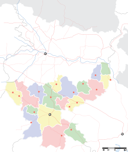
- Chakulia
-
Chakulia — city — Coordinates 22°29′N 86°43′E / 22.48°N 86.72°ECoordinates: 22°29′N 86°43′E / 22.48°N 86.72°E Country India State Jharkhand District(s) Purbi Singhbhum Population 14,330 (2001[update]) Time zone IST (UTC+05:30) Area
• 115 metres (377 ft)
Codes-
• Telephone • +9204056614
Chakulia is a city and a notified area in Purbi Singhbhum district in the state of Jharkhand, India.
Contents
Geography
Chakulia is located at 22°29′N 86°43′E / 22.48°N 86.72°E.[1] It has an average elevation of 115 metres (377 feet).
History
In 1971 during the war of independence of Bangladesh, a guerilla training camp was set up and used in Chakulia for training volunteers.
MAA TARA TEMPLE
Maa Tara Dham Chakulia was established in chakulia on 13 march 2008 . A high festive annual occasion is being held here on 13 , 14 and 15th march . A high populated gathering comes upon here . Daily in morning goddess is being worshipped and prasad is being distributed . In afternoon ann bhog is being distributed among the people . And in evening arti prasad is also being distributed . At every Amawasya hoom is being held in the temple .
LEELA OF MAA TARA :-
Once upon a time in chakulia sitaram sharma cousin was seriously affected by a disease in which blood was coming out from her mouth and nose . She was declared dead by Lt Dr Rabindra Soren . But her uncle and aunt didnt believed and took her to MAA TARA TEMPLE at chakulia and started crying in front of MAA TARA . Just look at the unexpected devine of MAA TARA that after half an hour the girl started laughing . Everybody were surprised of the above fact . At present the girl is doing everything normally and she is named as TARA SHARMA .
Demographics
As of 2001[update] India census,[2] Chakulia had a population of 14,330. Males constitute 52% of the population and females 48%. Chakulia has an average literacy rate of 64%, higher than the national average of 59.5%; with male literacy of 73% and female literacy of 54%. 13% of the population is under 6 years of age.
Transportation
References
- ^ Falling Rain Genomics, Inc - Chakulia
- ^ "Census of India 2001: Data from the 2001 Census, including cities, villages and towns (Provisional)". Census Commission of India. Archived from the original on 2004-06-16. http://web.archive.org/web/20040616075334/http://www.censusindia.net/results/town.php?stad=A&state5=999. Retrieved 2008-11-01.
Cities and towns in Kolhan division East Singhbhum district Bagbera • Baharagora • Chakulia • Chhota Gobindpur • Gadhra • Ghatshila • Ghorabandha • Haludbani • Jadugora • Jamshedpur • Jugsalai • Kokpara • Mahulia • Mango • Musabani • SarjamdaSeraikela Kharsawan district West Singhbhum district Barajamda • Chaibasa • Chakradharpur • Chiria • Danguwapasi • Gua • Jhinkpani • Kalikapur • Kandra • Kiriburu • Meghahatuburu • Noamundi • Porahat • SiniRelated topics Kolhan Division topicsCities and towns
in other DivisionsCategories:- Jharkhand geography stubs
- Cities and towns in East Singhbhum district
-
Wikimedia Foundation. 2010.


