- Musabani
-
Mosabani — city — Coordinates 22°31′N 86°27′E / 22.52°N 86.45°ECoordinates: 22°31′N 86°27′E / 22.52°N 86.45°E Country India State Jharkhand District(s) Purbi Singhbhum Population 33,892 (2001[update]) Time zone IST (UTC+05:30) Area
• 160 metres (520 ft)
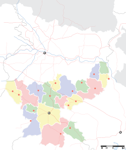
Musabani, also spelt as Mosabani or Mosaboni or Mushabani, is a census town in Purbi Singhbhum district in the Indian state of Jharkhand.
Musaboni is a mining village which was started by British before independence under the name ICC (Indian copper complex). It has a group of copper mines.
Contents
Demographics
As of 2001[update] India census[1], Musabani had a population of 33,892. Males constitute 52% of the population and females 48%. Musabani has an average literacy rate of 67%, higher than the national average of 59.5%: male literacy is 76%, and female literacy is 58%. In Musabani, 12% of the population is under 6 years of age.
Geography
Mushabani is located at 22°31′N 86°27′E / 22.52°N 86.45°E[2]. It has an average elevation of 160 m (520 ft).
It is surrounded with mountains and forest and situated on the banks of Subarnarekha River. It also has a good economic value as it has got Hindustan Copper Limited one of the deepest mine in Asia.
Education
- St. Joseph's Convent High School
- Kendriya Vidyalaya, Surda
- Saraswati Sishu Vidya Mandir, Mosaboni
- G.C.J.D High school
- Mosaboni Mines inter College, Mosaboni
- Sido kanhu janjatiya inter College, Mosaboni
- Ghatsila College, Ghatsila
- Mosabani Mines middle School
- Yadunath Baskey Degree college
References
- ^ "Census of India 2001: Data from the 2001 Census, including cities, villages and towns (Provisional)". Census Commission of India. Archived from the original on 2004-06-16. http://web.archive.org/web/20040616075334/http://www.censusindia.net/results/town.php?stad=A&state5=999. Retrieved 2008-11-01.
- ^ Falling Rain Genomics, Inc - Mushabani
Cities and towns in Kolhan division East Singhbhum district Bagbera • Baharagora • Chakulia • Chhota Gobindpur • Gadhra • Ghatshila • Ghorabandha • Haludbani • Jadugora • Jamshedpur • Jugsalai • Kokpara • Mahulia • Mango • Musabani • SarjamdaSeraikela Kharsawan district West Singhbhum district Barajamda • Chaibasa • Chakradharpur • Chiria • Danguwapasi • Gua • Jhinkpani • Kalikapur • Kandra • Kiriburu • Meghahatuburu • Noamundi • Porahat • SiniRelated topics Kolhan Division topicsCities and towns
in other DivisionsCategories:- Jharkhand geography stubs
- Cities and towns in East Singhbhum district
Wikimedia Foundation. 2010.


