- Mount Pleasant, Vancouver
-
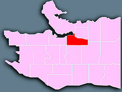
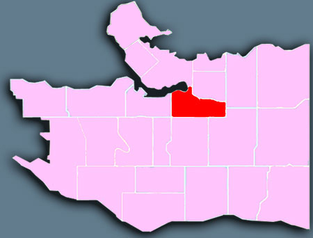
Mount Pleasant is a neighbourhood in the city of Vancouver, British Columbia, Canada, stretching from Cambie Street to Clark Drive and from Great Northern Way and 2nd, to 16th and Kingsway. The neighbourhood, once characterized as working-class, has undergone a process of gentrification since the early 1990s, including the area around the Main Street and Broadway intersection that is increasingly becoming known as South Main, or SoMa. Vancouver City Hall is also located in Mount Pleasant.
The neighborhood is served by the Canada Line, an extension of SkyTrain from Downtown Vancouver to Vancouver International Airport.
Mount Pleasant is known as one of the more up and coming neighbourhoods, especially in the communities surrounding Vancouver's downtown peninsula. Many first-time homeowners and young professionals, as well as a growing number of families, call Mount Pleasant home, which gives it its vibrancy. It is also home to a number of artists and writers, including CBC personalities Ian Hanomansing and Tod Maffin, The Tyee editor David Beers and documentary filmmaker Peter W. Klein.
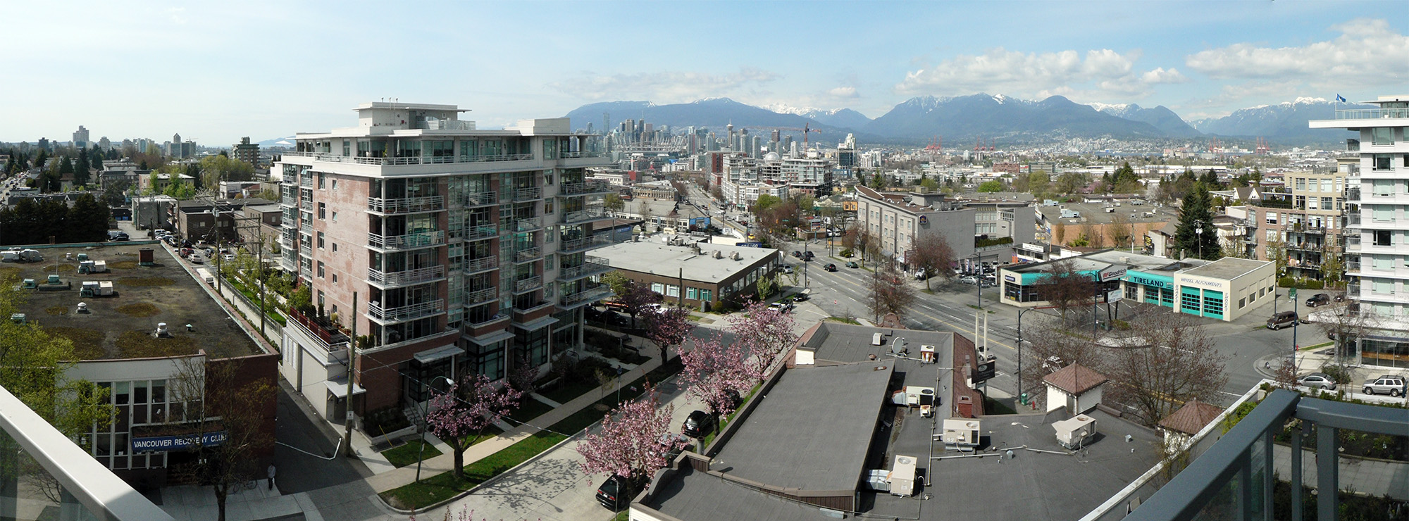
 Vancouver seen from Mount Pleasant, looking north across Kingsway just before its intersection with Broadway and Main Street. Vancouver City Hall and Vancouver General Hospital are visible to the far left, Downtown Vancouver to the centre, and North Vancouver to the far right.
Contents
History
Mount Pleasant owes much of its origins to a former stream and, because of it, developed much of its unique and rich character. The stream attracted a number of breweries from 1888 to 1912, hence it became known as Brewery Creek. In 1890, the first street cars arrived; as far south as 1st and Main. Brewery Creek, in conjunction with the connecting routes of Main and Kingsway, became the centre of industry and commercialism for the district of Mt. Pleasant. By 1897, there was a substantial population growth centred on Broadway and Main Street. The ability to commute to the City Centre and the industries of Brewery Creek and False Creek provided the draw for many working families that now populated the area below Broadway. In a sense, Mount Pleasant can be called Vancouver's "first suburb".
Demographics
As of 2006, Mt. Pleasant has 23,615 people, a 3.8% decrease from 2001. 13.7% of the population is under the age of 19; 44.8% is between 20 and 39; 33.4% is between 40 and 64; and 8.2% is 65 or older. 62.0% of Mt. Pleasant residents speak English as a first language, 10.0% speak a Chinese language, and 5.1% speak Tagalog. The median household income is $37,782, and 31.7% of its population lives in low-income households. Its unemployment rate is 5.5%. [1]
Footnotes
Brewery Creek Urban Study, 1985 by Barb Johnston and Denis Turco . http://www.lesliefield.com/bchs/
External links
- Mount Pleasant Electoral District
- City of Vancouver - Mount Pleasant Portal
- Mount Pleasant Community Calendar
- Mount Pleasant Business Improvement Association
Neighbourhoods in Vancouver, British Columbia Downtown neighbourhoods Coal Harbour • Chinatown • Davie Village • Downtown Eastside • English Bay • Financial District • Gastown • Granville Entertainment District • Granville Mall • International Village • Japantown • Robsonstrasse • Stanley Park • Victory Square • West End • Yaletown
West Side neighbourhoods Arbutus Ridge • Dunbar–Southlands • Fairview • False Creek • Kerrisdale • Kitsilano • Marpole • Oakridge • Shaughnessy • South Cambie • West Point GreyEast Side neighbourhoods Grandview–Woodland • Hastings–Sunrise • Kensington–Cedar Cottage • Killarney • Mount Pleasant • Renfrew–Collingwood • Riley Park–Little Mountain • Strathcona • Sunset • Victoria–FraserviewOther locations Champlain Heights • Commercial Drive • Granville Island • Greektown • Little Italy • Punjabi Market/Little India • Uptown/South Granville • South Main • University Endowment Lands • Hogan's Alley • Stanley ParkCategories:- Neighbourhoods in Vancouver
- Vancouver stubs
Wikimedia Foundation. 2010.