- Mazkeret Batya
-
Mazkeret Batya Hebrew transcription(s) – Hebrew מַזְכֶּרֶת בַּתְיָה – ISO 259 Mazkert Batya Baron Rothschild's farm

 Mazkeret Batya
Coordinates: 31°51′16.35″N 34°50′31.02″E / 31.8545417°N 34.84195°ECoordinates: 31°51′16.35″N 34°50′31.02″E / 31.8545417°N 34.84195°E District Center Founded 1883 Government – Type Local council Area – Total 7,440 dunams (7.4 km2 / 2.9 sq mi) Population (2008)[1] – Total 9,900 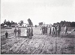 Mazkeret Batya in the early days, c.1899
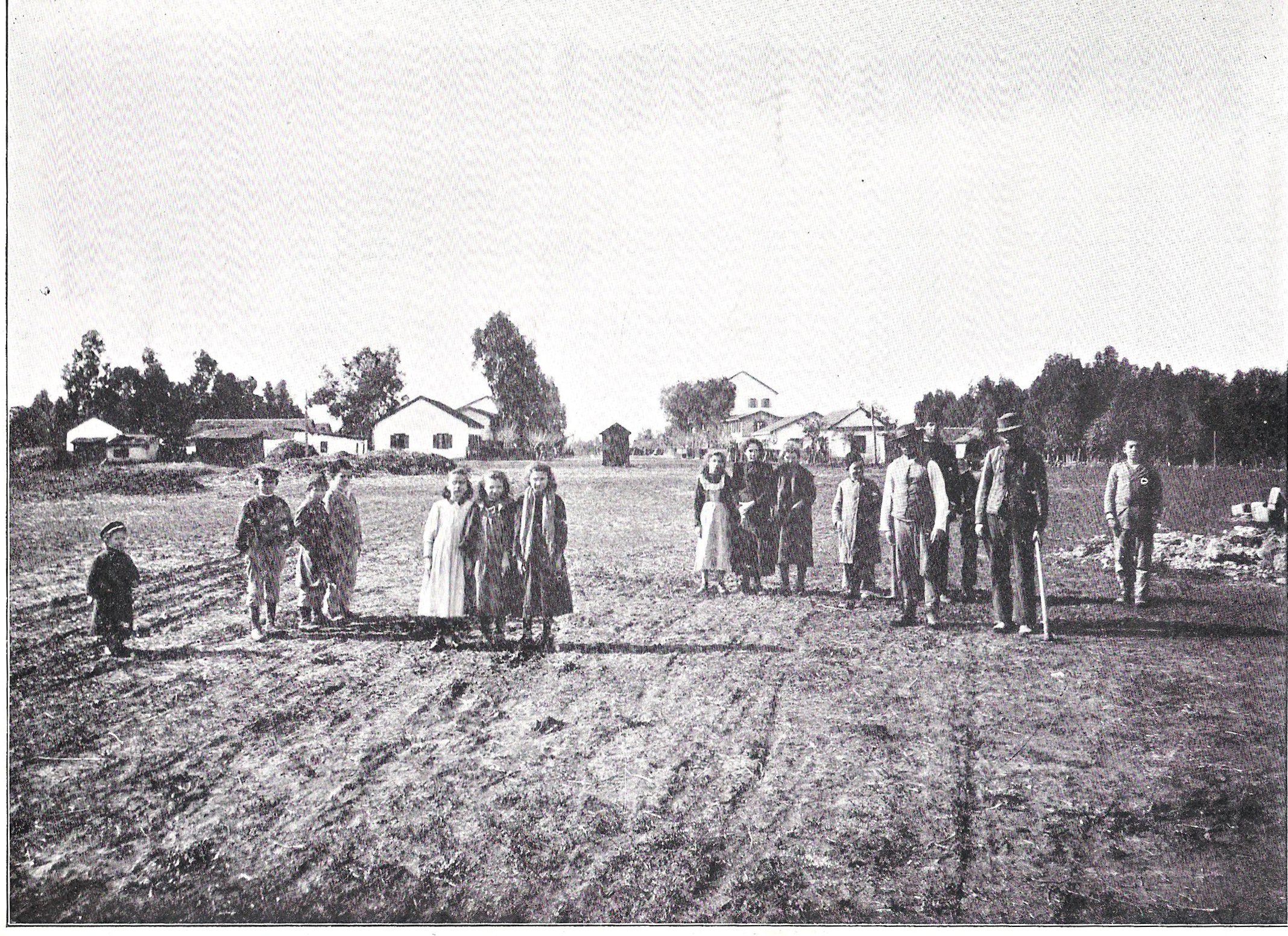
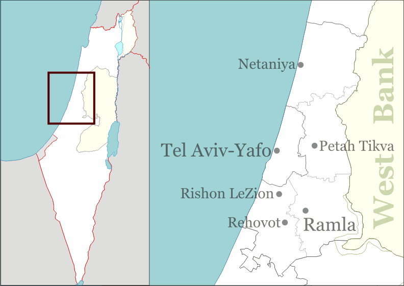
Mazkeret Batya (Hebrew: מַזְכֶּרֶת בַּתְיָה) (lit. "Batya Memorial") is a town in the center of Israel located southeast of Rehovot and 25 kilometres (16 mi) from Tel-Aviv. Mazkeret Batya spans an area of 7,440 dunams (7 km²). In December 2008, it had a population of 9,900. The mayor of Mazkeret Batya is Meir Dahan.[2]
Contents
History
Mazkeret Batya was established on November 7, 1883 by 10 pioneers from Russia and 7 local Jews. It was originally called Ekron, the first agricultural settlement of the Hovevei Zion movement. The land was purchased by Baron Rothschild in an early attempt to introduce Jewish farming in Palestine. Rabbi Shmuel Mohilever was instrumental in mobilizing funding and organizing the settlers. Mohilever's remains were later reinterred in the Mazkeret Batya cemetery. In 1887 the name was changed to Mazkeret Batya, in memory of Betty Solomon de Rothschild, mother of Baron Edmond James de Rothschild
The economy of the village was originally based on dry farming, which continued even after the Mekorot Company constructed a pipeline to bring water from Rehovoth. [3] In 1947, Mazkeret Batya was home to 475 people.[3]
During the Mandate era, a Jewish police station was established in Mazkeret Batya to safeguard the local roads. In the War of Independence, convoys to besieged Jerusalem left from Mazkeret Batya. A field hospital operated there to care for Haganah fighters wounded at Latrun. [4]
According to one source, at the end of the British Mandate for Palestine, the British tried to hand the nearby Aqir airfield and camp to the Palestinian Arabs, apparently without success. [3]
Today
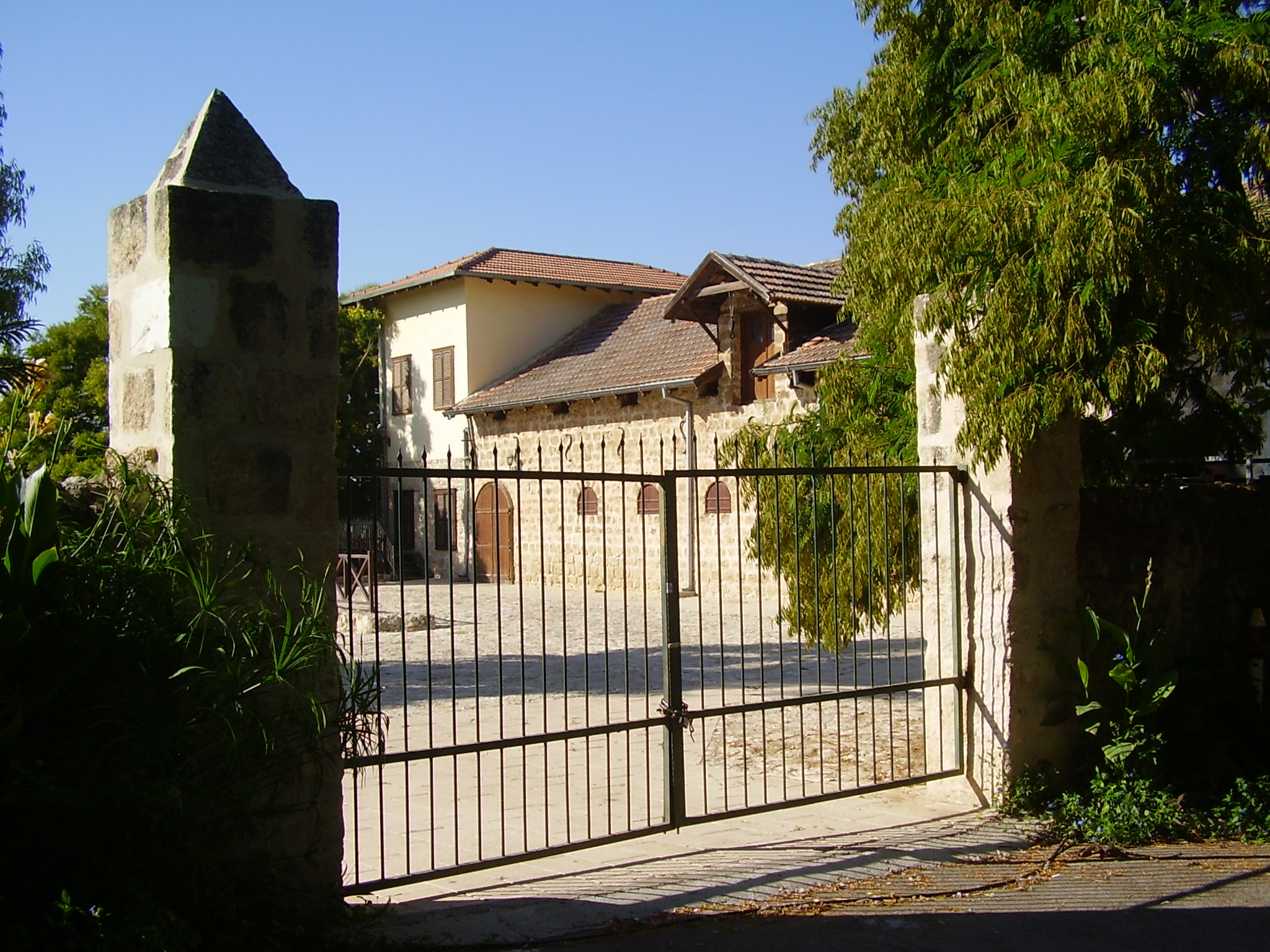
Due to its proximity to Tel Aviv, Mazkeret Batya has recently experienced a growth spurt. Mazkeret Batya is a mixed community of religious and secular Jews. Historic landmarks include Beit Ha'Itut (Signal House), the Great Synagogue, Beit Meshek HaBaron, the waterwheel and well, the reservoir and an old farmyard. [5]
International relations
Main article: List of twin towns and sister cities in IsraelTwin towns — Sister cities
Mazkeret Batya is twinned with:
References
- ^ "Table 3 - Population of Localities Numbering Above 2,000 Residents and Other Rural Population". Israel Central Bureau of Statistics. 2009-09-30. http://www.cbs.gov.il/population/new_2010/table3.pdf. Retrieved 2010-06-22.
- ^ Mazkeret Batya website
- ^ a b c Jewish National Fund (1949). Jewish Villages in Israel. Jerusalem: Hamadpis Liphshitz Press. pp. 41.
- ^ Society for Preservation of Israel Heritage Sites
- ^ Society for Preservation of Israel Heritage Sites
- ^ "Stadt Celle". www.celle.de. http://www.celle.de/index.phtml?sNavID=342.65&La=2. Retrieved 2010-01-05.
- ^ Harry Sanders, "'Shalom,' from Israel," Calgary Sunday Sun 25 Jan. 1998: S7
External links
Center District of Israel Cities El'ad · Hod HaSharon · Kafr Qasim · Kfar Saba · Lod · Modi'in-Maccabim-Re'ut · Ness Ziona · Netanya · Petah Tikva · Qalansawe · Ra'anana · Ramla · Rehovot · Rishon LeZion · Rosh HaAyin · Tayibe · Tira · Yavne · Yehud-Monosson
Local councils Be'er Ya'akov · Beit Dagan · Bnei Ayish · Elyakhin · Even Yehuda · Gan Yavne · Ganei Tikva · Gedera · Jaljulia · Kafr Bara · Kfar Yona · Kiryat Ekron · Kokhav Ya'ir · Mazkeret Batya · Pardesiya · Savyon · Shoham · Tel Mond · Tzoran-Kadima · ZemerRegional councils Brenner · Gan Raveh · Gederot · Gezer · Drom HaSharon · Hefer Valley · Hevel Modi'in · Hevel Yavne · Hof HaSharon · Lev HaSharon · Lod Valley · Nahal SorekBoroughs See also Other sub-divisions: Haifa District · Jerusalem District · Judea and Samaria Area · North District · South District · Tel Aviv DistrictCategories:- Center District (Israel)
- Populated places established in 1883
- Jewish villages in the Ottoman Empire
- Jewish villages in the Mandate for Palestine
Wikimedia Foundation. 2010.