- North Woolwich
-
Coordinates: 51°29′46″N 0°03′57″E / 51.49623°N 0.06582°E
North Woolwich 
 North Woolwich
North Woolwich shown within Greater LondonOS grid reference TQ435795 London borough Newham Ceremonial county Greater London Region London Country England Sovereign state United Kingdom Post town LONDON Postcode district E16 Dialling code 020 Police Metropolitan Fire London Ambulance London EU Parliament London UK Parliament East Ham London Assembly City and East List of places: UK • England • London North Woolwich is a place in the London Borough of Newham. It is located north of Woolwich proper which is on the south bank of the River Thames. The two places are linked by the Woolwich Ferry and the Woolwich foot tunnel.
Contents
History
Historically North Woolwich consisted of two nearby tracts of land, totalling 412 acres (1.7 km2), situated on the north bank of the River Thames. The western detached part was surrounded on three sides by the parish of East Ham and the eastern portion bordered East Ham to the west and Barking Town to the north.[1]
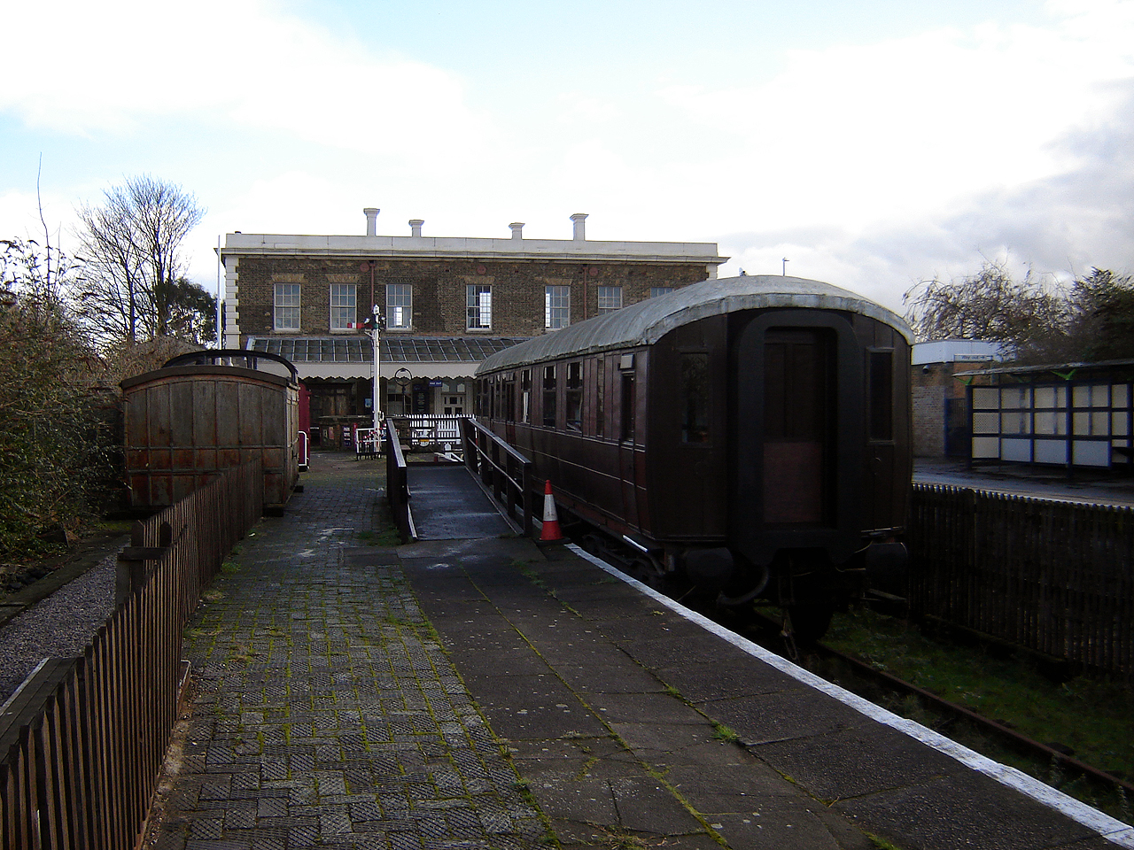
The now disused North Woolwich railway station, which was closed in preparation for future transport developments which will use sections of the line, is situated adjacent to the ferry terminal. An extension of the Docklands Light Railway to the area opened in December 2005. Until 2009, this terminated at King George V; a further extension south of the river, to Woolwich Arsenal, opened in 2009. This situation means that North Woolwich now sports two old station buildings. The closed North London Line station is adjacent to an earlier station which closed in 1979; this has housed the Old Station Museum since 1984, which is devoted to the history of the Great Eastern and London and North Eastern railways.
Administratively, North Woolwich was part of Kent [2] at least since the Norman Conquest when one of William the Conqueror's lords, Hamon, was granted land on both sides of the Thames at this spot, probably to enable him to enjoy the taxes from cross-river traffic. It lay in the parish of Woolwich and later the Metropolitan Borough of Woolwich, but was absorbed into the London Borough of Newham in 1965 when Woolwich south of the Thames became part of the London Borough of Greenwich. It is unique in Outer London in being part of the County of London before 1965. The population peaked just before the First World War, and reduced substantially in the Second World War when it was heavily bombed.
The area was formerly the site of industries including the cable works of W T Henley (later AEI) and the Western Electric Co (later STC) on the river to the west of the ferry, and a large Harland & Wolff ship repairing shop at Gallions Point to the south of the King George V Dock entrance lock (not to be confused with their works at the western end of the dock).
Population
- 1871: 1,455
- 1881: 1,504
- 1891: 2,055
- 1901: 3,086
- 1911: 4,409
- 1921: 3,970
- 1931: 3,579
Nearby places
The nearest Docklands Light Railway station is King George V.
Education
- For details of education in North Woolwich see the List of schools in the London Borough of Newham
Gallery
-

North Woolwich old railway museum frontage. (February 2007)
-

North Woolwich old railway museum. The platform for the recently closed North London Line station is visible on the far right. (February 2007)
References
- ^ 'West Ham: Introduction', A History of the County of Essex: Volume 6 (1973) Date accessed: 27 July 2009
- ^ ""Hansard : Considerations"". 18 June 1874. http://hansard.millbanksystems.com/commons/1874/jun/18/considerations#S3V0220P0_18740618_HOC_219. Retrieved 05 Oct 2011.
External links
Categories:- Districts of London
- Districts of Newham
- Cable manufacture in London
- Shipbuilding in London
- Districts of London on the River Thames
- Port of London


Wikimedia Foundation. 2010.