- New Plymouth Airport
-
New Plymouth Airport IATA: NPL – ICAO: NZNP Location of airport in Taranaki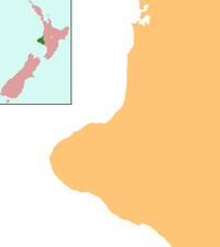
 NPL
NPLSummary Airport type Public Operator New Plymouth District Council
Government of New ZealandLocation New Plymouth Elevation AMSL 97 ft / 30 m Coordinates 39°00′31″S 174°10′45″E / 39.00861°S 174.17917°ECoordinates: 39°00′31″S 174°10′45″E / 39.00861°S 174.17917°E Runways Direction Length Surface ft m 05R/23L 3,281 1,000 Grass 05L/23R 4,298 1,310 Asphalt 14/32 3,937 1,200 Grass Statistics (2007) Passengers 275,000 New Plymouth Airport (IATA: NPL, ICAO: NZNP) serves the city of New Plymouth, and the surrounding region of Taranaki. It is on the west coast of New Zealand's North Island, and geographically, is the closest airport in the country to Australia. Locally speaking, it is 11 km from the city centre, on the highway north to Auckland, and 4 km from the outer suburb/satellite town of Bell Block.
The airport is the 11th busiest airport in New Zealand with 37,097 aircraft movements in 2010.[1] Beating Tauranga and Invercargill and just behind Queenstown. In October 2009, New Plymouth Airport was voted as the best regional airport in New Zealand.[2]
Contents
History
The original airport opened in 1933 with the New Plymouth Airport Act. It had five runways, the longest of which was around 5000 ft. During World War II, the airport became RNZAF Bell Block Airbase. Post war, the airport returned to civilian use, and was used by New Zealand National Airways Corporation with links to Whenuapai (Auckland) and Paraparaumu (Wellington).
In line with a general improvement throughout the 1950s and 1960s, of New Zealand's infrastructure, and National Airways Corporation (NZNAC) acquisition of Fokker F27 Friendships, New Plymouth's airport was reviewed. In view of the undulating land, the need for a tarmac runway for the F27, and the clearer approach paths required, a new airfield was soon under construction at the end of Brown Road (recently renamed Airport Drive). During construction of the airport, a small hill at the west end of the runway had to be levelled off, due to take-off and landing path infringements. This was rather controversial, due to said hill being a Māori burial ground. The government of the day decided to go ahead with construction anyway, and despite protests, the hill was levelled. Part of it still remains. The airport opened in 1966, replacing a grass airfield 3 km southwest, which is now industrial land. The foundation stone from the original airport, and a stone commemorating RNZAF Bell Block, were moved to the new airport when it opened.
The original terminal was renovated during the 1990s. The observation deck upstairs was lost at this time, and the outside observation area was lost in 2005, due to rising security concerns worldwide. Like many other regional airports in New Zealand, New Plymouth airport has enjoyed considerable passenger growth over the past ten years. From 132,600 in 1997 to just under 250,000 for the year to December 2006. Passenger numbers are expected to increase by a further 10% to more than 275,000 for the 2007 calendar year. [3]
Facilities
The terminal is equipped with two check-in desks for Air New Zealand subsidiary carriers, rental car outlets, flight arrival and departure monitors, public toilets, a cafe, and a Koru Regional Lounge.
New Plymouth Airport has a control tower with services provided by Airways Corporation. It is staffed from 6am to around 8 pm on weekdays, and reduced hours on weekends, to coincide with airline traffic movements. There is also one fire resuce unit and another small emergency unit based at New Plymouth Airport.
The airport's only sealed taxiway connects the apron and the asphalt runway, so aircraft taxi on the runway, and commence take off roll from runway ends. New Plymouth Airport is infamous for crosswinds, due mostly to the fact that although the tarmac runway faces into the prevailing SSW wind the area regularly receives a strong SSE/SE. The cross runway is not sealed, and thus airline traffic is limited to the tarmac runway, parallel to the sea. The tarmac runway is equipped with low intensity runway lighting, runway end lighting, and Precision Approach Path Indicators. The sealed taxiway and apron are also lit. The airport has VOR/DME equipment. It was equipped with an NDB, but this was recently removed.
New Plymouth Aero Club and its Air New Plymouth charter service are based at the airport, which carries out charter work and air ambulance services as well as providing a well recognised flight training facility. Aircraft located on the airport as of 2010 are 6 Cessna 152's (NPH, NPK, NPL, NPN (owned), FMV and JDB (leased)), a Cessna 172 (NPJ), a P68 Partenavia (ZSP), and a PA-31 Navajo (ECQ). Also located on site are a De Havilland Vampire, an L-39 Albatross, Four Yak 52's and a Catalina Flying Boat.
Airlines and destinations
Airlines Destinations Air New Zealand Link operated by Air Nelson Auckland, Christchurch, Wellington Previous Airlines
Sunair operated to/from New Plymouth for several years, finishing in 2005. They operated small Piper Navajo aircraft three times a week to Hamilton and Palmerston North.
Origin Pacific Airways used to operate Jetstream J31 and Metroliner aircraft to/from Auckland and to/from Nelson 6x weekly.
Aircraft
(This list is approximate and may be incomplete)
- 1966 - 1990 Fokker F27 Friendships Mk 100 and Mk500
- 1990 - 2006 Fairchild-Swearingen Metroliner
- 1990 - 2007 Saab 340
- 1995 - 2005 Piper Navajo
- 2000 - 2006 Jetstream J31 Occasional Jetstream J41 operations.
- 2005–present Bombardier Q300
References
- ^ Airways Aircraft Movements
- ^ "New Plymouth Airport wins best regional". The New Zealand Herald. NZPA. 19 October 2009. http://www.nzherald.co.nz/nz/news/article.cfm?c_id=1&objectid=10604111. Retrieved 30 October 2011.
- ^ [1]
External links
- New Plymouth Airport at the District Council web site
- Airport information for NZNP at World Aero Data. Data current as of October 2006.
Categories:- Airports in New Zealand

Wikimedia Foundation. 2010.