- Palmerston North International Airport
-
Palmerston North International Airport IATA: PMR – ICAO: NZPM Location of airport in North Island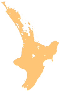
 PMR
PMRSummary Airport type Public Operator Palmerston North International Airport Location Palmerston North Elevation AMSL 151 ft / 46 m Coordinates 40°19′14″S 175°37′01″E / 40.32056°S 175.61694°E Runways Direction Length Surface ft m 07L/25R 6,240 1,902 Asphalt 07R/25L 1,995 608 Grass Palmerston North International Airport (IATA: PMR, ICAO: NZPM) is located on the outskirts of the suburb of Milson in Palmerston North, New Zealand, 5 km (3.1 mi) north-east of the City central area. Although the airport has not had a regular international flight since the end of March 2008, the official name, Palmerston North International Airport still remains. The airport handled 542,816 passengers for the year ending 31 December 2006 (461,542 domestic and 81,274 international)[1]
Contents
History
The first airfield on this site was created by the Milson Aerodrome Society in 1931, comprising a grass runway. It was used exclusively for private flights. The first commercial flights began in 1936, operated by Union Airways, and the airport was also used as a military facility in World War II. When the National Airways Corporation began using the airport in the 1950s the runway was sealed and a terminal building was constructed; jets started landing at the airport in 1975, beginning with a Boeing 737. A new terminal was constructed in 1992 and regular international flights began being offered in 1996. A Royal Brunei Airlines Boeing 767 landed at the airport on 10 March 2003, making it the first 767 to land at the airport. Since Freedom Air was scrapped, there have been no international flights to date. Despite the loss of International Service providers, the Airport still charges a $5 Departure Tax on most flights.
World record
On May 17, 1998, ten people towed a fully fuelled Freedom Air Boeing 737-300 over 100 metres in 47 seconds, to celebrate the opening of the new runway extensions. The record was logged in the Guinness World Records.
Services
There were two regular international services departing from this airport, to Sydney and Brisbane operated by Freedom Air, however services ended in March 2008.[2] Previously, flights also operated to Melbourne, the Gold Coast, and Nadi. The airport also receives a number of domestic flights. Flights from Air Post, Air Freight, Massey University's School of Aviation, commuter airlines such as Air2there, Air National, Vincent Aviation and Rescue Fire Services also use Palmerston North International Airport. The airport is also used for training purposes by RNZAF squadrons based at the nearby Ohakea base.
Facilities
The current terminal is a two storey building containing:
- a cafeteria and bar
- a duty-free shop (No Longer Operational)
- a bookstore
- a Union Airways Gallery exhibition of early commercial flight in New Zealand
- an Air New Zealand Koru Lounge
Airlines and destinations
Airlines Destinations Air New Zealand operated by Air Nelson Auckland, Christchurch Air New Zealand operated by Eagle Airways Wellington, Hamilton Air New Zealand operated by Mount Cook Airline Auckland, Christchurch, Dunedin, Hamilton Incidents
- Ansett New Zealand Flight 703, a de Havilland Canada Dash 8 crashed west of the Tararua Ranges, 16 km east of the airport during an instrument approach in bad weather on June 9, 1995. 4 out of 21 people were killed on board.
References
- ^ Palmerston North International Airport
- ^ "Air NZ to ground Freedom Air". Stuff.co.nz. 6 September 2007. http://www.stuff.co.nz//50460. Retrieved 1 November 2011.
External links
- Palmerston North Airport Accommodation
- Airport information for NZPM at World Aero Data. Data current as of October 2006.
- NZPM Details on AviationPage New Zealand
Categories:- Airports in New Zealand

Wikimedia Foundation. 2010.