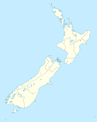
- Chatham Islands / Tuuta Airport
-
Chatham Islands
Tuuta AirportIATA: CHT – ICAO: NZCI Location of airport in New Zealand Summary Airport type Public Owner New Zealand Government Operator Chatham Islands Airport Limited Location Waitangi, Chatham Islands Elevation AMSL 43 ft / 13 m Coordinates 43°48′36″S 176°27′26″E / 43.81°S 176.45722°ECoordinates: 43°48′36″S 176°27′26″E / 43.81°S 176.45722°E Runways Direction Length Surface ft m 05/23 4,462 1,360 Bitumen Chatham Islands / Tuuta Airport (IATA: CHT, ICAO: NZCI) is a small airport 10.5 NM (19.5 km) northeast of Waitangi Township on the Chatham Islands, New Zealand.
Operational information:
- Airfield elevation is 43 ft (13 m) AMSL
- Runway 05/23, 1360 x 45 metres sealed
- PAPI 3.0/TCH 48
- Emergency runway lighting available upon request
- Pavement Strength PCN 20
- Circuit: Both runways - left hand
- Circuit Height: 1000 ft AMSL
- N:B: All movements confined to sealed areas. Avoid harsh braking and tight radius turns.
Airlines and destinations
Airlines Destinations Air Chathams Auckland, Napier, Wellington, Christchurch, External links
- Airport information for NZCI at World Aero Data. Data current as of October 2006.
Sources
NZAIP Volume 4 AD
Categories:- Airports in New Zealand
- Chatham Islands
- New Zealand outlying island geography stubs
- Oceanian airport stubs
Wikimedia Foundation. 2010.

