- Milford Sound Airport
-
Milford Sound Airport (IATA: MFN, ICAO: NZMF) is a small but very busy (in terms of flight movements) airport in Milford Sound, in New Zealands Fiordland region of the South Island. It is mainly used by tourist / flightseeing operators.
Milford Sound Airport IATA: MFN – ICAO: NZMF Summary Airport type Public Operator Ministry of Transport Serves Milford Sound Location Milford Sound Elevation AMSL 3 m / 10 ft Coordinates 44°40′24″S 167°55′24″E / 44.67333°S 167.92333°E Runways Direction Length Surface m ft 11/29 782 2,565 Asphalt Contents
Location
Milford Airport is located in Milford Sound, Southland, New Zealand, and serves the Milford Tourism Industry including Boats, Kayaks, Milford Track as well as the fishing boats based at Milford Sound.
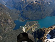
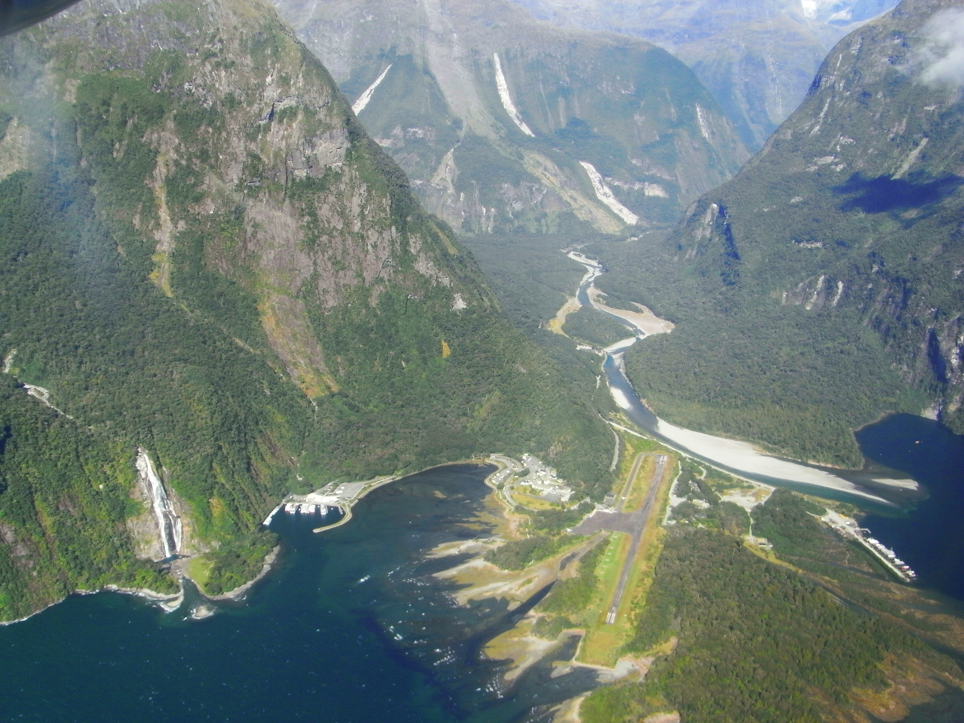
 Milford Sound Airfield at the Head of the Fiord at the junction of the Cleddau and Arthur rivers as seen from an aircraft
History
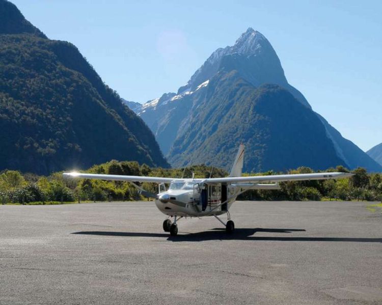
 Glenorchy Air's Gippsland Aeronautics GA 8 Airvan on the ground at Milford Airfield. In the background is Mitre Peak.
On November 17 1938, a Southland Airway’s Puss Moth piloted by Arthur Bradshaw made the first landing in at Milford Sound. However, any further development for air operations into the Fiord was delayed by World War II.
Post war pilot Fred ‘Popeye’ Lucas was the next to land an aircraft in Milford. He landed on the sand spit in his Southern Scenic Airtrips Auster on August 22 1951. This then sparked the addition of an airstrip for use by his company to expand tourism into Milford Sound. An airstrip was constructed, initially 550 yards (503 metres) in length with the first official landing achieved in May 1952.
Over the years the airstrip has been upgraded and lengthened till today’s sealed strip of 792 metres. In order for Southern Scenic Airtrips and National Airways Corporation (NAC) to be able to fly the larger twin-engine aircraft into the area the airstrip became officially licensed in 1956.
Prior to the ability of air operations Milford Sound had no access in the winter months as the roads become impassable. With the addition of the airstrip it was recorded that by 1964 more than 400 tourists were taking the ‘Gateway to Magnificence Experience’ flight to Milford Sound each month at peak holiday time.1
Activity
Weather permitting, there is substantial daily charter traffic of light aircraft (mostly Britten-Norman Islander, Cessna 172, 206, 207, GA8 Airvan) to and from Queenstown, Wanaka and Te Anau and on sightseeing trips. Helicopters are also very active.
Regular airline users
Airlines Destinations Aspiring Air 2 Wanaka Glenorchy Air 3 Queenstown Milford Sound Flightseeing 5 Queenstown Milford Sound Helicopters 4 Based at the Airport References
1‘Taking Off-Pioneering Small Airlines Of New Zealand 1945-1970’ Published 2003 By Richard Waugh with Bruce Gavin, Peter Layne & Graeme McConnell, Pages 16-36
Coordinates: 44°40′24″S 167°55′24″E / 44.67333°S 167.92333°ECategories:- Airports in New Zealand
- Fiordland
- Buildings and structures in the Southland Region

Wikimedia Foundation. 2010.