- Transport in Milford Sound
-
 The goal of over half a million people per year.
Transport in (and to) Milford Sound, New Zealand, is characterised by the remoteness of the area in which it is located. As the most popular tourism destination in the South Island, it nonetheless receives very large numbers of visitors. These tend to arrive and depart within just a few hours of each day, as there is little accommodation in the Sound, leading to strong demand peaks for tourism services during the noon and early afternoon hours.
To reduce this peaking and to allow further expansion without impacting the environment or reducing tourist amenity, various schemes have been proposed for better links to the Sound, including a new tunnel, a monorail and a gondola lift.[1]
Contents
Overview
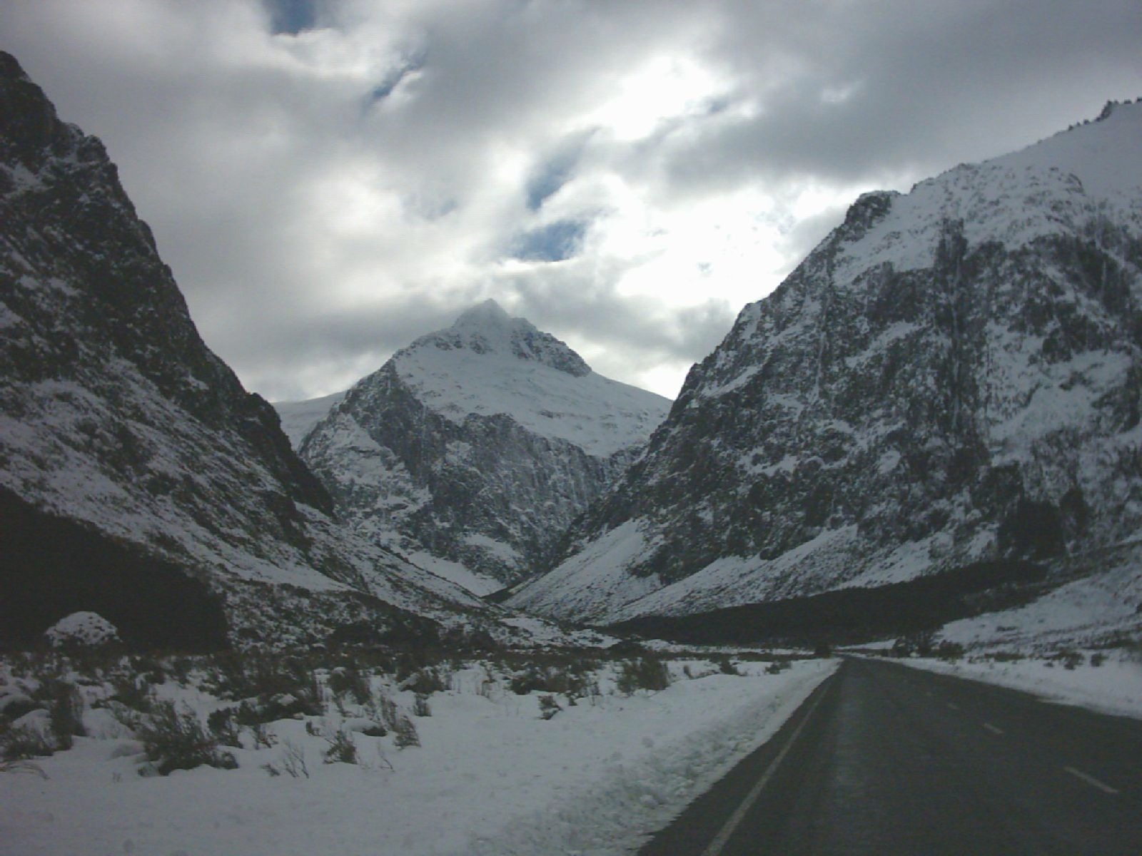
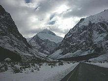 The avalanche-prone Milford Road.
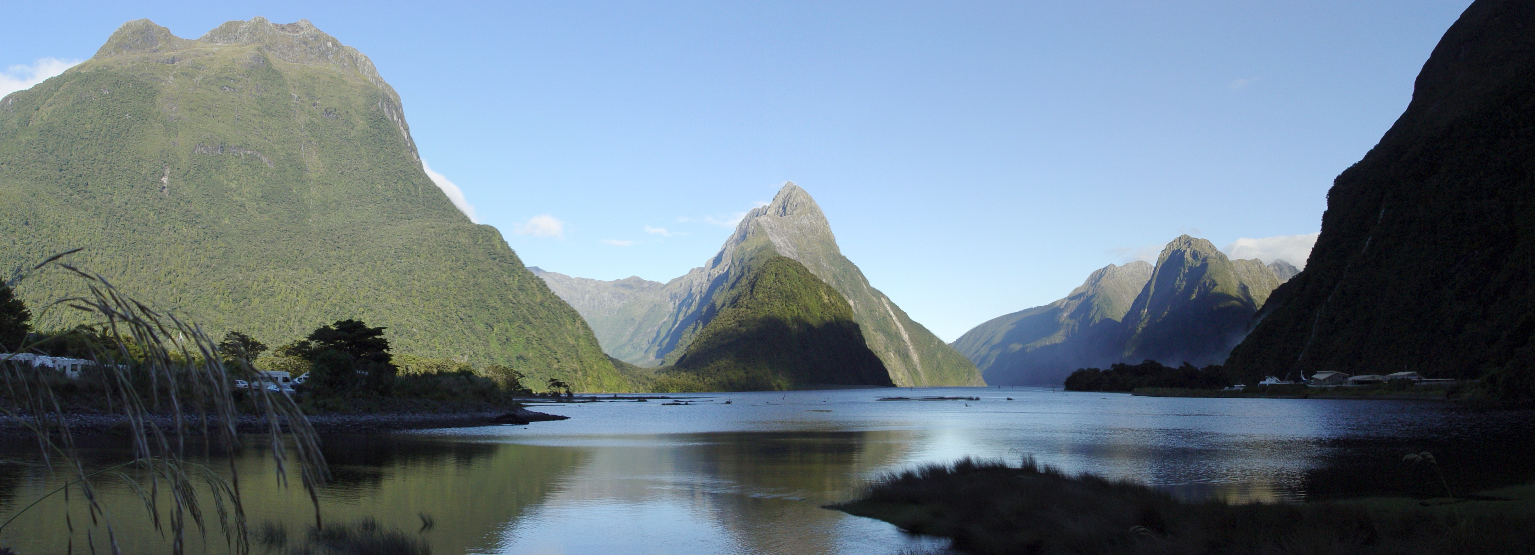
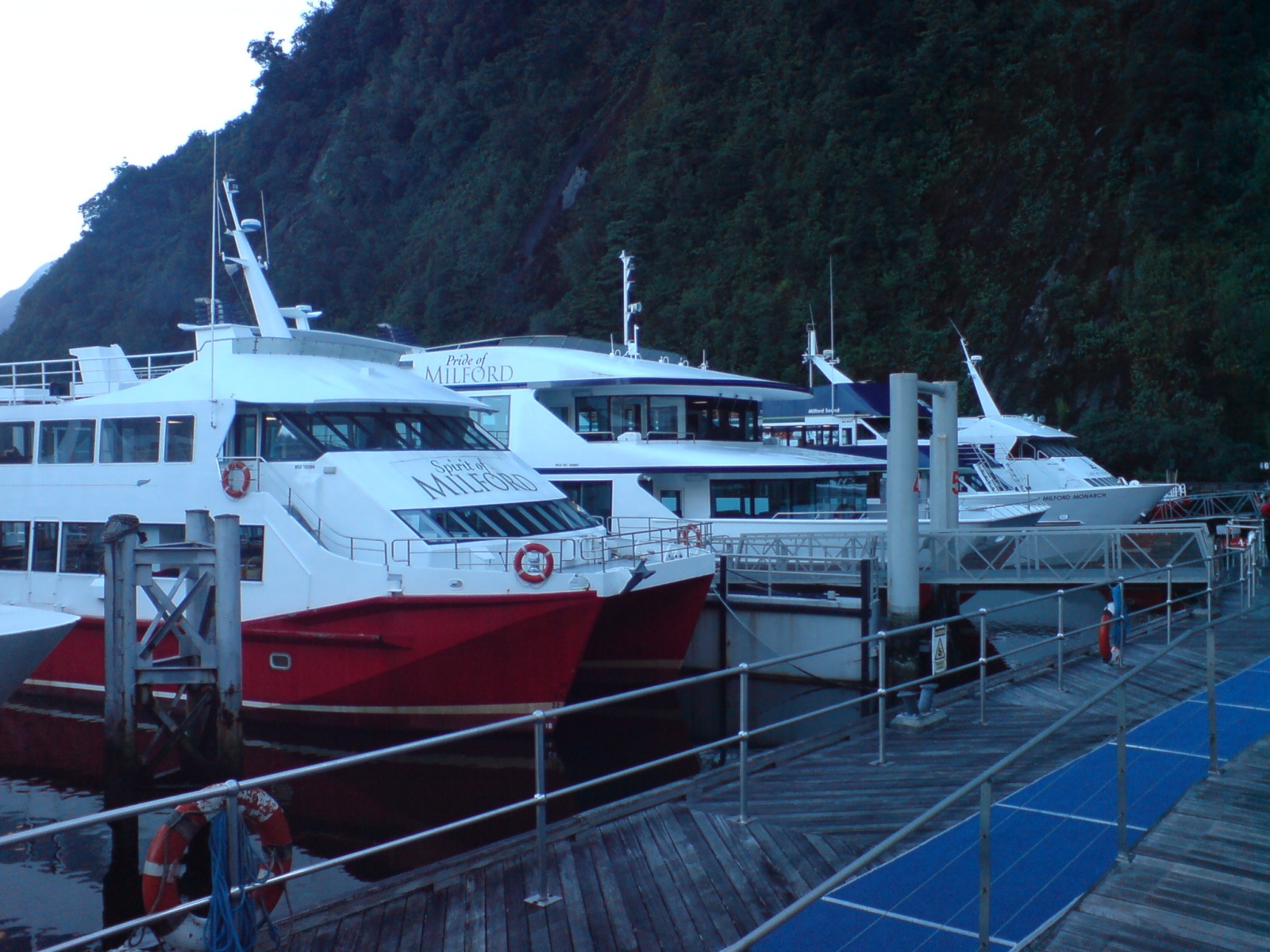
 Tourist day-cruise boats awaiting a short but busy day.
Remote location
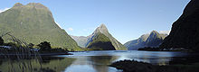
Milford Sound is a fjord in the southwest of the South Island of New Zealand, located in the most remote and least populated region of the country (Fiordland). Divided from more populous areas to the east by the high southern spurs of the Southern Alps, its only entry apart from a difficult mountain road is a narrow channel to the Tasman Sea, which even famous explorer Captain Cook did not enter during his 1769/1770 journey, as he considered the entry too treacherous and was unaware of the large body of water sheltered behind it.[citation needed]
Tourism bottleneck
By virtue of its great natural features, Milford Sound has long since become a major tourist attraction, receiving numbers of visitors unprecedented for such a remote location, over 550,000 per year.[1] This is expected to rise to 750,000 by 2012. A study has found that of all tourists travelling the South Island of New Zealand in summer, 54% travelled the Milford Road at some point.[2]
Increasing the difficulties for tourism to the Sound is the location within Fiordland National Park, which prevents substantial accommodation from being built - around 90% of all tourists are therefore only on a day trip,[2] and around 80% return in the late afternoon to Queenstown, a 12-hour round trip. Due to this long trip, an overwhelming majority of tourists arrive and depart quickly, leading to a great peaking of demand at the day-cruises terminal where the large tourist boats lie empty for most of the day, becoming extremely active only during the 3–4 hours around and past noon.[1]
The above difficulties in reaching this extremely popular destination have led to a number of serious proposals on how to better connect the attractions of Milford Sound to the rest of New Zealand, and how to increase tourism without reducing sustainability for this national natural treasure. In conjunction with these plans, proposals are also being considered how to upgrade the existing road to Milford Sound.[2]
Existing travel methods
By motor vehicle
Tourists to the Sound arrive mainly via coach over Milford Road State Highway 94, a high mountain road prone to avalanches in winter. The road was only opened in 1953, after Homer Tunnel was finished after almost 20 years of intermittent work. The road is one of the more dangerous public roads in New Zealand, with injury crash rates around 65% higher than the rest of New Zealand's network, and a fatality crash rate of almost twice average (per vehicle kilometre travelled),[3] making it the third most dangerous section of New Zealand's State Highway network (as of 2008).[4]
Stopping is prohibited on long stretches due to rock or snow avalanche dangers, and the road is often closed in winter, with the carrying of snow chains mandatory during snow conditions. Helicopters are used during winter to drop explosives onto snow buildup zones above the road in order to cause controlled avalanches, and the avalanche control programme is world-renowned.[5] However even this does not absolutely eliminate the danger that road traffic may be hit by an uncontrolled event, especially in the area of the Homer Tunnel portals.[3]
There are also no petrol stations on the whole length of the road from Te Anau to the Sound, meaning that vehicles need to take enough fuel for a return trip. All of this does not discourage up to 50 coaches and hundreds of private cars daily from making the 608 km round trip from Queenstown (slightly less from Invercargill).[1] Almost 60% travelled via coach.[2] ( I was last there in 2007, you could buy petrol and diesl from the shop in Milford Sounds, but be prepared for a shock, I think it would have to be nearly the most expensive fuel in NZ ).
Future increases in traffic will have to take into account the limitations of the existing road, which features various areas lacking passing lanes (especially problematic if cars are held up behind slow coaches on the steeper sections), a number of one-lane bridges and a narrow carriageway width. Homer Tunnel is a traffic-light controlled one-way route during peak summer periods, as it is not wide enough to allow coaches to pass each other (though passing bays are provided). Improvements to both the road and Homer Tunnel are planned by Transit New Zealand, though a widening of the tunnel is considered unlikely due to the high costs involved.[2]
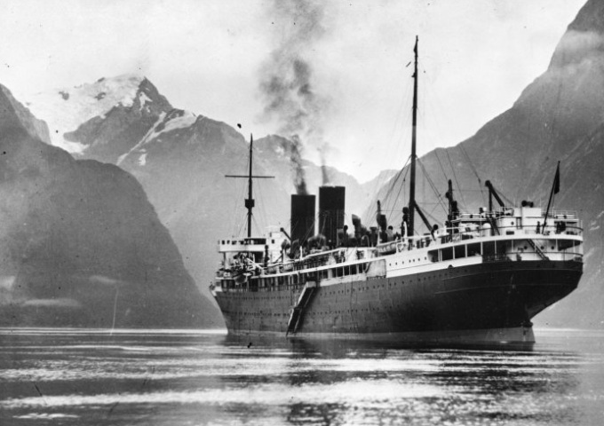
 The Monowai in the Sound in 1933.
By watercraft
A small number of tourists arrive via long-distance sea travel, such as on smaller cruise ships entering the Sound while stopping over in New Zealand from overseas or travelling from (the relatively distant) New Zealand harbours, or alternatively on private yachts. However, few such vessels nowadays travel along the rugged southwest coastline of the Island.
By aircraft
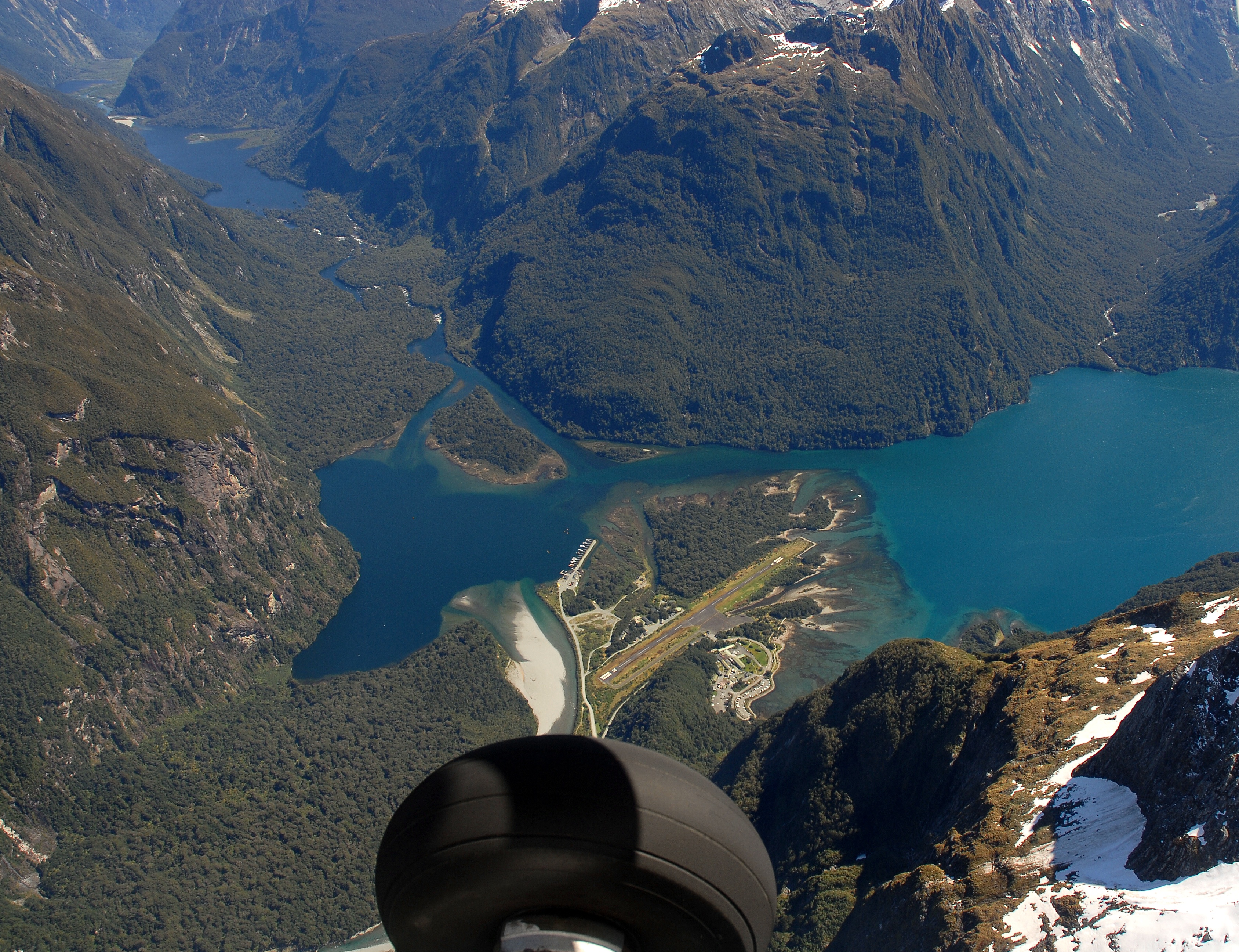
See also: Milford Sound AirportNumbers of tourists arrive via small planes or helicopters, or use them to overfly the Sound as part of the trip. In 2004 Milford Sound Airport had approximately 16,000 aircraft movements, most associated with flights to and from Queenstown. Around 35 aircraft can operate at the airport at any one time, though this level has not yet been reached. As flights can be spread over the day better than coach trips, only about 25 aircraft operated here during peak times of the day in 2004.[2]
 Milford Sound from the air, with the airfield in the centre. The main tourist boat marina is hidden below the mountainface to the lower right.
The Department of Conservation has noted that aircraft noise and activity in the Sound are often remarked on by tourists as being unexpectedly substantial (even more so on the nearby Milford Track). DOC is therefore encouraging the use of larger and less noisy aircraft.[2] In 2007, flight restrictions were announced, limiting the number of flights in the Fiordland area and the number of operators to 2004-2005 levels via a concession system, with 23 licenses only (the number of operators in 2004-2005). Operators are also required to pay for flight monitoring, and further restrictions may be declared if more than 25% of National Park visitors consider the aircraft noise annoying. Some operators have already complained about the restrictions, and DOC has noted that flight numbers could conceivably be increased if noise emissions would be reduced.[6]
By walking
Main article: Milford TrackThere exists one main track into Milford Sound from the eastern side of the main range of the Southern Alps, the Milford Track. Starting at the northernmost edge of Lake Te Anau, the 53 km track takes three days to complete and includes one mountain pass and many areas prone to flooding. Due to concerns about degrading the natural landscape, the track can be walked on a quota system only (and only westwards, with walkers having to stop at designated huts every night). With only several dozen walkers allowed on the track every day, places in the quota system are usually booked out many months in advance from the administering New Zealand Department of Conservation.
Proposed improvements
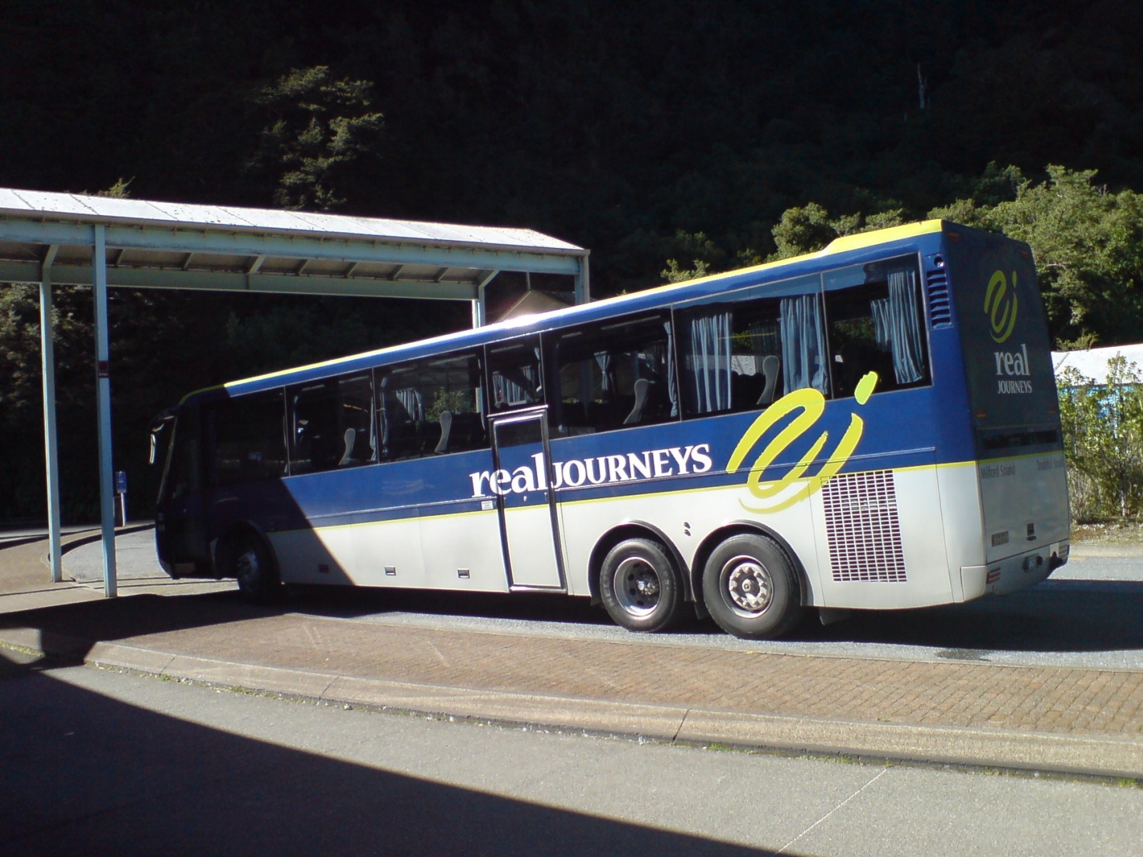
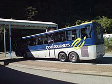 The coaches of some operators such as Real Journeys are built to improve the view through their glass roofs.
Bus pooling
In winter, during those times that the road remains open, coach numbers on the Milford Road have been observed as not dropping in the same degree as visitor numbers, with coaches often travelling largely empty. It has been proposed that initiatives be considered to force or entice tourism operators to pool their transport resources for greater efficiency.[2]
Mandatory park & ride
It has been proposed that a park & ride shuttle bus facility should be established at a location such as Te Anau, Te Anau Downs or Eglington Valley. Access to Milford Sound would be restricted to bus shuttles operating from here (and private vehicles during off-peak times). Staggering the departure would help reduce congestion both on the road and at the viewing spots. However, the proposal was considered to reduce tourism operator and tourist freedom, as well as to add transfer times to an already very long journey. Finally, it would take away the free right of access. As such, it was negatively reviewed and is unlikely to proceed.[2]
Other options
Expanding Milford Sound Airport to allow larger aircraft to fly tour groups in and out of the sound was also considered, but considered problematic for tourist amenity in the Sound, and for reasons of high travel cost.
Other options considered were the limitation of access to certified/compliant users (i.e. bus companies, similar to the 'mandatory park & ride' option), introducing a booking system for 'road slots', or the placing of tolls along the Milford Road. All these methods share problems of restricting access, therefore making visits to Milford Sound more complicated and costly.[2]
Proposed new methods
Milford Dart
Combining a new tunnel with special-purpose guided buses to avoid the southern detour to Te Anau on the route from Queenstown to Milford Sound, this proposal would provide the shortest possible route. Proposed by a group of South Island businessmen who also have an interest in some of the tourist operations in the Sound, this scheme would make use of the fact that the Hollyford Valley, where the existing road to Milford Sound from Te Anau turns west up to Homer Tunnel, is only a few dozen kilometres away from the Routeburn Valley (of Routeburn Track fame), in turn easily reached by existing roads.[1]
The proposal would create a 10.2 km tunnel through the mountain range and link up the existing roads with short extensions, cutting travel distances from 304 km one-way to only 125 km, with travel time reduced from 5.5 hours to 2 hours. Within the tunnel, buses would make use of guidance technology (side-facing wheels) to allow them to travel in a tunnel with much smaller diameter than usual, thus reducing construction costs. Speeds within the tunnel are expected to be up to 80 km/h at up to 2.5 minute frequency. The tunnel is expected to have to attract at least 200,000 passengers per year to be commercially viable, and would cost around NZ$170 million.[1]
The tunnel faces a number of criticisms. One of the major hindrances is the location of both entrances in national parks, Fiordland National Park in the west and Mount Aspiring National Park in the east. While the proposed new road sections would be very short, they have already led to criticism from environmental groups which note that general policy forbids the construction of new roads in National Parks.[7] The disposal of up to 250,000 m³ of spoil from the tunnel excavation is also considered problematic. Southland business interests are also concerned that the new tourism will bypass Te Anau, and lead to unsupportable traffic demands on the aging Homer Tunnel.
In December 2007 The New Zealand Conservation Authority said that it would not allow the tunnel to be built in the Mount Aspiring National Park, despite support from the Otago Conservation Board and the Director-General of Conservation. The developers still want to go ahead with a longer tunnel skirting the National Park, though it is unclear how much the larger project would cost.[8] Southland District Council Mayor Frana Cardno is very disappointed at today's decision by the Department of Conservation to move one step closer, subject to conditions and public process, to a private tunnel through New Zealand's internationally acclaimed World Heritage Fiordland and Aspiring National Parks.
November 10, 2011, Source, Southland District Councils Fuseworks.
The Department of Conservation's view is that with appropriate conditions, the impacts of the Milford Dart proposal are acceptable, but the department will take into consideration public consultation before making a final decision on the concession. However, Southland District Council Mayor, Mrs Cardno, believes this project is inconsistent with the Conservation Act, the National Park Plans and is also inconsistent with the General Policy for National Parks. She is urging everyone to have their say because the public has 40 days to make submissions on the proposal.
Fiordland Link Experience
This proposal intends to combine a number of innovative transport options into one trip (hence 'Experience'), while still cutting the travelling time to the Sound by about one hour each way (previous hopes of longer savings seem unlikely to be realised).[9] In Queenstown travellers would board 25-m catamarans capable of carrying up to 240 people. These would cross Lake Wakatipu to the south-western shore, 20 km away. There, passengers would travel up the mountain on an existing back-country road, using specially constructed all-terrain coaches on balloon tyres (to reduce impact on the road).[1]
Arriving at the Kiwi Burns swing bridge terminal, tourists will continue on on a mechanical (as opposed to maglev) monorail travelling 35 minutes through high country and native bush for a distance of 41 km, which would be the longest monorail connection in the world, before joining up with a bus park and ride facility on the existing road to Milford Sound north of Te Anau. Three passing loops along the line would allow four trains to run, at speeds of up to 90 km/h. Kiwi Burns Saddle, the highest point of the journey, is 675 m above sea level, and the higher-altitude section of the rail would be heated to prevent snow-buildup in winter. Each monorail train would seat 160 passengers, consisting of 16 articulated 2.6 m wide sections totalling 66 m in length. Only one train would be constructed initially.[1]
The proposal, which would cost up to NZ$132 million, would have to achieve around 220,000 two-way passengers per year to be viable. Compared to the Milford Dart project, the backers, Infinity Investment Group, believe that they will have an easier time achieving consents, as the proposal does not touch upon any National Parks, and the construction and operation process is considered to be very ecologically sustainable, such as the use of comparatively small piles for the monorail which will be bored and placed from a working vehicle moving forward on the rail being constructed, thus making construction roads unnecessary. It is hoped that the consent process can be begun mid 2007, and the actual operation started in 2011.[1]
Sky Trail Milford
A third option, previously proposed around 2001, would have created a gondola route between the Caples Valley and the Hollyford Valley. The proposal was a cooperation between Skyline Enterprises of Queenstown and Rotorua, and the Ngāi Tahu iwi, and was to cost around NZ$ 100-110 million.[9] With 12.6 km length, the Skytrail would have become the longest such ride in the Southern Hemisphere, and was intended to transport 900 passengers per hour. With a duration of 35 minutes for a one-way trip, the gondola was to reduce the 12-hour round trip by about 3 hours.[2]
The project was shelved after the Department of Conservation refused permission based on its expected impact on the pristine wilderness it was to cross.[1] Critics such as Forest and Bird Society had, amongst other reasons, protested against the destruction of beech forest for 85 towers and 2 transfer stations, bus traffic on previously less used roads, and the despoiling of natural landscapes by gondola traffic.[10] There was also some concern about the location of the Skytrail in an area of strong seismic and wind activity.[2]
Other options
Further options considered at some stage in the recent decade included a new one-way route (Queenstown-Milford Sound) via Glenorchy (northwest of Queenstown) and through a tunnel in the Darren Mountains (reducing the one-way trip to the Sound from five hours to two hours).[2][11] The scheme had some similarities to the 'Milford Dart' scheme, but apparently did not go forward apparently due to the high difficulties faced with building new infrastructure in the two national parks.
An even more ambitious scheme would have seen a road constructed from Haast, a coastal town north of Milford Sound, with no road connection to it at present. This would allow a multi-day round trip, for example from Queenstown to Te Anau to Milford Sound to Haast and back to Queenstown. However, high costs associated with building around 120 km of new road in a remote area (estimated at NZ$165–275 million) and issues with constructing a new road through Fiordland National Park were noted, in addition to the new route possibly increasing congestion on the shared part of the route (from the Hollyford Valley to Milford Sound).[2] The proposal was therefore not considered in greater detail. However, it resurfaced in 2010, with some in the business community calling for it to be constructed as a "Road of National Significance", for up to $315 million dollars (and annual maintenance of over $1 million). According to their study, the costs would be acceptable due to the local benefits and additional tourism income it would provide, though conservation groups oppose the project.[12]
Local transport
Within the sound, a number of small and large tourism operators provide transport facilities, often linked with tourism activities such as sightseeing (the largest component), fishing or other mostly water-borne pursuits. There is also some limited transport available between the various land facilities (airport, accommodation, tourism facilities).
See also
References
- ^ a b c d e f g h i j Over And Under: Linking Queenstown and Milford Sound - e.nz magazine, IPENZ, May/June 2007
- ^ a b c d e f g h i j k l m n Milford Sound Transport - Issues and Options (GHD Ltd for Venture Southland, 2005)
- ^ a b Strategy Study Summary Report - State Highway 94 Te Anau to Milford Sound (PDF) - Transit New Zealand, September 2001
- ^ Country's deadliest roads identified - NZPA via Newstalk ZB, Sunday 27 January 2008
- ^ "Making the Way to Milford". Engineering insight. IPENZ: pp. 37pp. January / February 2011.
- ^ Fiordland noise rules upset tourism flyers - New Zealand Herald, Tuesday 2007-06-26
- ^ National Park must be protected from road construction - Royal Forest and Bird Protection Society of New Zealand, Friday 2006-09-15
- ^ Milford tunnel access road turned down - The Press, Saturday 15 December 2007, via stuff.co.nz. Retrieved 2008-01-10.
- ^ a b Scenic monorail on the way for Milford Sound - New Zealand Herald, Wednesday 2004-09-08
- ^ Gondola Be Gone - Royal Forest and Bird Protection Society of New Zealand, Thursday 2001-02-08
- ^ Milford train tunnel planned - The New Zealand Herald, Thursday 28 February 2008
- ^ "Highway through heritage". The New Zealand Herald. http://www.nzherald.co.nz/nz/news/article.cfm?c_id=1&objectid=10627334. Retrieved 24 February 2010.
External links
- Milford Dart (official project website, includes maps)
- Fiordland Link Experience (official project website, includes maps)
Wikimedia Foundation. 2010.