- Milford Track
-
Milford Track 
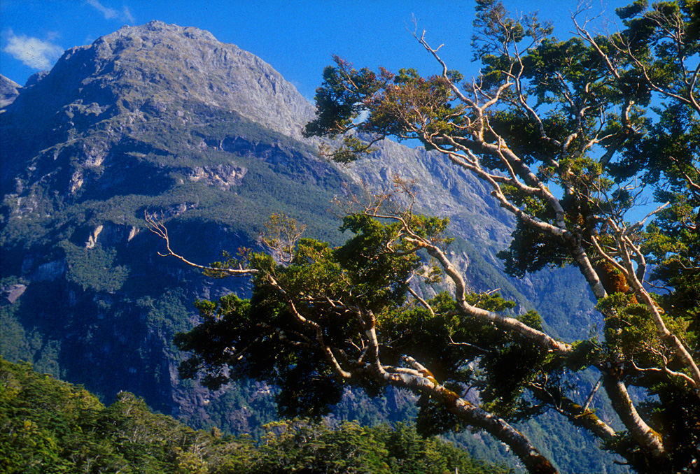
Mitre Peak, Milford Sound Length 53.5 km (33.2 mi) Location Fiordland National Park, Southland, New Zealand Designation New Zealand Great Walk Trailheads Lake Te Anau, SH94 Sandfly Point, Use Hiking Highest point Mackinnon Pass 1,140 m (3,740 ft) Lowest point Sandfly Point 0 m (0 ft) Trail difficulty Medium Season Summer to Autumn Months Late October to late April Sights See below Hazards Hypothermia, sunburn, high winds, flooding, sandflies The Milford Track is a widely known tramping (hiking) route in New Zealand – located amidst mountains and temperate rain forest in Fiordland National Park in the southwest of the South Island.
The track is commonly known as "The Finest Walk in the World",[1] a phrase often attributed to New Zealand poet Blanche Baughan. The article which was eventually published by the London Spectator in England, was originally titled A Notable Walk but was changed by an editor to The Finest Walk in the World and the tag line stuck.
Contents
History
The native Māori people used the Milford Track for gathering and transporting valuable greenstone. There are many Māori legends about the track and the native species found in it.
Donald Sutherland and John Mackay were the first European explorers to see what are now known as Mackay Falls and Sutherland Falls, in 1880.
Quintin McKinnon was the trekker and entrepreneur that first widely disseminated information about the Milford Track to the general public. He began by guiding tours himself and expanded with a marketing campaign from there. Many parts of the Milford Track are named for Mackinnon, including Mackinnon Pass, the tallest point of the Track. According to the official New Zealand Department of Conservation literature, Mackinnon also impressed with his "ability at cooking pompolonas, a type of scone from which one of the guided trip huts takes its name."[2]
With Milford Sound never really having an industrial or agricultural future, most visitors and investors from early on decided that tourism was to be the main draw to the sound, and the Milford Track was established to a large degree to provide a tourism function for guided treks.
The track was very famous with women from early on. Some parties consisted of three-quarters females even in the first half of the 20th century.[1]
For a great length of its history, only commercial companies had the right to be on the track. Only later did the 'Freedom Walker' movement, led by New Zealand's alpine and walking clubs, force a compromise which allowed individual, non-guided tours on the strictly "rationed" route. Today, the quota system allows approximately half the "capacity" of the track to be used by guided tours while the other half is undertaken by people walking on their own or in informal groups. Both groups use separate systems of huts.
Due to its popularity and the limited facilities available for overnighting (camping is not permitted), the track therefore remains heavily regulated.
Route description
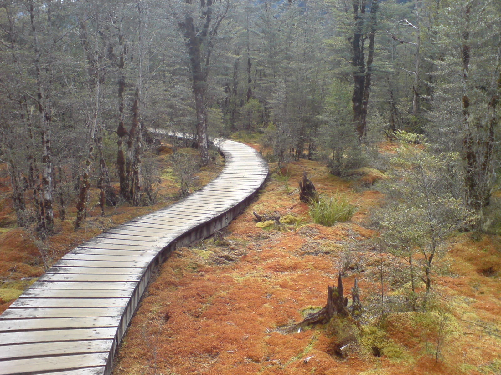
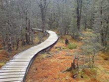 Some sections carry over wetlands.
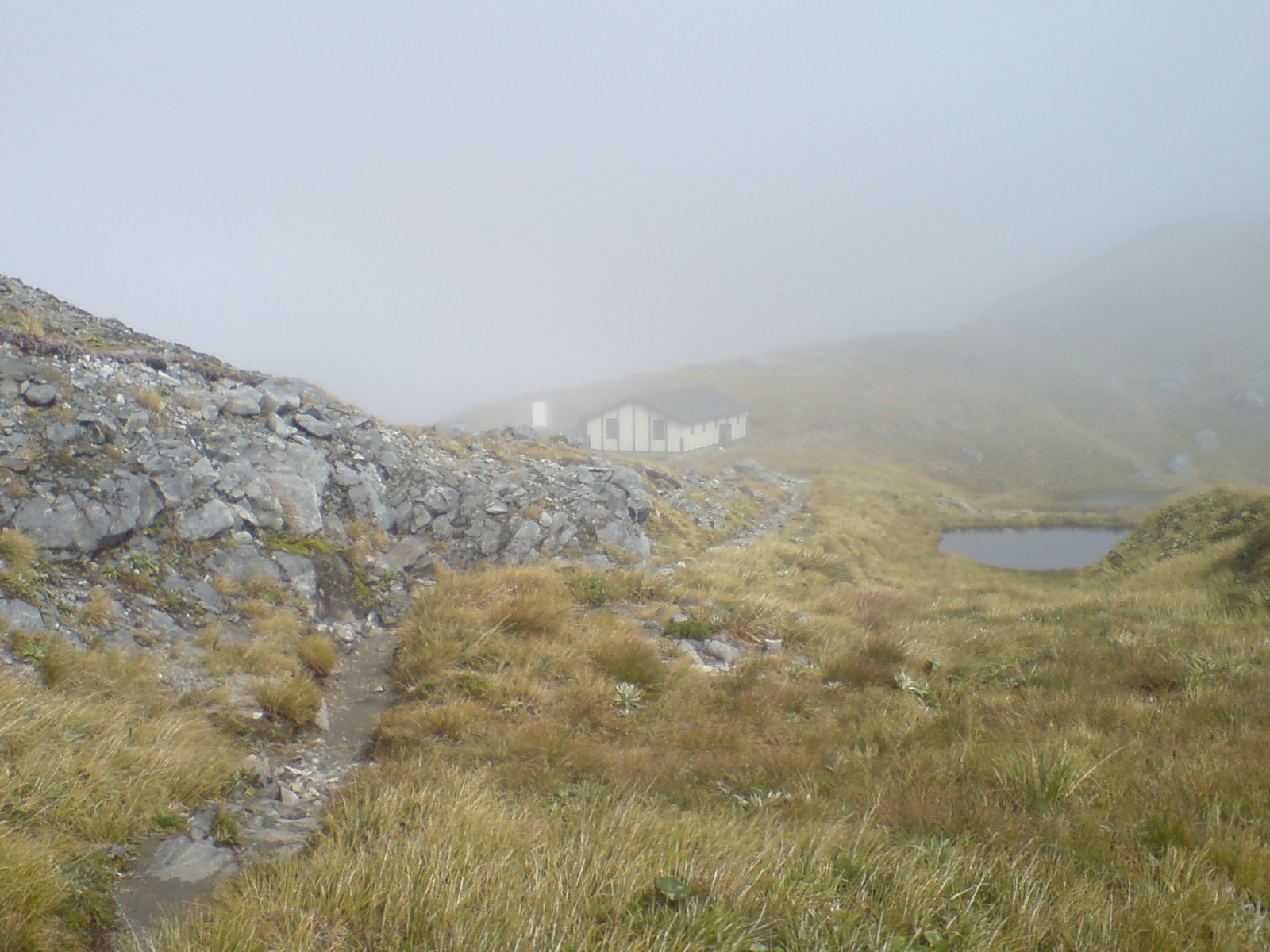
 The shelter hut on Mackinnon Pass.
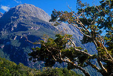 Sheerdown Peak near the end of the Milford Track.
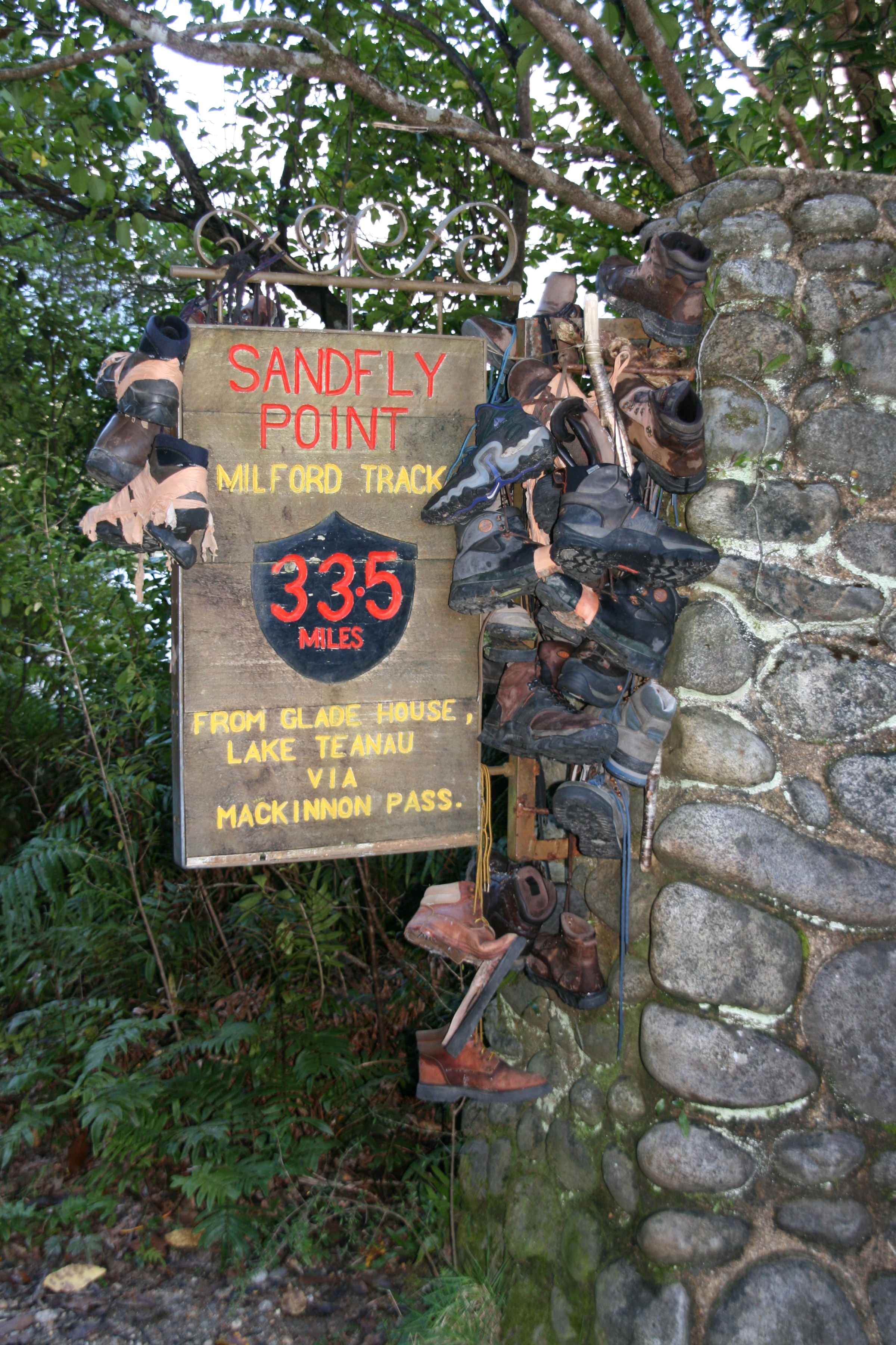
 Abandoned hiking boots at the sign announcing the finish of the track.
The track spans a distance of 53.5 km starting at the head of Lake Te Anau and finishing at Milford Sound at Sandfly Point. It traverses rainforests, wetlands, and an alpine pass.
As a popular route, it is well maintained by the Department of Conservation and is one of the nine Great Walks.
The Lake Te Anau end of the track can be reached either by a ferry, or by climbing over Dore Pass from the Milford Sound road.
Sandfly Point can only be reached by the sea, either sea kayaking or the regular ferry which runs for trampers during the peak season.
Summer peak season
During the summer peak season of late October to late April, access to the trail is highly regulated. Walkers must complete the track in four days, travelling only in the northward direction. Camping is prohibited on the trail. Walkers can tramp the track independently, or as part of a more expensive guided walk with a guide company. A maximum of 90 walkers can start the trail per day (40 Independent, and 50 Guided). Usually these 90 places are booked out for many months in advance, despite the high cost of the guided walks.
Due to the one-way ticket system and limited hut capacities, trampers need to keep moving even during bad weather. During periods of especially heavy flooding, the DOC regularly calls in helicopters which fly trampers over flooded sections of the track at no further charge.[3]
Independent tramping
If hiking independently, each night must be spent in a hut owned and maintained by the Department of Conservation. The huts for independent walkers have basic facilities, which include bunk areas, restrooms, and cooking facilities; walkers have to carry their own equipment and food.
Guided tramp
On a guided walk, walkers stay in lodges owned and operated by the company. These lodges have facilities such as hot showers, catered meals, beds, lounge areas, electric lights, and drying rooms. Guided trampers need only carry clothing, toiletries, their sheets, and lunch while on the trail.
Off Season
During the off season from May to mid-October, the track is essentially unregulated, and can be tramped in either direction, over any number of days. It is however much more difficult and dangerous tramping in this season, as facilities at huts are removed, some bridges are removed to prevent damage, and numerous avalanche paths cross the track.
Huts
Name Description Location DOC Huts Clinton Hut Night 1, shortly before Clinton Forks, after the marsh boardwalk 44°54′18.2265″S 167°54′06.6271″E / 44.905062917°S 167.901840861°E Mintaro Hut Night 2, Situated just before the start of the climb up to Mackinnon Pass 44°48′37.6068″S 167°46′34.8433″E / 44.810446333°S 167.776345361°E Dumpling Hut Night 3, A few kilometers after Quintin Lodge 44°46′07.1815″S 167°45′56.3539″E / 44.768661528°S 167.765653861°E Private Lodges (for guided walkers) Glade House Night 1, just 1.2 km from track start. 44°55′19.0207″S 167°55′44.5579″E / 44.921950194°S 167.929043861°E Pompolona Lodge Night 2, In a forested part of the Clinton Canyon, just after Bus Stop Shelter. 44°50′16.0077″S 167°47′33.0951″E / 44.837779917°S 167.792526417°E Quintin Lodge Night 3, At the turnoff to Sutherland Falls, on the Roaring Burn. 44°47′28.1969″S 167°45′17.6311″E / 44.791165806°S 167.754897528°E Day Use Shelters Hirere Shelter Just after Clinton Forks 44°52′12.4809″S 167°50′32.1287″E / 44.870133583°S 167.842257972°E Bus Stop Shelter Just before Pompolona Lodge 44°50′25.73″S 167°48′16.08″E / 44.8404806°S 167.8044667°E Pass Hut Located on the summit of Mackinnon Pass 44°48′11.5774″S 167°46′33.55260″E / 44.803215944°S 167.775986833°E Boatshed Hut Just before Mackay Falls 44°44′20.3285″S 167°48′11.1794″E / 44.738980139°S 167.803105389°E Sights
Name Description Location Mackinnon Pass A spectacular main-divide pass surrounded by glacier encrusted mountains 44°48′4.7954″S 167°45′58.5687″E / 44.801332056°S 167.766269083°E Sutherland Falls Tallest waterfall in NZ at 580 m, continuously fed by Quill Lake 44°48′.8028″S 167°43′48.7668″E / 44.800223°S 167.730213°E Nicholas Cirque Ring of glacial mountains at the head of the valley that is followed when heading northbound to the Mackinnon Pass 44°48′S 167°45′E / 44.8°S 167.75°E Mackay Falls & Bell Rock Bell Rock was hollowed out by Mackay Falls and then turned upside down. It is possible to stand in the hollowed out part, which is over 4 m high inside 44°43′52.2879″S 167°47′25.4022″E / 44.731191083°S 167.7903895°E Giant Gate Falls Last major waterfall on the Milford Track heading northbound 44°42′13.9603″S 167°51′09.4569″E / 44.703877861°S 167.852626917°E Lake Ada A lake created by a landslide cross the Roaring Burn river 44°42′30.6758″S 167°51′27.5585″E / 44.708521056°S 167.857655139°E Milford Sound World famous for its spectacular sheer cliffs lining the mirror-like fjord 44°36′55.1187″S 167°51′43.8424″E / 44.61531075°S 167.862178444°E Lake Te Anau Created by glacial action, the lake is the second largest body of fresh water in New Zealand and is surrounded by mountains including the Kepler and Murchison Mountains which rise 1,400 m above the surface of the lake. 44°56′24.2160″S 167°54′43.7652″E / 44.94006°S 167.912157°E See also
References
- ^ a b The Finest Walk In The World - information and history book provided in the Milford Track huts, New Zealand Department of Conservation
- ^ History of the Milford Track at NZ Department of Conservation.
- ^ "More than 170 airlifted across Milford Track". The New Zealand Herald. NZPA. 7 May 2009. http://www.nzherald.co.nz/nz/news/article.cfm?c_id=1&objectid=10570895. Retrieved 25 October 2011.
External links
- "Milford Track, New Zealand Great Walks, Department of Conservation". http://www.doc.govt.nz/templates/trackandwalk.aspx?id=36688.
- WikiTravel Entry for Milford Track
- Conservation work in the Milford Track area
Categories:- Fiordland
- Southland Region
- Hiking and tramping tracks in New Zealand

Wikimedia Foundation. 2010.