- Wanaka Airport
-
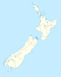
Wanaka Airport IATA: WKA – ICAO: NZWF Location of airport in New Zealand Summary Airport type Public Operator Wanaka based Manager and Management Committee Location Wanaka Hub for Aspiring Air Elevation AMSL 1,142 ft / 348 m Coordinates 44°43′21″S 169°14′45″E / 44.7225°S 169.24583°ECoordinates: 44°43′21″S 169°14′45″E / 44.7225°S 169.24583°E Runways Direction Length Surface ft m 11/29 3,937 1,200 Asphalt Wanaka Airport (IATA: WKA, ICAO: NZWF) is the airport servicing the town of Wanaka, Otago, New Zealand and the surrounding ski fields. It is also the host of the biennial Warbirds over Wanaka air show and serves as a base for sightseeing flights to Milford Sound and Mount Aspiring National Park. The airport is located 10 km from the centre of Wanaka township.
The lack of a VHF omnidirectional range (VOR) beacon at the airport poses an issue for some aircraft. Not many aircraft have appropriate GPS systems to enable non-precision instrument approaches in bad weather.
Airlines and destinations
The only scheduled services at present are operated by Air New Zealand's 19 seater Beechcraft 1900D to Christchurch.
Non scheduled services are made by Vincent Aviation to Te Anau and Wellington, Aspiring Air to Queenstown and Glenorchy Air from Queenstown and Glenorchy. The runway's PCN value is too low to cope with heavier aircraft, along with restrictions on the passenger capacity of aircraft due to the limited airport facilities, however larger aircraft (such as Dash8-Q300 and ATR 72) do operate on scheduled services at peak demand times.
Airlines Destinations Air New Zealand operated by Eagle Airways Christchurch Aspiring Air Queenstown External links
Categories:- Airports in New Zealand
- Wanaka
- Oceanian airport stubs
Wikimedia Foundation. 2010.

