- Colonia Roma
-
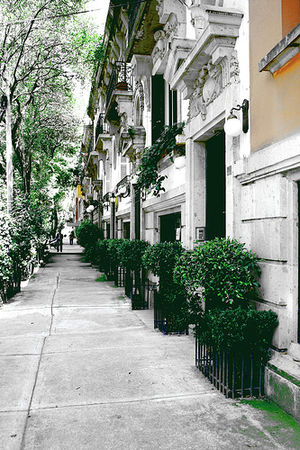 A street in the Colonia Roma
Colonia Roma is a colonia or neighborhood located in the Cuauhtémoc borough of Mexico City just west of the city’s historic center. The area was a very shallow part of Lake Texcoco, dotted with tiny islands and one small island village of Aztacalco during the pre-Hispanic period. During the colonial period, the area dried up and became rural lands first owned by Hernán Cortés and then by the Counts of Miraville. In the late 19th and early 20th centuries, this area west of what was Mexico City proper was being turned into “modern” colonias for the wealthy seeking to escape the deterioration of city center. The colonia’s height as an “aristocratic” and “European” enclave was from its founding in the 1900s until about the 1940s. However, wealthy residents began to move to newer colonias as early as the 1940s and problems associated with urbanization began to appear in the 1950s. Older mansions began to give way to modern commercial buildings in the 1960s and 1970s as the deterioration became more serious. The 1985 Mexico City earthquake caused widespread destruction in the colonia, especially to newer and more commercial and apartment buildings, even causing one major development to mostly disappear. Since then, there have been efforts to conserve the area’s architectural heritage and regain some of its former prestige with some success.
Today, the area is a mixed use zone (residential/office) divided into three zones: a mostly commercial area along the main streets to the north, a cultural area along Alvaro Obregon and the mostly residential “Roma Sur” (South Roma). Its original wide streets, boulevards and small parks filled with trees remain. It is still home to about 1,100 mansions and other architecturally and historically important structures, mostly built between 1906 and 1939. Most of these are no longer residences but rather offices, cultural centers and other businesses. Examples of these adaptations include the Casa Lamm Cultural Center, the Casa Universitaria del Libro, the main building of the Universidad de Londres and the various art galleries which are mostly found on Colima Street.
This area was designated as a "Barrio Mágico" by the city in 2011.[1]
Contents
Description and landmarks
General description
The colonia was an exclusive area for the wealthy on the edge of the city when it was built in the very early 20th century. It declined from the mid 20th century to nearly the end of the same, but it has revived somewhat as a Bohemian area with restaurants, art galleries, offices and more. Today, the area attracts younger generations of artists, writers and urban hipsters, with rents rising once again.[2] The colonia subdivides into three areas: a commercial zone on Avenida Insurgentes, Avenida Chapultepec and Avenida Cuauhtemoc, a residential area informally known as Roma Sur, and a cultural corridor along Alvaro Obregon Street.[3]
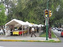 Book vendors set up at the boulevard part on Obregón Street
The boundaries of the colonia are marked by the following streets: Avenida Chapultepec to the north, Avenida Alvaro Obregon, Eje 4 Sur Benjamin Franklin, Antonio M. Anza and Viaducto Miguel Alemán to the south, Avenida Cuauhtémoc and Jalapa Street to the east and Avenida Insurgentes and Avenida Veracruz to the west.[4] Within, these boundaries, most of the streets are quiet and lined with large, leafy trees, mostly how they were laid out when the colonia was built.[2] The largest street is Alvaro Obregon, whose traffic islands have large trees, walking paths and metal benches. On weekends, these islands fill with vendors selling art, antiques and collectibles.[2] However, this and other of the larger streets such as Durango, Oaxaca, Querétaro and San Luis Potosí, were designated as “ejes” or axis streets in the 1950s for through traffic.[5]
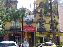 Converted mansion
Along with the tree lined streets, green spaces were also created with the addition of small parks called plazas. The old heart of the neighborhood is the Plaza Rio de Janeiro, originally called Plaza Roma. This plaza is surrounded by a number of old mansions as well as a couple a tall modern towers. In the center, there is a fountain and a replica of Michelangelo’s David. One mansion that faces this plaza is popularly called the La Casa de las Brujas (House of the Witches) although its official name is the Edificio Rio de Janeiro. The popular name of this red-brick castle-like structure, built in 1908, comes from the face that seems to be formed by the windows on the top of the corner tower and the Art Deco entrance, which was added in the 1930s. The Plaza Luis Cabrera is on the corner of Alvaro Obregon and Orizaba Streets. It was the setting for part of a short story called “La batallas en el desierto” by José Emilio Pacheco.[2]
Colonia Roma is one of a number of “modern” colonias such as Colonia Juárez, Colonia Santa María la Ribera and Colonia San Rafael, which were built on what was the western edge of the city in the late 19th and early 20th centuries for wealthy residents looking to escape the city center. The streets and houses were designed and built based on European styles, which can still be seen today, especially on Orizaba, Alvaro Obregon, Colima and Tonalá Streets, where the older facades are best conserved. These were homes of bankers, factory owners, politicians, artists and businessmen who worked in the city center but lived here.[3][6] Like its sister colonias, Roma has since lost many of its original mansion homes, but it has resisted this loss better. Today, there are an estimated 1,100 structures which date from the 1930s or earlier, compared to the 500 to 600 the remain in Santa María la Ribera and Colonia Juárez.[6] Most of the area’s historically and architecturally significant structures were built between 1906 and 1939.[7] These earlier structures include examples of Neo-colonial (which imitate the styles built during Mexico’s colonial period) and Art Deco, but most are “Porfirian,” meaning that they are a mix of French, Roman, Gothic and Moorish elements which were all fashionable in the late 19th and early 20th centuries.[6] One of these old mansions is the home of television personality Paco Stanley, who says he bought the structure because of its “small friendly ghosts,” naming it “La Princesita” or The Little Princess. Stanley uses the property both as living space and office.[8] These houses and streets have provided the backdrop for films such as Los Olvidados, filmed in La Romita by Luis Buñuel and literary works such as Batallas en el desierto by José Emilio Pacheco, Agua Quemada by Carlos Fuentes, Manifestacion de Silencios by Arturo Azuela and El Vampiro de la Colonia Roma by Luis Zapata .[9]
However, the colonia now also has a large number of more modern structures, defined as having been built since the 1950s. These structures came to replace many of the original structures as the character of the colonia changed, along with the lack of urban planning, zoning and the destruction caused by the 1985 earthquake.[6] Owners of many of the older structures have had or have wanted to demolish or radically change them for economic reasons, a process which still persists today.[9] In cases where they have succeeded, modern office and apartment buildings have appeared. Not only are these structures taller and markedly different in design,[6] they also weigh more, affecting the ground around them and causing damage to remaining earlier structures.[10]
While the older mansions are no longer economically viable as residences, there has been efforts since the 1990s to save them, by converting them into offices, stores, restaurants and other businesses with restrictions aimed at conserving their facades and the colonia’s overall character.[6][9] Like neighboring Colonia Condesa, Roma has a number of cafes, restaurants and other eateries established in older structures (as well as newer ones). One difference between the two neighboring colonias is that Condesa’s popular habit of placing tables on the sidewalks outside has not really caught on in Roma. The practice is spotty in Roma, mostly appearing with cafes and small eateries, but more formal restaurants look down on the practice. A number claim that it discourages potential customers from walking by, thinking the area is private property.[11]
Colima Street is home to a number of art galleries which have worked since the 1990s to establish themselves as an international art market to compete with New York, Paris, London and Tokyo. These galleries include the Landucci Gallery. Artists such as Mexican photographer Victor Carresquedo and American Barry Wolfryd have set up shop in the area as well as the Centro Libre de Arte, Mexico City’s newest fine arts school. The goal is to promote Mexican art from its current status as regionally relevant to one with broader appeal, by not only promoting native artists more effectively at home but also by sponsoring international tours, featuring established artists such as Francisco Toledo, Roberto Márquez and Alfredo Castaneda as well as newer talents such as Cisco Jimenez and Guillermo Kuitca. The area is also attracting South American and Central American artists looking to break into the U.S. and world art markets.[12]
While there have been efforts to restore the area’s reputation as aristocratic and upscale, the area still has problems associated with deterioration. There are a number of cabarets and men’s clubs, which have attracted and sustained prostitution in the area.[6] There are still unmaintained and abandoned buildings in which live squatters and other very poor people. Since the 1990s, there was a small poor community of about 35 Otomi in the colonia, living in abject poverty. Most earned money and depend on community soup kitchens. Most live as squatters in abandoned buildings.[13]
Landmarks
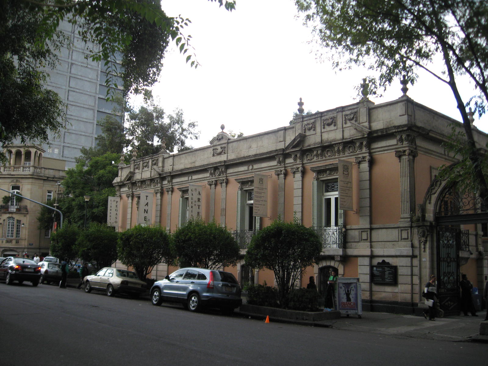
Casa Lamm
 Casa Lamm Cultural Center
The best known landmark in the colonia is the Casa Lamm .[2][14] La Casa Lamm was a project to rehabilitate one of the old mansions which was supported by local authorities.[3] Today, it is a cultural center and restaurant located in a restored mansion that dates to 1911 on Alvaro Obregon Street. The house was built by Luis Lamm, one of the original developers but he never lived there. Instead, he rented it to a religious organization which ran an orphanage. In 1939, it was sold to a private family, which kept it and maintained it until 1990. In 1993, the mansion was renovated and opened as a private cultural institute.[2]
The institute consists of art exhibition space and management, some graduate level programs in the fine arts and a restaurant and bookstore, which are open to the public. Since it opened, it has hosted numerous art exhibitions. In 1999, it received custody of Televisa’s large art collection, which was formerly housed in the Centro de Arte Contemporaneo in Polanco. This collection contains works by artists such as Sergio Hernández, María Izquierdo, Francisco Toledo, Jasper Johns, Gerhard Richter, Manuel Álvarez Bravo, Tina Modotti and Guillermo Kahlo. This collection is displayed on a rotating basis on a wing which was added for it.[2] In 1994, Casa Lamm, along with art galleries OMR and Nina Menocal have worked to make Roma a center for the visual arts in Mexico, attracting more galleries, artists and others to set up shop here. The ongoing project has had mixed success. It has attracted the participation of entities such as the Salón de la Plástica Mexicana, the Universidad de la Comunicación, Jomart, the Universidad Interamericana de México and the Casa de Francia, and various galleries have has full and profitable shows. However, security problems and lack of maintenance of public areas in the colonia by the city government have sometimes made it difficult to attract or keep artists and institutions.[14]
The institute offers studies in poetry, novel writing and theater of the 20th century. It also offers a master’s degree in Literary Appreciation and Creation, which combines both classes on criticism as well as workshops for writers mostly focusing on Latin American and European works.[15] On the ground floor of the building, facing the street are the bookstore and restaurant. The Liberia Pegaso bookstore contains large selections in English and Spanish, especially in art-related books.[2] The restaurant was last remodeled in 2003, and is considered to be a very fashionable place to eat. Most of the dining area is centered on an open-air patio accented by a black fountain. The menu is a mix of Mexican and international cuisine.[16]
Casa Universitaria del Libro
The Casa Universitaria del Libro (University House of Books) is located on Puebla and Orizaba Streets. The building dates from 1920, when it was built by Joaquin Barando for the McGregar family. During the Second World War it was used as the Brazilian embassy. The Centro Asturiano took possession in the 1930s. When this institution moved to Polanco in 1986, it began to lease the building free to the Universidad Autónoma de México (UNAM) .[4][17] Although unproven, it is still rumored that the house was used for prostitution at one point and there is also local legend which states that a ghosts wanders through its halls, rooms and especially in the terrace.[17] The bookstore specializes in the promotion of mostly written works produced by those associated with UNAM in the center of the city away from the Ciudad Universitaria. It sponsors approximately 250 activities per year such as book readings and signings, conferences, seminars and round tables. There is no other bookstore in Mexico dedicated solely to the promotion of a university’s academic and literary production.[17]
Museo Objeto del Objeto
Museo Objeto del Objeto (Object of the Object Museum or MODO) was inaugurated in 2010, following Mexico City's tradition of collectors founding or expanding museums with their personal collections. This museum is based on the collection of ordinary objects such as commercial packaging (especially beverage containers), advertisements, household appliances and more for a total of over 30,000 items collected by Bruno Newman over more than forty years. The museum is dedicated to communication and design, using the collection as a starting point for collaboration and research.[18][19]
Churches
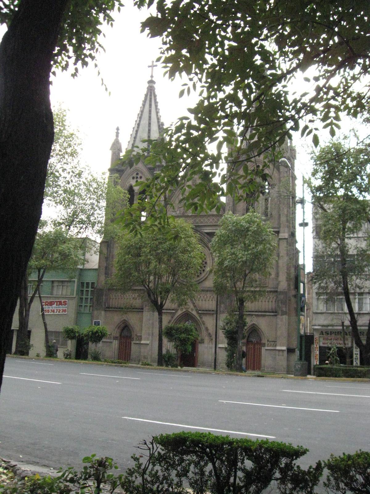
The Sagrada Familia Church is located on the corner of Puebla and Orizaba Streets. Its architecture is classed as Romanesque Revival and Gothic Revival, which was designed by Mexican architect Manuel Gorozpe. The first stone was laid in 1906, but most of structure was built between 1910 and 1912, of reinforced concrete. At the time, the church was criticized as “mediocre, ostentacious and of decadent taste.” In the 1920s, painter and Jesuit priest Gonzalez Carrasco decorated the interior with murals, with two smaller paintings realized by Hermano Tapia. The interior also contains the remains of Miguel Agustín Pro, a Jesuit priest executed by Plutarco Elias Calles in 1927 during the Cristero War and is considered to be a martyr. The church is fronted by a small atrium bordered bya wrought iron fence constructed by the Gábelich workshop, which was in neighborhing Colonia Doctores. It is one of the few wrought iron works to survive from the early 20th century.[20]
 Nuestra Señora del Rosario (Our Lady of the Rosary) Church on Cuauhtémoc street on the far eastern edge of Colonia Roma
On the corner of Querétaro and Zacatecas Streets is the Nuestra Señora del Rosario Church, which was built by Mexican architects Angel and Manuel Torres Torija. This church is Gothic Revival begun in 1920 and concluded in 1930. While built after the Porfirio Díaz era of the late 19th and early 20th century, this church shares many of the features as churches from that time. Records indicate that the project was probably planned around 1911 but was delayed due to the Mexican Revolution. The facade contains a decorative rose window, common to Gothic styles with ojival doors and windows. The interior is spacious with three naves with notable stained glass windows with orient themselves vertically.[20]
Educational institutions
In addition to the educational programs at the Casa Lamm and the Casa Universitaria del Libro, the colonia has a number of private educational institutions from primary school to university. Some, such as the Instituto Pedagogico Anglo Espanol, the Instituto Renacimiento and the Colegio Mexico have been established since the first half of the 20th century.[3]
There are two universities based in the colonia. The Universidad de Londres is a mostly business college. Its main campus is in Colonia Roma, but it also has eight other facilities in other parts of Mexico City and three in other parts of Mexico. The Roma campus is housed in one of the palatial mansions from the Porfirian era on Orizaba street. It offers twenty bachelor’s degrees, eight master’s and eight certificate programs.[21]
The Universidad de las Américas de la Ciudad de México (UDLA) was founded in 1940 as the Mexico City Junior College (MCC). In the 1960s, its name changed to the University of the Americas and shortly thereafter to the current one. It was founded in Colonia Roma but moved to a facility on the Mexico City-Toluca highway. When the institution split in the 1980s, one campus moved to Puebla and the other moved to the current location back in Colonia Roma in newly built facilities.[22] UDLA offers seven bachelor’s degrees, four graduate degrees and various certificate programs. It is located in a modern facility on Puebla Street.[23]
La Romita
La Romita is a small section of the colonia which used to be an independent village and colonia and whose streets are still significantly different from the rest of Roma. The territory of modern Colonia Roma in pre-Hispanic times consisted of the very shallow waters of Lake Texcoco and a number of very small islands of firm ground. A recent study of former lake area, including Colonia Roma, has shown that uneven sinking of streets and ground is most likely caused by the presence of archeological remains such as villages on former small islands and chinampas (man made floating islands). This sinking has created small mounds of 50 to 100 cm.[24] The village of Aztacalco (Nahuatl:house of herons) was on one of these small islands. It was an independent village from colonial times until the very early 20th century, when it was made its own colonia in 1903 with the name of La Romita.[4] When Colonia Roma was created, Romita was officially incorporated into it, but the local residents fought redevelopment. The area has since developed semi-independently from the rest of Colonia Roma, both in infrastructure and socially.[2] Even today, the area is relatively difficult to access, with narrow streets leading to a very small plaza and church called Santa María de la Natividad de Aztacalco. This church was established in 1550, but it was “demoted” from parish to chapel in 1962.[2][4] The local residents were of a significantly lower social class than the rest of Roma, with the wealthy residents avoiding it for fear of thieves. In the 1930s and 1940s, the area had two legendary female thieves named Plácida Hernández and the other only referred to as “La Loba” (The She-Wolf) .[2]
The area had one famous gang known as the Halcones (Falcons). This gang was prominent in the 1940s and 1950s, when it was led by Arturo “El Negro” Durazo and controlled a large part of La Romita. Durazo befriended and protected a more studious resident of the area, José López Portillo, who eventually went into politics and became president of Mexico from 1976 to 1982. In return for protection received when he was young, Portillo made Durazo the chief of police of Mexico City. This led wide scale corruption and brutality until Durazo was replaced and jailed by the following president Miguel de la Madrid .[2] The area still has a reputation for crime and is found at the extreme northeast of the colonia near Metro Cuauhtémoc .[2]
Centro Urbano Benito Juárez
Another distinct area of the colonia is on the far southeast corner and is of more recent creation. The Centro Urbano Benito Juárez, or Multifamiliar Juárez was a very large apartment complex in the 1940s and early 1950s. Prior to this, it was the site of the Estadio Nacional (National Stadium) which was used for sporting and political events,[25] and La Piedad Park.[26]
It was one of several projects of this type by architect Mario Pani. It was designed to house city government workers and to be semi-autonomous with its own schools, administration, businesses etc.[27] and incorporate as much outdoors space as possible.[26] It also featured one of the largest mural projects of the 20th century by artist Carlos Mérida. The complex was one of the largest projects in the world to integrate artwork into the architecture.[28] Carlos Mérida’s mural work here was the most important of his career and the largest mural project in Mexico in the 20th century.[29]
Despite having been tested for ground stability, the complex suffered damaged from an earthquake in 1957.[30] Later, most of the complex, and the mural work with it, were destroyed by the 1985 Mexico City earthquake and the demolition of many of the damaged buildings.[25] Many of the buildings could have been saved, but it proved uneconomical to do so. The government erred when it created the rental contracts with tenants by neglecting to add a clause allowing them to raise rents. By 1985, there were tenants paying as little as 200 pesos a month for rent. ($25USD in 1950, $.10USD in 1985).[30] For this reason, maintenance of the buildings and grounds suffered until it became impossible. The government decided that this was the time to condemn nearly all of the buildings, with only several still remaining.[30] The earthquake made most complex disappear.[31] What remains continues to deteriorate. There are problems with lack of parking, crowded streets, abandoned units and crime.[27] Most the land where the demolished buildings stood has become the Ramon Lopez Velarde Park. This park is frequently used by residents of the southeast corner of the colonia as well as neighboring colonias and the visitors from the Centro Medico. However, since it was established, it has experienced degradation due to lack of maintenance, trash, graffiti and homeless.[32]
History
During Aztec times, this area was shallow lake and a number of very small islands. The Aztecs farmed on chinampas, which were small floating artificial islands moored close to firm land. The repeated creation and sinking of these islands over time extended solid land in the area.[2] The most important settlement was Aztacalco (house of herons in Nahuatl) which was located on one of these small islands.[4] After the Spanish conquest of the Aztec Empire, this area was part of the lands granted to Hernán Cortés by the Spanish Crown in 1529. During much of the colonial period, it was part of the property of the Counts of Miraville,[2] but by the early 20th century, it was the property of two families named Echegaray and Calero Sierra, and bordered the lands of the Hacienda de la Condesa. Although still rural, it was already bordered by streets such as Avenida Chapultepec and Avenida La Piedad (today Avenida Cuauhtémoc) .[4]
In the late 19th and early 20th centuries, the mostly dried lakebed areas west of Mexico City were being developed into “modern” colonias for the city’s wealthy looking to leave the deteriorating city center. Aztacalco, then called La Romita or La Romerita, was established as a colonia in 1903.[4] At about the same time, the rest of the land which is now Roma, called Hacienda de Romita or Potreros de Romita, was acquired by an investment group called Companía de Terrenos de la Calzada de Chapultepec. This group included British circus owner Edward Walter Orrin, along with famous clown Ricardo Bell, U.S. engineer Casius Clay Lamm and his sons, and Mexican Pedro Lascuráin. The intent was to develop the land into a residential subdivision, which was approved by the city government in 1902, with the name of Roma instead of Romita.[4][9] The project also had participation from the Porfirio Díaz government, which commissioned itself to provide infrastructure such as roads, water and sewer, and would be the first colonia in Mexico City with these services.[2][33] The colonia was also designed with wide streets, with tree-filled traffic islands and boulevards such as those in Paris.[9] The names of these new streets came from the states and cities which the Orrin Circus had performed.[4] The largest of these streets was and still is Avenida Alvaro Obregon, originally called Avenida Jalisco. Small parks such as Plaza Rio de Janeiro and Plaza Luis Cabrera were added for more green space.[5] These streets and plazas still remain although a number of the wider streets such as Alvaro Obregon, Durango, Oaxaca, Querétaro and San Luis Potosí have been converted into “eje” or axis roads for through traffic.[5] The project also included the incorporation of the formerly separate La Romita, but residents resisted and the two communities remained socially separate.[2]
After the initial development of infrastructure and some homes, project stalled after the outbreak of the Mexican Revolution in 1910. After the war was over, Roma, along with sister colonias of Colonia Juárez, Colonia Condesa, Colonia San Rafael, Colonia Santa María la Ribera and others, experienced a building boom in the 1920s and 1930s. The architecture in all of these areas at this time rejected Mexico’s traditional Baroque architecture of red tezontle stone and wrought iron balconies and window rails for a more modern look, heavily influenced by European trends, especially French, and eventually Art Deco.[9] The colonia was at its most exclusive, considered aristocratic and “European,”[9] from its beginning to the end of the 1930s, with its historically and architecturally significant buildings constructed between 1906 and 1939.[7] It not only attracted wealthy Mexican families, but also a number of foreign residents the initial British and American developers to a number of French and Spanish.[9] By the 1930s, the colonia has a number of clubs or meeting houses such as La Bandida, where many politicians in Manuel Ávila Camacho’s government would meet, and erotic bathhouses such as La Torre.[9] Although two significant churches were built between 1900 and 1940, the Cristero War in the 1930s and its related religious persecutions, resulted in their closing, with services held clandestinely in private homes.[5]
In the 1940s and 1950s, the area was still exclusive and could boast of having been the home of influential artists, businessmen and politicians.[3] Residents from the first half of the 20th century included former presidents of Mexico Luis Echeverría, José López Portillo, Álvaro Obregón and Miguel de la Madrid,[33] as well as Ramón López Velarde, Concepción Acevedo de la Llata|“Madre Conchita,” who was accused of planning Obregon’s assassination, Francisco I. Madero’s widow, Jorge Ibargüengoitia, Fernando Benitez, Juan José Arreola, José Agustín, Pita Amor, Julio Sesto, Fernando Solana, Alfonso García Robles, Andrés Palca, María Conesa, Pascual Ortiz Rubio, David Alfaro Siqueiros, Enrique Bátiz Campbell and Leonora Carrington.[9] However, a number of families began to move out when newer exclusive zones such as Polanco, Anzures and Lomas de Chapultepec were built even further to the west.[9] Rents were frozen all over the city during the Second World War, initially as a temporary measure, but this freezing was never lifted until the 1990s. Loss of rental income would eventually led to landlords’ lack of maintenance of older buildings as the decades progressed.[9]
By the 1950s, the colonia began to attract lower-class residents due to the low rents. Long time residents complained about the influx of Arabs, Jews and Mexicans from southern states such as Campeche, Chiapas and Tabasco into the neighborhood.[9] Some areas became dangerous at night. La Romita, due to its socioeconomic segregation was considered very dangerous with organized gang activity by the 1950s. Vagabonds and gang activity in the Plaza Rio de Janeiro area was also a problem by the end of this decade.[9]
In the 1960s, older residences began to give way to newer commercial buildings, especially in the northern part of the colonia.[9] Businesses such as General de Gas, Woolworth’s, the Mexican Red Cross and Telefonos de Mexico (Telmex) established centers here.[3] By the end of the decade, most of the north, especially along Avenida Chapultepec, was redefined as commercial space.[9] The newer, taller and heavier buildings not only began to change the character of the colonia, they affected the ground around them, causing damage to the older mansions that neighbored them.[10]
Serious decline began in the 1970s.[3][9] More wealthy families moved out as more office buildings were constructed, and Carlos Hank Gonzalez’s “eje” road system, made the colonia less isolated from the rest of the city and less exclusive. Men’s clubs and prostitution began to appear.[9] The commercial development either destroyed or radically modified the mansions of the early 20th century. One reason for this was that there was little in the way of urban planning or zoning regulations either in this colonia or neighboring ones, so many older homes were either converted into offices and businesses or razed completely to make way for office and apartment buildings.[3][6] The deterioration culminated with the 1985 Mexico City earthquake. A geological fracture erupted southwest to northeast thorough the colonias of Colonia Condesa, Colonia Cuauhtémoc, Colonia Guerrero, Colonia Hipódromo Condesa, Colonia Juarez, Colonia Maza, Colonia Morelos, Colonia Peralvillo, the northern part of Colonia Roma and Colonia Tabacalera. In Roma alone, 472 buildings partially or completely collapsed mostly in the northern part of the colonia around Morelia, Mérida, Cordoba, Puebla, Cuauhtemoc, Insurgentes, San Luis Potosí and Chiapas streets.[3][9][34] Most of these buildings were newer, built since the 1950s and many were used for lower class housing, leaving 15,000 homeless.[9][34] The Conjunto Urbano Benito Juárez, located in the southeast corner of the colonia, was mostly destroyed. The main reasons for the widespread destruction in Roma was that much of it was built on soft former lakebed and much of the newer construction was taller and not as solidly constructed as the older mansions.[9] The widespread destruction and homeless, not only in Roma but in the rest of the city center, created an urgent need for new housing. Destroyed properties were expropriated, and lower class housing was hastily constructed. The cause most of the rest of the older and wealthier residents to leave, and lowered property values greatly.[3] This damage and reconstruction not only cause the flight of the wealthy from Roma, but from neighborhing Colonia Condesa as well, even though it did not suffer significant damage.[3] The effects of this earthquake remain in Roma. As of 2005, there were still fifteen inhabited buildings with serious structural faults at risk of collapse and another 700 considered to be significantly compromised.[34]
The most serious decline of the colonia occurred from the 1970s to the early 1990s. The population of the colonia declined from 95,000 inhabitants in 1970 to 35,000 in 1995.[9] Between the commercialization that has been ongoing since the 1960s and the aftermath of the 1985 earthquake, Colonia Roma has lost a large portion of its original structures from the first decades of the 20th century.[6] Due to their size, most of the old mansions became economically unviable as residences, but their central location and proximity to major transportation has made them and the surrounding area valuable for business,[3] pushing owners to want to radically alter or even destroy them.[9]
However, the 1985 earthquake spurred not only stricter building codes for new structure, but also neighborhood associations with the aim of conserving and restoring the architectural heritage and prestige of the colonia. These have worked to halt construction of tall apartment and office buildings and to conserve the remaining early 20th century mansions. Neighborhood groups succeeded in having the city’s attorney general’s office relocated in the mid 1990s as well as nixing the construction of an underground parking garage at the Plaza de las Cibeles.[9] Since 1990, no new apartment buildings have been constructed, although some of the older constructions has been adapted as such.[3] Rents hit bottom just after 1985, attracting artists and urban hipsters into the area. Many of these people were also interested in the restoration and conservation of the old mansions, converting them into office space and other businesses but conserving the original facades.[2][3] In 1988, city authorities decided to rescue and renovate the La Romita area, especially its church, Santa María de la Natividad de Aztacalco.[4] In the entire colonia, there are still 1,100 mansions from the early 20th century,[6] even though restoration and conservations efforts have had mixed success. One problem is the lack of government maintenance of roadways and another is that private investment into conserving, refurbishing (as offices and businesses) and resale of the buildings has been spotty and sporadic.[3][7] Today, the best-conserved mansions are along the streets of Colima, Tonalá, Alvaro Obregon, and Avenida Chapultepec.[2][6] One of the colonia’s successes since the 1990s, has been the opening of a number of art galleries, especially along Colima Street, which was mostly spurred by the establishment of the Casa Lamm Cultural Center.[2] There has been progress into zoning much of the colonia as mixed use (residential/office), with focus on promoting the older mansions as commercial and cultural space. Traffic has been routed around much of the area to keep more residents from moving out.[3] Since 2002, there have been efforts to formally designate and catalogue the historical and architecturally significant structures in order to have even more protections afforded to these buildings.[10]
References
- ^ Quintanar Hinojosa, Beatriz, ed (November 2011). "Mexico Desconocido Guia Especial:Barrios Mágicos [Mexico Desconocido Special Guide:Magical Neighborhoods]" (in Spanish). Mexico Desconocido (Mexico City: Impresiones Aereas SA de CV): 5–6. ISSN 1870-9400.
- ^ a b c d e f g h i j k l m n o p q r s t Humphrey, Chris (2005). Moon Handbooks-Mexico City. Berkeley, CA: Avalon Travel Publishing. pp. 63–66. ISBN 978-1-56691-612-7.
- ^ a b c d e f g h i j k l m n o p Diego Ayala (March 31, 1996). "Buscan su tradicion y calidad de diseno [Searching for its tradition and quality of design]" (in Spanish). Reforma (Mexico City).
- ^ a b c d e f g h i j "Colonia Roma [Colonia Roma]" (in Spanish). Mexico City: Borough of Cuauhtémoc. http://www.cuauhtemoc.df.gob.mx/delegacion/mapa/colonias.html. Retrieved November 11, 2010.
- ^ a b c d Miryam Audiffred Laso (February 2, 1997). "Huellas de historia en la Colonia Roma [Footprints of the history of Colonia Roma]" (in Spanish). Reforma (Mexico City): p. 5.
- ^ a b c d e f g h i j k Arturo Mendoza. (January 10, 1996). "Por esas calles de la Colonia Roma [Through the streets of Colonia Roma]" (in Spanish). Reforma (Mexico City): p. 10.
- ^ a b c Dora Luz Haw. (March 13, 2002). "Exigen un reglamento para la Colonia Roma [Demand for regulations for Colonia Roma]" (in Spanish). Reforma (Mexico City): p. 3.
- ^ Angelica De Leon. (April 27, 1998). "Tiene su 'princesita' en la Colonia Roma [He has is "little princess" in Colonia Roma]" (in Spanish). El Norte (Monterrey, Mexico): p. 9.
- ^ a b c d e f g h i j k l m n o p q r s t u v w x Adriana D. Valasis. (March 1, 1997). "Colonia Roma: Patrimonio arquitectonico/ Se niega a morir [Colonia Roma: Architectonical heritage/Refuses to die]" (in Spanish). Reforma (Mexico City): p. 4.
- ^ a b c Antimio Cruz. (September 25, 2002). "Pretenden frenar deterioro de la Roma [Intending to stop the deterioration of Roma]" (in Spanish). Reforma (Mexico City): p. 2.
- ^ Francisco J. Almaraz. (June 28, 1995). "Los duenos de la calle: Comer fuera [The owners of the street: To eat outside]" (in Spanish). Reforma (Mexico City): p. 1.
- ^ Sgambati, Albert (November 1997). "Rise of the Roma Empire". Business Mexico. (Mexico City) 7 (11): 53–56.
- ^ Marcela Turati. (March 21, 1999). "La Roma Otomi; [1] [The Otomi of Roma]" (in Spanish). Reforma (Mexico City): p. 4.
- ^ a b Blanca Ruiz (September 15, 2000). "Travesias/ Corredor de la Roma [Journeys/Colonia Roma Corridor]" (in Spanish). Reforma (Mexico City): p. 34.
- ^ Leslie Aguirre. (June 25, 2007). "Casa Lamm: Para tu escritor interno [Casa Lamm: For your inner writer]" (in Spanish). Reforma (Mexico City): p. 28.
- ^ Saliba, Armando (September 2003). "Casa Lamm". Business Mexico. (Mexico City) 13 (9): 62.
- ^ a b c Leticia Sanchez. (October 28, 1996). "Cumple 10 anos la Casa Universitaria del Libro [Casa Universitaria del Libro celebrates 10th birthday]" (in Spanish). Reforma (Mexico City): p. 4.
- ^ "Abre el Museo del Objeto del Objeto la muestra Colección de colecciones con más de 500 artículos de la vida cotidiana [Museo Objeto del Objecto opens exhibit called "Colección de colecciones" with over 500 objects from everyday life]" (in Spanish). Mexico: CONACULTA. May 19, 2011. http://www.conaculta.gob.mx/sala_prensa_detalle.php?id=13294. Retrieved August 14, 2011.
- ^ "¿Qué es el Museo del Objeto del Objeto? Abrirá este sábado [What is the Object of the Object Museum. Will open this Saturday]" (in Spanish). Milenio (Mexico City). October 20, 2010. http://www.milenio.com/cdb/doc/noticias2011/f093ccf4edf26d1cdb9c4181ba22032b. Retrieved August 14, 2011.
- ^ a b Edgardo Ra. "Las iglesias porfirianas de la ciudad de México. [The Porfirio Diaz era churches of Mexico City]" (in Spanish). Mexico City: Mexico Desconocido magazine. http://www.mexicodesconocido.com.mx/las-iglesias-porfirianas-de-la-ciudad-de-mexico.html. Retrieved November 11, 2010.
- ^ "Universidad en la Ciudad de México, D. F., Del. Cuauhtémoc [The University in Mexico City, Cuauhtémoc Borough]" (in Spanish). Mexico City: Universidad de Londres. http://universidades.estudia.com.mx/universidad+de+londres.htm. Retrieved November 11, 2010.
- ^ "Información Institucional [Institutional information]" (in Spanish). Mexico City: Universidad de las Américas. http://www.udla.mx/htdocs/udla/informacion-institucional.php. Retrieved November 11, 2010.
- ^ "Universidad de las Américas-Ciudad de Mexico [University of the Americas-Mexico City]" (in Spanish). Mexico City: Universidad de las Américas. http://www.udla.mx/htdocs/index.php. Retrieved November 11, 2010.
- ^ Antonio Bertran (September 19, 1996). "Crestas de asfalto, senal de vestigios [Asphalt waves signs of archeological vestiges]" (in Spanish). Reforma (Mexico City): p. 15.
- ^ a b Contreras "Centro Urbano Benito Juárez [Urban Center Benito Juarez]" (in Spanish). Mexico City: Borough of Cuauhtémoc. http://www.cuauhtemoc.df.gob.mx/delegacion/mapa/colonias.html Contreras. Retrieved August 18, 2010.
- ^ a b Blair Allen Paltridge (1992). Carlos Merida's integration of art, architecture and ideology in the Multifamiliar Juarez (PhD thesis). University of California, Los Angeles. p. 78. Docket AAT 9224132.
- ^ a b "Centro Urbanos [Urban Centers]" (in Spanish). Mexico: ARQHYS Architect's site. September 2, 2007. http://www.arqhys.com/tutoriales/2007/09/centros-urbanos.html. Retrieved August 18, 2010.
- ^ Daniela Ruiz Contreras (February 10, 2010). "Centro Urbano Presidente Juárez [Urban Center Benito Juarez]" (in Spanish). Mexico: Arquitectura en Red. http://www.arqred.mx/blog/2010/02/10/centro-urbano-presidente-juarez/. Retrieved August 18, 2010.
- ^ Blair Allen Paltridge (1992). Carlos Merida's integration of art, architecture and ideology in the Multifamiliar Juarez (PhD thesis). University of California, Los Angeles. p. 7. Docket AAT 9224132.
- ^ a b c Blair Allen Paltridge (1992). Carlos Merida's integration of art, architecture and ideology in the Multifamiliar Juarez (PhD thesis). University of California, Los Angeles. p. 130. Docket AAT 9224132.
- ^ Yunnuen Campos (September 17, 2005). "A 20 años del sismo del 85 [20 years since the quake of 85]" (in Spanish). Noticieros Televisa (Mexico City). http://www.esmas.com/noticierostelevisa/terremoto/475688.html. Retrieved August 18, 2010.
- ^ Anayansin Inzunza. (May 22, 2004). "Exigen vecinos rescatar parque en la Roma Sur [Neighbors demand rescue of park in Roma Sur]" (in Spanish). Reforma (Mexico City): p. 5.
- ^ a b Adriana D. Valasis. (January 6, 1997). "Cumple 95 anos la Colonia Roma [Colonia Roma’s 95th birthday]" (in Spanish). Reforma (Mexico City): p. 4.
- ^ a b c Arturo Paramo (September 11, 2005). "Persisten riesgos en la Roma - Juarez [Risks persist in Colonias Roma and Juárez]" (in Spanish). Reforma (Mexico City): p. 2.
External links
Colonias and Neighborhoods of Cuauhtémoc, D.F. Colonias Colonia Centro • Colonia Doctores • Colonia Obrera • Colonia Roma • Tepito • Colonia Algarín • Colonia Ampliación Asturias • Colonia Asturias • Colonia Atlampa • Colonia Buenavista • Colonia Buenos Aires • Centro Urbano Benito Juárez • Colonia Condesa • Colonia Cuauhtémoc • Colonia Esperanza • Colonia Exhipódromo de Peralvillo • Colonia Felipe Pescador • Colonia Guerrero • Colonia Hipódromo • Colonia Hipódromo Condesa • Colonia Juárez • Colonia Maza • Colonia Morelos • Colonia Paulino Navarro • Colonia Peralvillo • Colonia San Rafael • Colonia San Simón Tolnahuac • Colonia Santa María Insurgentes • Colonia Santa María la Ribera • Unidad Habitacional Nonoalco-Tlatelolco • Colonia Tabacalera • Colonia Tránsito • Colonia Valle Gómez • Colonia Vista Alegra • Zona Rosa
19°24′59.08″N 99°9′42.11″W / 19.4164111°N 99.1616972°WCoordinates: 19°24′59.08″N 99°9′42.11″W / 19.4164111°N 99.1616972°W
Categories:- Neighborhoods in Mexico City


Wikimedia Foundation. 2010.