- Nuwara Eliya District
-
Nuwara Eliya District
நுவரேலியா மாவட்டம்
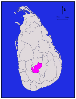
නුවරඑළිය දිස්ත්රික්කය— Administrative District — Map of Sri Lanka with Nuwara Eliya District highlighted Coordinates: 7°00′N 80°45′E / 7°N 80.75°ECoordinates: 7°00′N 80°45′E / 7°N 80.75°E Country  Sri Lanka
Province Central Province Created Capital Nuwara Eliya Divisions List- Divisional Secretariats: 5
- Grama Niladhari: 491
Government – District Secretary D. P. G. Kumarasiri – Local List- Municipal Councils: 1
- Urban Councils: 2
- Pradeishiya Sabhas: 5
Area – Total 1,741 km2 (672.2 sq mi) – Land 1,706 km2 (658.7 sq mi) – Water 35 km2 (13.5 sq mi) Population (2001) – Total 703,610 – Density 404.1/km2 (1,046.7/sq mi) Time zone Sri Lanka (UTC+05:30) ISO 3166 code LK-23 Website ds.gov.lk/dist_nuwaraeliya Nuwara Eliya District (Tamil: நுவரேலியா மாவட்டம், Sinhala: නුවරඑළිය දිස්ත්රික්කය) is a district in Central Province, Sri Lanka. Its area is 1,228 km². Nuwara Eliya town is a tourist attraction.
Contents
Demographics
Ethnic groups Sinhalese 282,621 (40.17%) Sri Lankan Tamil 46,066 (6.55%) Sri Lankan Moor 16,555 (2.35%) Indian Tamil 355,830 (50.57%) Burgher 632 (0.09%) Sri Lankan Malay 1,059 (0.15%) Other 847 (0.12%) Religions Buddhism 279,139 (39.67%) Hinduism 359,135 (51.04%) Islam 19,099 (2.71%) Roman Catholic 35,008 (4.98%) Other Christian 10,741 (1.53%) Other 488 (0.07%) The population according to 2001 census is 703,610 of which 50.61 % Tamils of Indian origin, 40.2 % are Sinhalese, 6.5 % native Sri Lankan Tamils and 2.4 % Sri Lankan Moors. 51.0 % of the population are Hindu, 39.7.0 % Buddhists, 5 % Roman catholic, 2.7 % muslim and 1.5 % belong to non-catholic Christian denominations.[1]
Maps
References
- ^ Department of Census and Statistics official government website
External links
Districts of Sri Lanka Central (Kandy • Matale • Nuwara Eliya) · Eastern (Ampara • Batticaloa • Trincomalee) · North Central (Anuradhapura • Polonnaruwa) · Northern (Jaffna • Kilinochchi • Mannar • Mullaitivu • Vavuniya) · North Western (Kurunegala • Puttalam) · Sabaragamuwa (Kegalle • Ratnapura) · Southern (Galle • Hambantota • Matara) · Uva (Badulla • Moneragala) · Western (Colombo • Gampaha • Kalutara) Categories:
- Nuwara Eliya District
- Districts of Sri Lanka
- Kingdom of Kandy
- Central Province, Sri Lanka geography stubs
Wikimedia Foundation. 2010.

