- Matara District
-
Matara District — Administrative District — Map of Sri Lanka with Matara District highlighted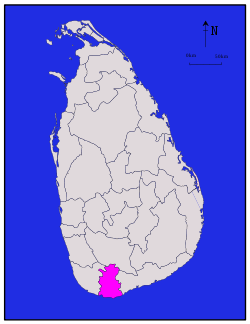
Coordinates: 6°10′N 80°30′E / 6.167°N 80.5°ECoordinates: 6°10′N 80°30′E / 6.167°N 80.5°E Country  Sri Lanka
Province Southern Province Created Government - District Secretary Area - Total 1,246 km2 (481.1 sq mi) Time zone Sri Lanka (UTC+05:30) ISO 3166 code LK-32 Matara is a district in Southern Province, Sri Lanka. Its area is 1,246 km². It is represented in the Sri Lankan Parliament following the Sri Lankan parliamentary election, 2010 by former Sri Lankan national Cricketer Sanath Jayasuriya who stood for the United People's Freedom Alliance.
Districts of Sri Lanka Central (Kandy • Matale • Nuwara Eliya) · Eastern (Ampara • Batticaloa • Trincomalee) · North Central (Anuradhapura • Polonnaruwa) · Northern (Jaffna • Kilinochchi • Mannar • Mullaitivu • Vavuniya) · North Western (Kurunegala • Puttalam) · Sabaragamuwa (Kegalle • Ratnapura) · Southern (Galle • Hambantota • Matara) · Uva (Badulla • Moneragala) · Western (Colombo • Gampaha • Kalutara) Categories:
- Matara District
- Districts of Sri Lanka
- Southern Province, Sri Lanka geography stubs

Wikimedia Foundation. 2010.