- Dera Ghazi Khan District
-
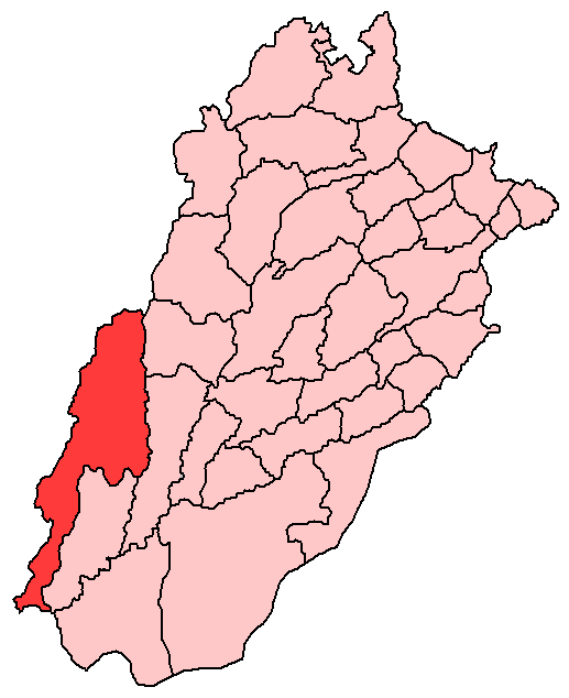
Dera Ghazi Khan District — District — Location of Dera Ghazi Khan District
(highlighted in red) within Punjab.Country Pakistan Province Punjab Capital Dera Ghazi Khan Established Government – District Nazim Malik Miqdad Abbas – District Naib Nazim Sajjad Hussain Khosa Population (1998) – Total 1,643,118 Time zone PST (UTC+5) District Council Number of Tehsils 3 Dera Ghazi Khan (Urdu: ضلع ڈیرہ غازی خان) is a district in the Punjab province of Pakistan. The district covers an area of 5,306 m² and it is a long narrow strip of country, 198 m. in length, sloping gradually from the hills which form its western boundary to the river Indus on the east.
Below the hills the country is high and arid, generally level, but sometimes rolling in sandy undulations, and much intersected by hill torrents, 201 in number. With the exceptions of two, these streams dry up after the rains, and their influence is only felt for a few miles below the hills.
The eastern portion of the district is at a level sufficiently low to benefit by the floods of the Indus. A barren tract intervenes between these zones, and is beyond the reach of the hill streams on the one hand and of the Indus on the other. Although liable to great extremes of temperature, and to a very scanty rainfall, the district is not unhealthy.
The Sulaiman Mountains rise to a height of 10,000 feet (3,000 m) in the north of the district.[1]
Contents
History
The city was founded at the close of the 15th century and named after Nawab Ghazi Khan Mirani, son of Nawab Haji Khan Mirani, a Balochi chieftain, who had declared independence from the Langah Dynasty's Sultans of Multan. Together with two other Deras i.e. settlements, Dera Ismail Khan and Dera Fateh Khan, it gave its name to Derajat. Derajat eventually came into the possession of the British after the Sikh War in 1849 and was divided into two districts: Dera Ghazi Khan and Dera Ismail Khan. After the partition of India, many of the city's Hindu residents settled in Derawal Nagar colony of Delhi, India.[2] The district of Rajanpur was later carved out of the Dera Ghazi Khan district. Some of them also settled in various part of India, including Bhiwani, Delhi, Jhansi, Ranchi, Ambala and Haridwar.
Dera Ghazi Khan was founded in 15th century by Amar a Tribal Sardar of Mirani tribe. The old city of Dera Ghazi Khan was situated at the distance of 10 miles (16 km) towards east of the present city. In 1908, the old city of Dera Ghazi Khan was abolished due to heavy flood in the river Indus. Resultantly the existing city of Dera Ghazi Khan was came into being in the year 1910. The city is divided into different blocks. The British ruler established colonial system in the continent and declared D.G.Khan as district in the year 1849. General Court Land was appointed as first Deputy Commissioner of this District. Keeping in view the rapidly increasing population of the area and deteriorating law and order situation district D.G.Khan was divided in two districts i.e. D.G.Khan and Rajanpur. Presently there are two revenue sub division of the District. A tribal belt/political area spread along with western side of the District. Mirani has been extinct three centuries ago. The population according to the 1901 census of India (then a British colony) was 471,149 - the great majority being Baloch Muslims. The frontier tribes on the Dera Ghazi Khan border include the Qasmani, Qaisrani, Lund, Bozdar, Khosa, Leghari, Jatoi, Nutkani, gorgij, Mirani {Chandio}. Pakistan. Their ancestors came in from Afghanistan around 200 years ago and settled in the old Dera Ghazi Khan. In very small number people belonging to Saharan Jat lineage were also setteled in the old Dera Ghazi Khan, they basically belongs to Jangladesh, Utterpardesh & Rajhistan (India). After the major floods of early 1900s that washed away the city, they moved into the new Dera Ghazi Khan. They are still settled in Block 11. One of the Family Member Akhund Nadir Majeed (Late) Ex Joint Secretary PML-N was knoned as a Great Social Worker .Encyclopaedia Britannica 11th edition published in 1911 mentions Baluchs of this area as:
“ Frank and open in his manners, fairly truthful, faithful to his word, temperate and enduring, and looking upon courage as the highest virtue, the true Baluch of the Derajat is a pleasant man to have dealings with.[3] ” There are petroleum and gas reservoirs in district Dera Ghazi Khan at sites rodho, zindapir, afiband, Dhodhak etc. The Koh-e-Sulaiman Range constitutes a major part of this area, This range is full of naturl deposits like Marble & Lime Stone. A big cement plant DG Cement is also situated in Kofla Sattai Tehsil Dera Ghazi Khan.
Administration
The district is divided into 3 tehsils ,[4] which are divided into a total of sixty Union Councils:[5] REHMANI BALOCH
Tehsil No. of Unions Dera Ghazi Khan Tehsil 41 Taunsa Sharif Tehsil 13 De-Ex.Area of D.G.Khan 05 Total 59 Notable areas
Fort Munro is a hill station in Dera Ghazi Khan which lies on the Quetta Road at 85 km from Dera Ghazi Khan city in the Sulaiman Mountains Range. Its altitude is 1800 meters (6,470 feet) above sea level and attracts many people for short stays during the summer.
References
- ^ Dera Ghazi Khan District - Imperial Gazetteer of India, v. 11, p. 248
- ^ "Colonies, posh and model in name only!". NCR Tribune. http://www.tribuneindia.com/2003/20030319/ncr1.htm. Retrieved 2007-12-16.
- ^ Encyclopaedia Britannica Article on Baluchistan, British India
- ^ Pakistan Government - List of Tehsils
- ^ Tehsils & Unions in the District of D.G. Khan
Divisions of Pakistan Balochistan KP Punjab Bahawalpur · Dera Ghazi Khan · Faisalabad · Gujranwala · Lahore · Multan · Rawalpindi · Sahiwal · SargodhaSindh  This article incorporates text from a publication now in the public domain: Chisholm, Hugh, ed (1911). Encyclopædia Britannica (11th ed.). Cambridge University Press.Categories:
Wikimedia Foundation. 2010.