- Mersham
-
Coordinates: 51°07′07″N 0°56′04″E / 51.1187°N 0.9345°E
Mersham 
 Mersham
Mersham shown within KentPopulation 1,022 [1] OS grid reference TR053396 Parish Mersham District Ashford Shire county Kent Region South East Country England Sovereign state United Kingdom Post town TONBRIDGE Postcode district TN25 Dialling code 01233 Police Kent Fire Kent Ambulance South East Coast EU Parliament South East England UK Parliament Ashford List of places: UK • England • Kent Mersham is a small village and civil parish, three miles east of Willesborough and the town of Ashford in the county of Kent.
Contents
History
Historically Mersham has been a farming community with close ties to the local market town of Ashford. The small village dates back to Saxon times and is mentioned in the Domesday Book. The village was owned by the Archbishops of Canterbury for over 500 years. The beautiful Church of St. John the Baptist, which stands on the site of a Saxon church, is part Norman. There are two water mills on the East Stour river, one of which, Swanton, is still working. Part of Hatch Park, an ancient deerpark and SSSI, is within the parish.
It is thought that the village gives rise to the surname Marshman.[citation needed]
The Knatchbulls
The village has been the home of the Knatchbull family since the times of Henry VIII. In 1638 Sir Norton Knatchbull founded Ashford Grammar School, to which pupils were not admitted until they could read the Bible in English, he was also the Member of Parliament for Romney. In the early 19th century Edward Knatchbull served under Robert Walpole in the Whig government and in 1830 another Sir Edward Knatchbull became M.P. for Romney and served under Sir Robert Peel in his government of 1841.
Local Facilities
- Mersham Primary School
- 2 Public Houses – The Royal Oak & The Farriers Arms
- Village Hall
- Local Shop & Post Office
- Playing Fields & Play Areas
Mersham is also mentioned in the American series Dynasty (Season 5, Episode 11, Swept Away) as being the place where one of the characters (Alexis Colby) grew up.
See also
References
- ^ Ashford Borough Council Census 2001
External links
Towns and villages in the Ashford district of Kent, England 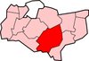 Aldington · Aldington Frith · Anvil Green · Appledore · Appledore Heath · Ashford · Bagham · Bethersden · Biddenden · Bilsington · Bilting · Bockhanger · Bodsham · Bonnington · Boughton Aluph · Boughton Corner · Boughton Lees · Brabourne · Brabourne Lees · Brattle · Bromley Green · Brook · Challock · Charing · Chilham · Chilmington Green · Crundale · Eastwell · Ebony · Egerton · Godinton · Godmersham · Great Chart · Hamstreet · Hastingleigh · High Halden · Hinxhill · Hothfield · Kenardington · Kennington · Kingsnorth · Leigh Green · Little Chart · Mersham · Molash · Newenden · Newtown · Orlestone · Pluckley · Reading Street · Rolvenden · Rolvenden Layne · Ruckinge · St Michaels · Sevington · Shadoxhurst · Small Hythe · Smarden · Smeeth · Stanhope · Stone in Oxney · Stubbs Cross · Tenterden · Warehorne · Westwell · Westwell Leacon · Willesborough · Wittersham · Woodchurch · Woolpack Corner · Wye
List of places in Kent Categories:- Ashford, Kent
- Villages in Kent
- Villages around Ashford, Kent
- Civil parishes in Ashford, Kent
- Kent geography stubs


Wikimedia Foundation. 2010.