- Qasigiannguit
-
Qasigiannguit Aerial view of Qasigiannguit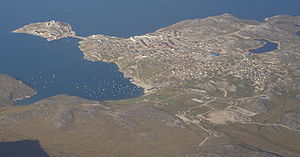 Location within Greenland
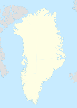
 Qasigiannguit
Coordinates: 68°49′10″N 51°11′36″W / 68.81944°N 51.19333°WCoordinates: 68°49′10″N 51°11′36″W / 68.81944°N 51.19333°W State  Kingdom of Denmark
Constituent country  Greenland
Municipality Qaasuitsup Founded 1734 Population (2010) – Total 1,253 Time zone UTC-03 Postal code 3951 Qasigiannguit (Danish: Christianshåb) is a town located on the southeastern shore of Disko Bay, in the Qaasuitsup municipality in western Greenland. With 1,253 inhabitants as of 2010,[1] it is the twelfth-largest town in Greenland. The main industry is shrimp and halibut fishing.
Contents
History
Qasigiannguit was founded in 1734, and is home to Greenland's oldest wooden house. The former house of Paul Egede, was inaugurated on 25 July 1734, in the colony of Christianshåb.[2] Because of the wind, the house was moved across the small bay to its present site during 1806. In 1997 the museum was officially opened in the Egede house. In the summer of 1999, an archaeological discovery provided the museum with a collection of finds from different prehistoric cultures.[3]
Transport
Air
Main article: Qasigiannguit HeliportDuring winter Air Greenland operates winter-only air services from the town heliport to Ilulissat, Qeqertarsuaq on Disko Island and Aasiaat.[4]
Sea
During summer and autumn, when the waters of Disko Bay are navigable, communication between settlements is by sea only, serviced by Diskoline.[5] The ferry links Qasigiannguit with Ilulissat, Aasiaat, Ikamiut, Akunnaaq, and Qeqertarsuaq.
Population
With 1,253 inhabitants as of 2010, Qasigiannguit is the fourth-largest town in the Qaasuitsup municipality.[6] The population has decreased by more than 22 percent relative to the 1990 levels, and by nearly 11 percent relative to the 2000 levels, decreasing over the course of the last decade.[6]
 Qasigiannguit population growth dynamics in the last two decades. Source: Statistics Greenland[6]
References
- ^ Statistics Greenland, Greenland in Figures, 2010
- ^ O'Carroll, Etain (2005). Greenland and the Arctic. Lonely Planet. pp. 181. ISBN 1-74059-095-3.
- ^ Museum.gl
- ^ "Booking system". Air Greenland. http://book.airgreenland.com/. Retrieved 8 July 2010.
- ^ Diskoline timetable
- ^ a b c Statistics Greenland
Categories:- Disko Bay
- Populated places in Greenland
- Populated places established in 1734
- Populated places of Arctic Greenland


Wikimedia Foundation. 2010.